Alex_Sor
-
Posts
27 -
Joined
-
Last visited
Alex_Sor's Achievements
")
Contributor (2/6)
60
Reputation
-
Basics Of Ground Penetrating Radar
Alex_Sor replied to Alex_Sor's topic in Detector Prospector Forum
The situation in the Ukrainian economy is very bad now. Zelensky even before the war was "famous" for his failed decisions in terms of economic development, but what is happening now will be the final collapse ... Because of the war, I lost my business in Ukraine, if you want to help me and my family, my Paypal is: Alex.Sor.2022@gmail.com -
Basics Of Ground Penetrating Radar
Alex_Sor replied to Alex_Sor's topic in Detector Prospector Forum
The total combat losses of the enemy from 24.02 to 12.06 were approximately: Operational information as of 06.00 on 12.06.2022 regarding the Russian invasion The one hundred and ninth era of the Ukrainian nation’s heroic confrontation with the Russian military invasion has begun. In the Volyn and Polissya directions, the enemy did not take active action. In the border areas of the Republic of Belarus, additional measures are being taken for the engineering equipment of checkpoints and the deployment of additional means of electronic warfare. In the northern direction, the enemy continues to provide enhanced protection of the Ukrainian-Russian border in the Bryansk and Kursk regions. Increased levels of terrorist threat continued in Belgorod and Kursk oblasts. The enemy continues to fire mortars at the positions of the Defense Forces in the border areas. In addition, the aggressor fired on civilian infrastructure in the areas of Rozhkovichi, Gremyach, Luhivka and Popivka. The situation in the Kharkiv direction has not changed significantly. To restrain the actions of the defense forces, it exerts systematic fire on the positions of our units. In addition, the enemy fired on civilian infrastructure near Vernopil, Ukrainka, Petrivka, Chepil and Khrestyshche. He struck an air strike near the village of Mospanovo. In the Slavic direction, the enemy carried out systematic artillery shelling in the areas of the settlements of Petrivske, Nova Husarivka, Kurulka, Dolyna. He is trying to gain a foothold in the village of Bogorodichne, the fighting continues. The enemy did not take active action in the Lyman direction. Increased the intensity of artillery use, including multiple rocket launchers, in the areas of Shipylivka and Dronivka. Conducts regrouping of troops. In Severodonetsk, the occupiers are conducting assaults in the city of Severodonetsk, to no avail. Fighting continues in the Toshkivka area. In the Bakhmut direction, the enemy fired at our positions with mortars, barrel and jet artillery in the areas of the settlements of Komyshuvakha, Gorske, Mykolaivka, Belogorivka, and Novoluhanske. Enemy army aircraft struck near Pokrovsky. Ukrainian soldiers repulsed the offensive near the village of Vrubivka. The enemy also tried to advance in the direction of the settlement of Nikolaevka. He received a decisive rebuff and left. Our defenders also successfully repulsed the enemy assault in the Vasylivka area. The Russian occupiers suffered losses and retreated to their former positions. The enemy did not conduct active hostilities in the Avdiivka, Kurakhiv, Novopavliv and Zaporizhzhya areas. He insidiously fired on civilian infrastructure in the areas of Zhelanne, Avdiivka, Karlivka, Vuhledar and Orikhiv. Deploys additional units in some areas. In the South Bug direction, the enemy defended, firing at units of our troops with artillery, mortars and multiple rocket launchers. He tried to fight the battery. The Russian occupiers cynically shelled the settlements of Tverdomedovo, Berezneguvate, Kobzartsi, Kvitneve and Luch. Over the past 24 hours, the enemy has lost ten tanks, sixteen armored combat vehicles, seven UAVs, more than ten vehicles and up to 150 manpower. We believe in the Armed Forces of Ukraine! Let's win together! Glory to Ukraine! -
Gold Mining Underwater, Offshore
Alex_Sor replied to Alex_Sor's topic in Gold Panning, Sluicing, Dredging, Drywashing, Etc
Remote control will devalue (kill) the whole idea. Remote control implies the presence of a ship on the surface of the sea, a long cable. In case of excitement and storm, the ship will not be able to work, because it will not be able to stay in one place. Only an underwater manned vehicle for 1-2 people with air and electricity autonomy for 2-3 days makes sense. No windows, just TV cameras. In fact, this is an underwater excavator + dredge in one device. Turbidity and sludge will not interfere with operation if the cameras are at the end of the loader bucket. Minimum automation of left-right movement for suction is pulled. I thought of everything for a long time 🙂 -
Gold mining underwater, offshore I have a dream 🙂 I want to build an underwater vehicle for gold mining (washing) underwater, in the coastal area of Alaska and other places. Background: I am a former Submarine Engineer, mechanical and electrical specialist (+ electronics). I really liked the series on the Discovery Channel, about how gold is mined from the bottom of the sea in Nome (Alaska). I am impressed with the courage of these people. But ... I see that already now they have problems with mining gold from a depth of more than 5 meters. The shelf area (underwater part) extends much further than those small areas that are now being developed near Nome. To work in bad weather on the surface of the sea, and not to depend on it, you need to have an underwater manned vehicle on a caterpillar track, with a dredge and a flushing chute. This will allow you to work autonomously, for several days underwater, mining gold. In my opinion (thoughts) it should be a submarine with tracked engines, ballast tanks, which can independently float on the sea surface and sink to the bottom for work. I can design, calculate, and build this. I need money for this, and a few assistants who can work with their hands 🙂 Extraction of gold and minerals from the bottom of the sea is my old dream ... And I know how to make a submarine without spending millions of dollars 🙂
-
Basics Of Ground Penetrating Radar
Alex_Sor replied to Alex_Sor's topic in Detector Prospector Forum
-
Basics Of Ground Penetrating Radar
Alex_Sor replied to Alex_Sor's topic in Detector Prospector Forum
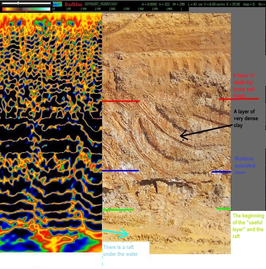
We found some data on Republic of Ghana (Africa) An expedition to search for gold placers worked there in 2014. They were looking for the channels of ancient rivers in order to check the placers of metals. Unfortunately, we were not given the primary files of georadar surveys, we received only a part of the reports ... The reports were verified during the expedition by excavator digging. The shooting depth actually reached 12-14 meters. A radar with a frequency of 300 MHz was used. I will give below what we have. 1) the test object buried in the soil of Ghana looks like this: The soil is mineralized and "rings" around the object. 2) This is how a layer of pebbles (boulders of different sizes from granite) looks like on the radar screen. 3) this is what a raft looks like with splashes of metal. You see numerous V-shaped and inverted V marks at the bottom (deep). 4) here is the combined frame: on the left is what the radar shows, and on the right is the result of a hole cut by an excavator.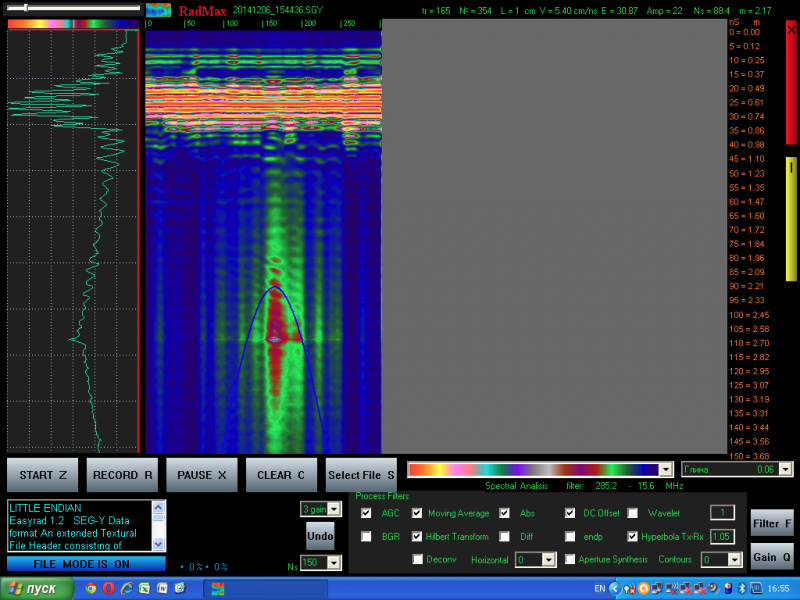


-
Basics Of Ground Penetrating Radar
Alex_Sor replied to Alex_Sor's topic in Detector Prospector Forum
Dear sirs 🙂 1) dry salty (even just salt itself) soils break through well (low attenuation). Any crystalline rocks break through well, we can talk about 5-15 meters of depth. Wet (wet) salt rocks are electrolyte (like seawater) and have a very high attenuation. 2) America (USA) has made it almost impossible to visit with tourist visas, all of us (who live in the former USSR, Ukraine) are considered criminals and deceivers 🙂 who will come and stay to live illegally in the USA. If someone took responsibility and made an invitation to one of us, we could bring a radar and travel (visit) places (fields) for measurements. 3) The cost of a radar complete with all antennas is about $8000. You could chip in money (put together money from several people) and buy one radar for several people, we could send you a radar and support you remotely. 4) Gold mining means you spend hundreds of thousands of dollars on digging and flushing equipment. If you do not have equipment for deep exploration (for example, georadar), then you will spend tens of thousands of dollars on fuel and blindly washing tons of rock, playing roulette - "lucky or unlucky." In Ukraine, many amber seekers have georadars, despite the fact that we are a poor country and for such a sum of money you can buy a house in a village in Ukraine 🙂 -
Basics Of Ground Penetrating Radar
Alex_Sor replied to Alex_Sor's topic in Detector Prospector Forum
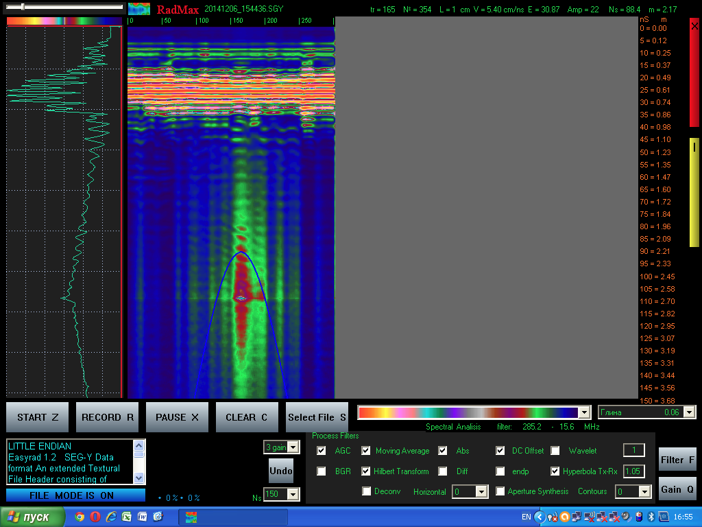
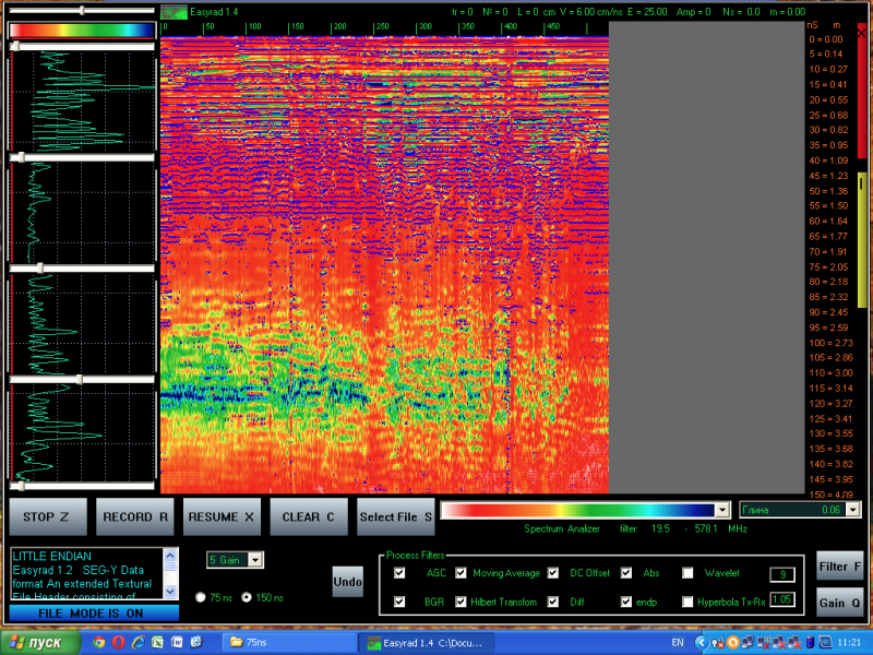
test in the forest. EasyRad GPR Pro GPR + RadMax software -
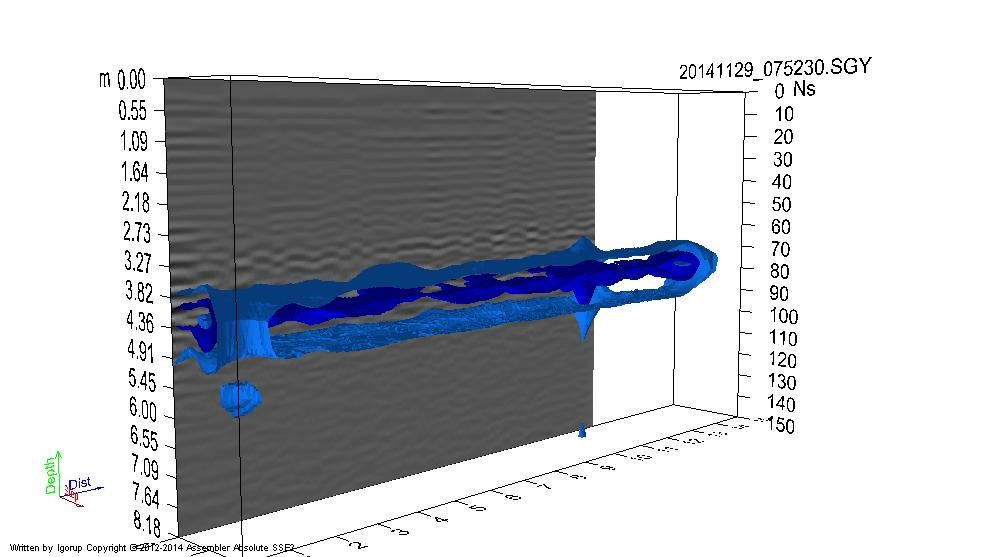
Basics Of Ground Penetrating Radar
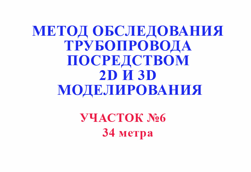
Alex_Sor replied to Alex_Sor's topic in Detector Prospector Forum
Underground pipeline. 3D processing of measurements of several profiles, processing in the RadMax program. ( pipeline length = 34 meters )
-
Basics Of Ground Penetrating Radar
Alex_Sor replied to Alex_Sor's topic in Detector Prospector Forum
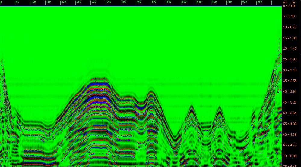
3D processing of measurements river bed from several profiles, processing in the RadMax program.
-
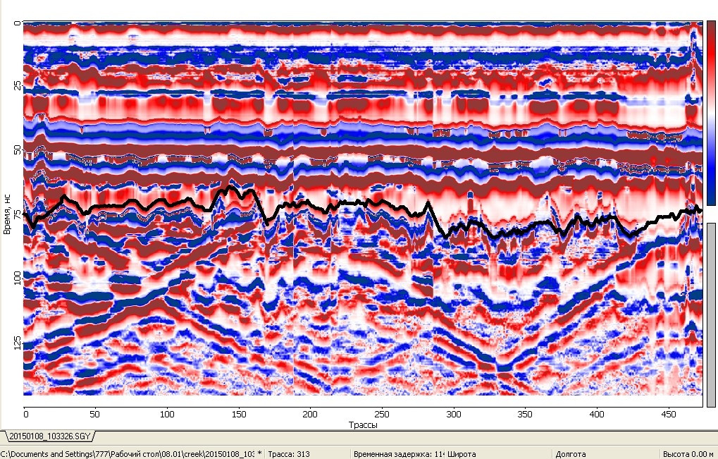
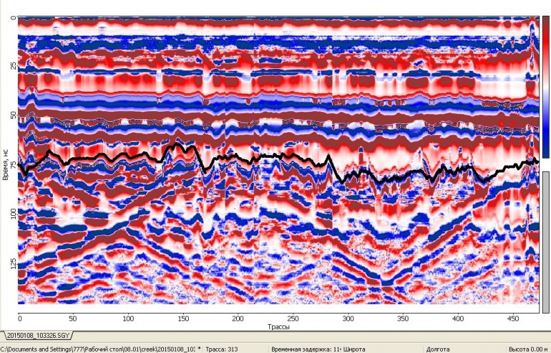
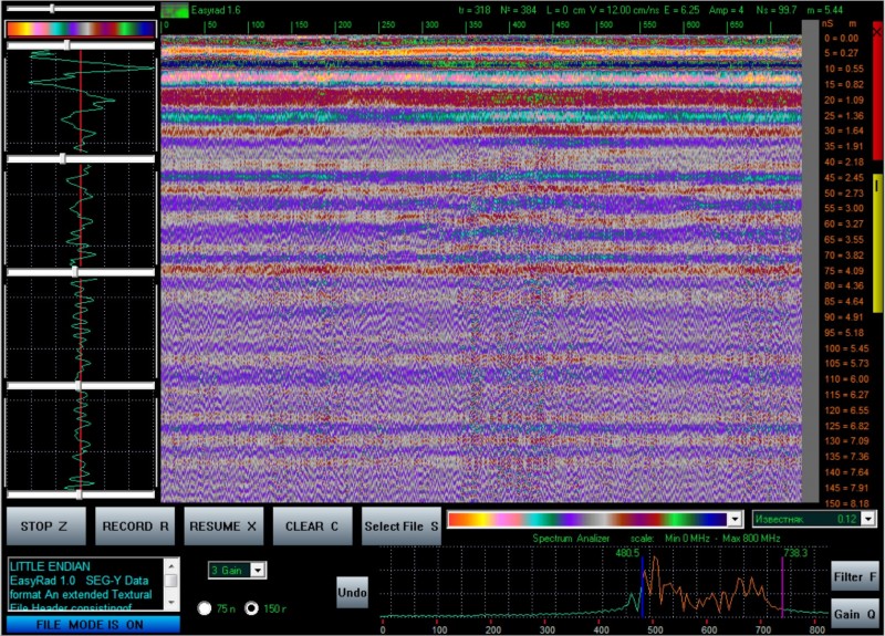
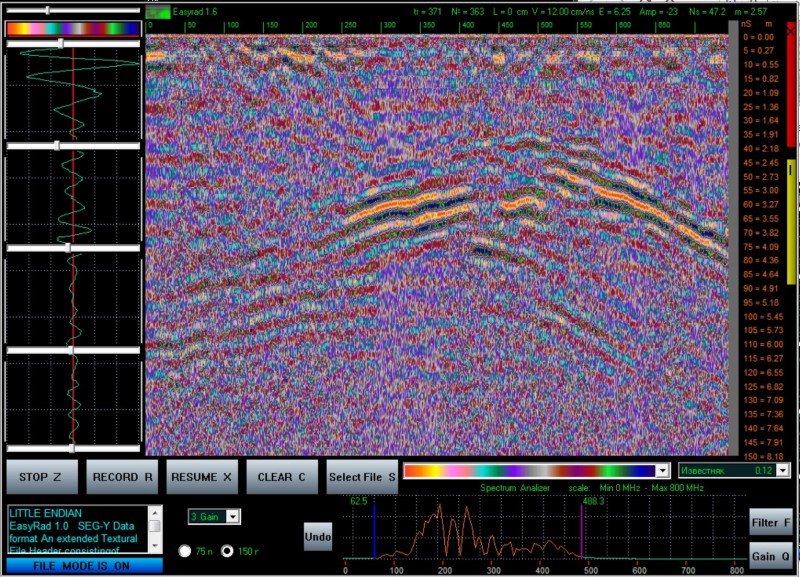
Basics Of Ground Penetrating Radar
Alex_Sor replied to Alex_Sor's topic in Detector Prospector Forum
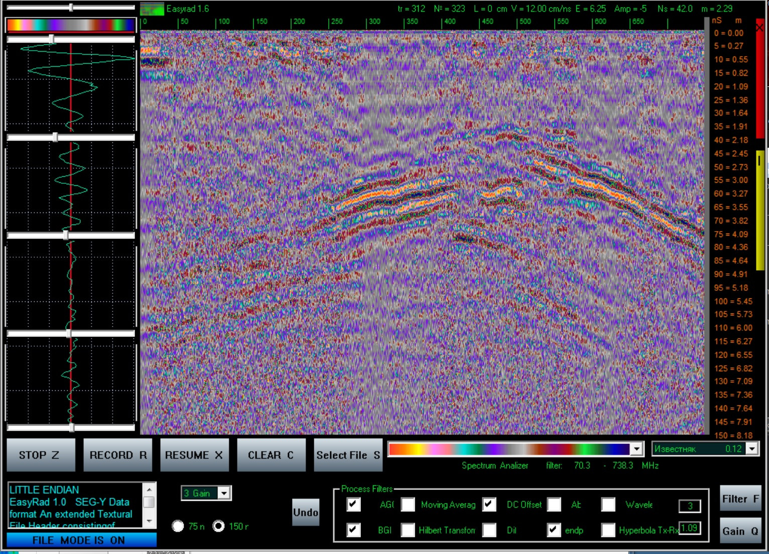
this is how the real riverbed looks like under water Advanced processing is applied here. Measurements were made across the river bed!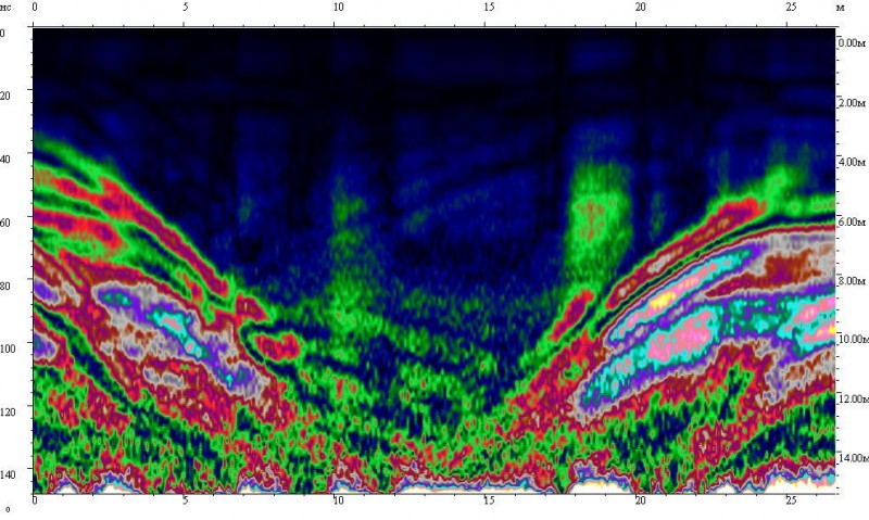
-
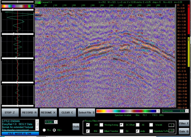
Basics Of Ground Penetrating Radar
Alex_Sor replied to Alex_Sor's topic in Detector Prospector Forum
Winter work through the ice. This is a picture of a real bed of an old river, under a layer of ice. (Ice is radio-transparent) Now there is a swamp in that place, but we were looking for the old river bed. the first channel of river - on the green scale (top of the image) 50-200, the second channel of river= 650-800. Measurements were made across the river bed!
-
Basics Of Ground Penetrating Radar
Alex_Sor replied to Alex_Sor's topic in Detector Prospector Forum
Amber. Real filming and real processing is in this video. Set in the settings "show subtitles" and "translate into English". ( from 13:40 time ) And here is a photo of part of what we managed to lift from the depth ...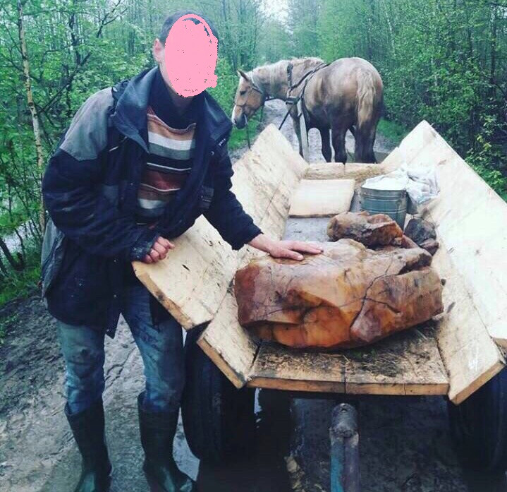
-
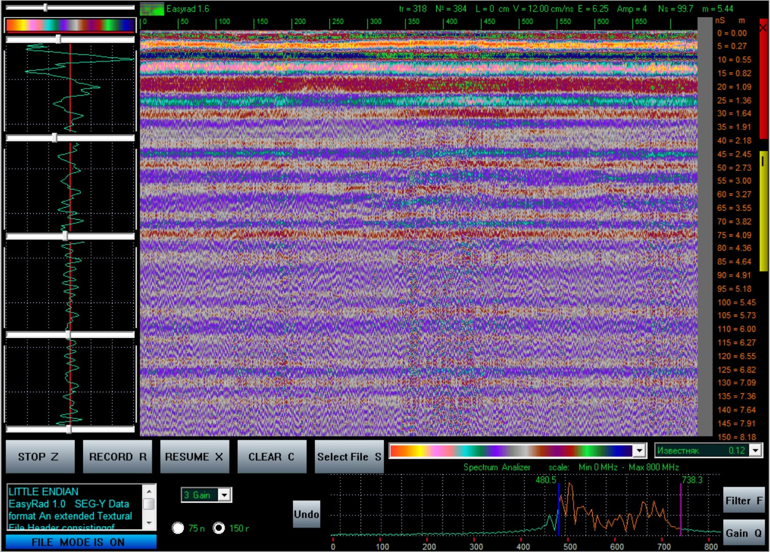
Basics Of Ground Penetrating Radar
Alex_Sor replied to Alex_Sor's topic in Detector Prospector Forum
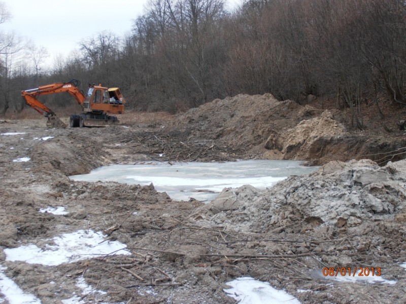
I can say, that several times I was invited to a company that was engaged in checking the ancient city of the times "Kiev Rus" (Ukraine) (about 1200 AD). So, I checked the rest of the protective rampart around the city (what was left of it). It was mostly clay (not wet), gray-yellow in color, and I was able to find remnants of burnt (fire and carbon-soot) bricks. They were at a depth of about 1 meter from the surface, metal detectors showed nothing (we had Lorenz with a 2.5 meter antenna carried by two people). I was interested in the picture on the radar, and I reported that under us there may be hundreds of stoves, where there could be something interesting. We dug the object, and indeed there were burnt and covered with twisted soot stones. Small metal objects are visible during post-processing of the radar profile (when you are in no hurry and can play a lot with display palettes). In my experience, approximately 30% of objects are in real-time when they pass in the field (field shooting). The rest 70% can be detected during post-processing, when there is time for many profile runs in a processing program with different mathematical filters. For example, an object near the city of Kaliningrad. (former Germany). In this place, there was a suspicion of an underground bunker, in which there were some objects. We managed to shoot. Filming (see the profile picture) showed the presence of an underground cavity with some boxes inside of which objects have a chaotic orientation. It is visible as "ripples up" above the boxes. See the picture. Pay attention to the area (picture above) 300-450 (green numbers at the top of the scale). This is a screenshot from the georadar screen, Easyrad program. I have a "source file" of the footage and can play with it using different palettes and filters. If I apply other filters, and cut the frequencies of the rad to high (cut off the low frequencies, i.e. leave only the return of frequencies from small objects), then I will get this picture: Pay attention: it was the reflections of a higher frequency (from 480MHz to 800MHz) that appeared here and the "ripples" created by multiple reflections became more distinct. If we leave only low frequencies (80-500 MHz), then we will more clearly see the bunker itself and something big in it (300-450 in green numbers): Unfortunately, the bunker had a "secret", when trying to excavate the bunker, the excavator damaged the waterproofing, and the bunker was flooded with water ... Unfortunately, the fate of the object is currently unknown. Due to the outbreak of the 2014 war.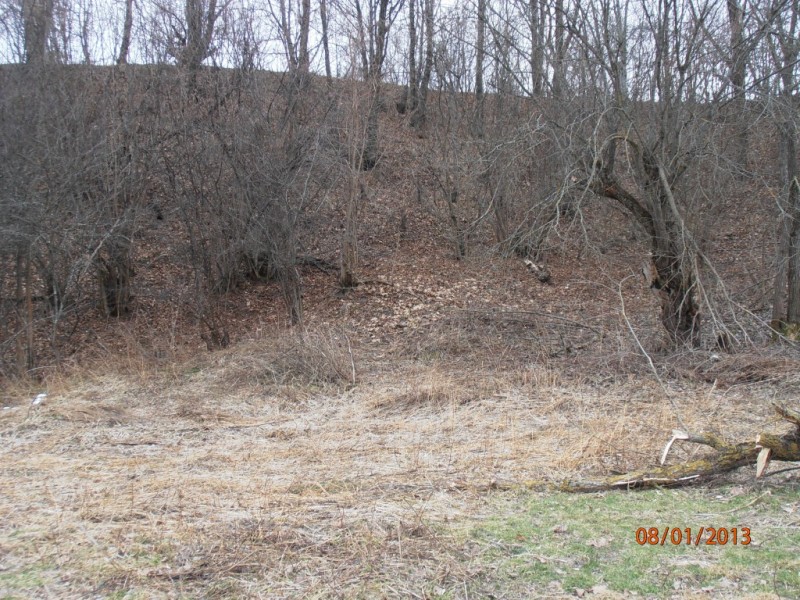
-
Basics Of Ground Penetrating Radar
Alex_Sor replied to Alex_Sor's topic in Detector Prospector Forum
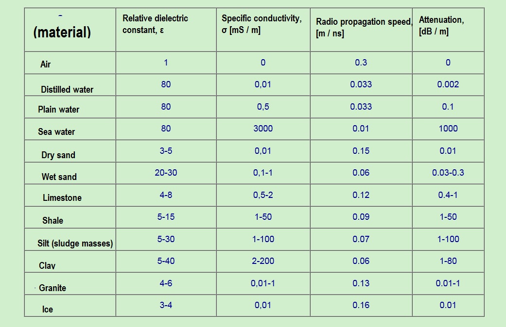
The probing signal emitted by the GRLPZ antenna propagates under the earth's surface, attenuating as it propagates, and, encountering an inhomogeneity, is partially reflected in different directions, including in the direction of the receiving antenna. The level of the received signals depends on the reflection coefficient of the signal from the subsurface inhomogeneity. The reflection coefficient depends on how much the electrical parameters of the inhomogeneities differ from the parameters of the environment. The larger the difference, the larger the reflected signal. Part of the signal travels further and is reflected from the next discontinuity, etc., until the signal is completely attenuated. The table below shows the electrical characteristics, radio propagation velocity and attenuation coefficient of the media most commonly encountered in practice. Table: Physical properties of natural environments: As you can see from the table, (the last column of the table) Ice and Granite can be equally transparent to radar. The most transparent is "dry sand" and "distill water". Georadar specifications: Maximum sounding depth (at a frequency of 100 MHz), = 24meters Resolution in the vertical direction, = <10 centimeters Resolution in the horizontal direction, = <10 centimeters Error in the analysis of electrical constants and the speed of propagation of radio waves in the ground, =% 15-20