Search the Community
Showing results for tags 'geology'.
-
-
Something I heard recently, was many prospectors don't detect lower than a certain sea level in a given area. Well, that was news to me and I said to the guy that told me "at what level would that be?" He said different levels for different areas. ( he said around 260 meters above sea level for the particular area we were in at the time) I then meet someone else who said: "yes that's something that some people follow." He explained his theory but unfortunately, I only grasped half of what he was saying. I've been thinking about this and wonder why the levels one would detect at would matter. *Originally a lot of Victoria was underwater (ocean). I'm not sure if all the sea water had departed from the area before the period in which gold was being formed in. The only reason I can think of, is if the water was still present then as the gold got washed off the hills and came into contact with the water it slowed down immensely and the gold dropped out and stayed at that sea level. Just like when a river that's skinny widens out the flow slows down and the gold drops out. The other idea and along the lines of what the second guy thought was that gold cools at different temperatures than other metals and when it reached the level that was covered in water it cooled down at that level and formed in the host rocks. Anyway, hope this isn't a stupid question and someone could explain it a little better. (I asked someone else and never got a reply so I thought id ask here.)
-
Does anybody know why a gravel bar in a creek on Google Earth would show as Pink instead of black and white? This is in central Indiana, not much in colored rocks or mineral deposits in the area. It is a glacial gold area and with copper nuggets but they don't show up on aerial maps. I did spot a large gray clay stream bank on another creek which had alternating layers of red and gray just above the creek line like an ice cream cake. Too bad its owned by the state and they refuse to let us prospect there. It is a known gold creek too. It cannot be seen without Google Earth and a Historical Imagery view of the woods taken March 30 ,2005, otherwise tree cover blocks the view on both of these creeks. What's the best color laser printer for around $300 for aerial map prints? -Tom V.
-
As I read the amazing "Reg Wilson" threads about the numerous large nuggets found in Australia I began thinking about the amazing depositional situation that created them. I have "Googled" a bit to try and find any literature on the subject, but have not found anything to satisfy my curiosity. . Can anyone recommend any papers or books that describes the creation of the Australian deposits. I understand how gold is deposited, but what is unique about the Australian situation that resulted in so much large gold?
-
 Geology and Gold Mineralization of the Gold Basin-Lost Basin Mining Districts, Mohave County, Arizona By TED G. THEODORE, WILL N. BLAIR, and J. THOMAS NASH With a section on K-AR CHRONOLOGY OF MINERALIZATION AND IGNEOUS ACTIVITY By EDWIN H. McKEE and a section on IMPLICATIONS OF THE COMPOSITIONS OF LODE AND PLACER GOLD ByJ.C. ANTWEILER and W.L. CAMPBELL 1987 U.S. GEOLOGICAL SURVEY PROFESSIONAL PAPER 1361 The Lost Basin district contains a wide-ranging group of placer and lode mines in a belt lying between Hualapai Wash on the west and the Grand Wash Cliffs on the east (fig. 3). It extends from the Colorado River at the mouth of the Grand Canyon southward through the Grand Wash Cliffs for a total length of about 32 km. This district, although much larger in areal extent, has not been as active nor as productive as the adjacent Gold Basin district. The principal gold veins were discovered in 1886, and the production of the district was reported by Schrader (1909) to be "many thousand dollars," chiefly in gold. Placers apparently were first worked in 1931 and resulted in a minor local boom. However, recorded pro- duction in copper, gold, and silver during 1904-32 was valued at less than $45,000 (Hewett and others, 1936). The King Tut placers, discovered in 1931, were the most important placers in the Lost Basin district. Systematic sampling of the King Tut placers by G.E. Pitts in 1932. delineated approximately 90,000 tons of indicated reserves and 250,000 tons of probable reserves before mining operations on a relatively large scale began (Mining Journal, 1933, p. 10). All of this was confined to approximately one section of land. In the last four months of 1933 the King Tut yielded 117 oz of gold (Gerry and Miller, 1935). By 1936 the gold output from the King Tut was 450 oz, which represented the bulk of the entire pro- duction from the Lost Basin district. In 1939 Mr. Charles Duncan placered 13 oz of gold in 16 days, using only a sluice box and wash tub, near the King Tut placers (Engineering and Mining Journal, 1939), whereas the King Tut placers themselves were only worked intermittently until 1942. Eventually, placer mining of unconsolidated gravel from the upper reaches of present-day arroyos extended across approximately 25 km2 in the general area of the King Tut placers (Blacet, 1969). Nonetheless, by 1942 no additional production was recorded from the Lost Basin district. However, in the middle and late 1960's several small operators using dry washers were active intermittently in the general area of the King Tut placers. These washers were powered by small portable gasoline motors. Because of the surge in the price of gold during 1978-80, small-scale placer operations and extensive exploration efforts, centered on an area just to the north of the King Tut placers, began again. These efforts were continuing intermittently through 1986. Download The Full Report Here
 -
A REVIEW OF GOLD MINERALIZATION IN EASTERN AUSTRALIA A. R. WILDE May 1988 The purpose of this report is to review the different styles of mineralization encountered in Eastern Australia, their distribution and genesis, particularly in the light of discoveries which have resulted from intensive exploration in recent years, and has been compiled almost entirely on the basis of literature research. Only occurrences in the states of Victoria, Queensland and New South Wales were considered. The report is arranged by state, not because this is geologically justified but because the various state geological surveys, mines departments and mining journals are prime sources of data. https://d28rz98at9flks.cloudfront.net/14266/Rec1989_030.pdf
-
Lithium. There are guys I know who have sold claim blocks for Lithium exploration within the last year. Half the dry lake beds in Nevada have been staked in the last year. Even the dry lake bed where they hold the Burning Man event. These things are related to spikes in commodity prices - lithium prices have been rising as demand for car and other batteries increase. Look for an article on Lithium prospecting in this next issue of the ICMJ. If you don't subscribe, well, you should. On REEs, you are 5 years too late - they spiked 5 years ago and exploration companies were mad for potential REE properties. On the other hand, as I said you have to go against the flow, staking property when prices are bottoming and no one has any interest. REEs will spike again someday.
-
Last weekend I got to tag along with Josh and Tom Bohmker, and a few other knowledgable miners. The destination was the Briggs Pocket in Southern Oregon. This was not an easy hike for some of the crew, but we all made it out and back. We did have one guy fall down a steep slope, but Josh was able to catch him before he tumbled down to the bottom. The video tells some of the history of this famous pocket mine as well as how Josh and his family have used modern P.I. detectors to recover the gold left on the hillside by previous generations of miners. Of all types of metal detecting for gold, I would count pocket hunting as the most difficult - due to the terrain, research, and extensive geology knowledge required. It's something not many people have the patience for (me included), so I have to say I admire the gumption of the Bohmker family - they discovered the Briggs Pocket just two weeks before another party and have pulled a lot of gold out of their claim. The gold from the Briggs Pocket tends to be spongey and interwound with the host rock (quartz). I will post some journal excerpts at the bottom of this post in case you'd like to read some historical accounts as well. But here's the video: Every time I see Josh and Tom I learn so much about the geology of gold. Anyone who has an interest in pocket hunting might want to look them up. They do go on regular expeditions with folks, which I believe they run through their website. I thought you guys might like a virtual tour of the Briggs Pocket - since this forum is where I got started on my journey of searching for gold. HISTORICAL ACCOUNTS Briggs History: (As recorded by the Mining Review, Salt Lake City, Utah bi monthly publication) June 30, 1904 Discovery of a mammoth pocket near the head waters of sucker creek, forty miles south of Grants Pass. The discovery was made by the two sons of David Briggs, while out hunting, and was purely accidental as they stumbled across it while trailing a deer. They have already brought in $6,000 from the pocket, and believe they will bring as much more before the glory hill is emptied. Much of the gold was in great slabs as big as a man's hand, and all of it came from a shallow cut, but three feet wide, three feet deep, and but six feet in length. July 15th, 1904 The Rush is still on to the new Eldorado up in the siskiyous, beyond Holland, and on the Oregon California line. I took the fever and joined the caravan, mainly for the purpose of satisfying a curiosity, but not an idle one, for it is to severe a strain on a scribblers physical make up to climb twenty miles almost straight up just to see what is going on over the divide. ......................... We found about 100 men scattered about the head of Thompson and Indian creeks, a number of whom had taken up claims. A townsite has been surveyed, and the town will be know as "Goldenview City" The strike made by Briggs has already taken out $25,000 in gold. Contented in the truth that want will never more drive them out of unbefitting toil, they are satisfied with the life of the mountains. Here is the freedom no other land can give, the genuine freedom of the western outer world. It was these mountains that gave up bountifully from their long hidden treasures. And they who were so fortunately endowed with not forget the giver. _ Dennis H Stovall Records indicate that this was worked for two seasons, and there was a group that braved the winter and worked through. In the end, the strike led to a rush up there of over 2000 men, almost everything was claimed up, and many smaller strikes were made within the vicinity. I don't think the town of Goldenview ever came to pass. They (Briggs) sold the claim and staked a new claim not far away. A company from Chicago invested substantial money into developing the mine, but turned up nothing, or at least not enough to be profitable. By June of 2005, there was no more reports on the Briggs strike.
-
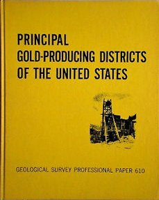
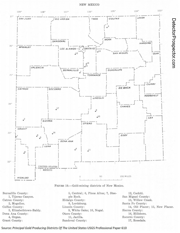
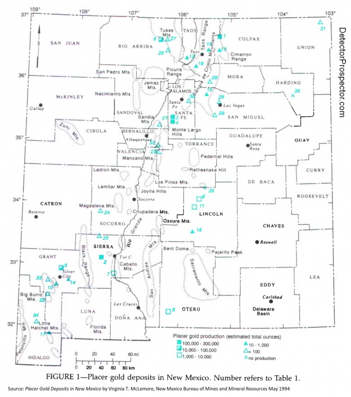
Another question via email, with personal references removed. I prefer to answer these on the forum so everyone gets the benefit of the answer plus others can offer their opinions also. "I am new to metal detecting and, your site here has really helped me out. I have a couple questions that maybe you can help me out with. What are some of the geologic indicators that you look for to determining where to prospect for nuggets? I try to study some of the geology maps but I could use some further pinpointing. I have also been looking at the National map of Surficial Mineralogy. Using the aster and minsat7 maps what are some of the indicators that may point you to higher gold bearing ground? Any help would be deeply appreciated. Could you point me to some old places where you have found gold? I'm not asking to be shown active patches. Just areas that you feel are worked out. I just want to see what gold bearing ground looks like. This would help me to start to learn the commonalities and characteristics of gold bearing grounds. Still looking for that first nugget! Thanks again for any info you can provide." My method is much simpler than that. I basically look for gold where gold has been found before. Think of it like fishing. If you want to go catch salmon you have two options. You can go to where people have caught salmon before - pretty good odds here. Or you can go where nobody has ever caught a salmon before. Very poor odds! So call it prospecting using history to determine where gold has been found before, and then getting as close as I can to those places. History and proximity. Finally, I may then employ geology to narrow that search in a given area if it turns out the gold is confined to certain rock types. The first place I normally turn as a rough guide to any new location in the U.S. is: Principal Gold Producing Districts Of The United States USGS Professional Paper 610 by A. H. Koschmann and M. H. Bergendahl - A description of the geology, mining history, and production of the major gold-mining districts in 21 states. This 1968 publication obviously lacks the latest production figures but it still is a great overview to where an individual prospector can look for gold in the United States. It is a 283 page pdf download so be patient. Pay particular attention to the listed references in the extensive bibliography for doing further research. You can download this here and find many more useful free books on this website at the Metal Detecting & Prospecting Library Principal Gold Producing Districts of the United States So just for fun let's say I want to go look for gold in New Mexico. The section on New Mexico starts on page 200 and here is a quick summary of the opening paragraphs: "The gold-producing districts of New Mexico are distributed in a northeastward-trending mineral belt of variable width that extends diagonally across the State, from Hidalgo County in the southwest corner to Colfax County along the north-central border. From 1848 through 1965 New Mexico is credited with a gold production of about 2,267,000 ounces; however, several million dollars worth of placer gold was mined prior to 1848. Mining in New Mexico began long before discoveries were made in any of the other Western States (Lindgren and others, 1910, p. 17-19; Jones, 1904, p. 8-20). The copper deposits at Santa Rita were known and mined late in the 18th century, and placer gold mining began as early as 1828 in the Ortiz Mountains south of Santa Fe. In 1839 placer deposits were discovered farther south along the foot of the San Pedro Mountains. The earliest lode mining, except the work at Santa Rita, dates back to 1833 when a gold-quartz vein was worked in the Ortiz Mountains. In 1865 placers and, soon afterward, quartz lodes were found in the White Mountains in Lincoln County; in 1866 placer deposits were discovered at Elizabethtown in Colfax County, and silver-lead deposits were discovered in the Magdalena Range in Socorro County. In 1877 placers and gold-quartz veins were found at Hillsboro, and in 1878 phenomenally rich silver ore was found at Lake Valley in Sierra County. The mineral belt of New Mexico is in mountainous terrain that lies between the Colorado Plateau on the northwest and the Great Plains on the east. It is a zone of crustal disturbance in which the rocks were folded and faulted and intruded by stocks, dikes, and laccoliths of monzonitic rocks. Deposits of copper, lead, zinc, gold, and silver occur locally throughout this belt. Some deposits of copper and gold are Precambrian in age, but most of the ore deposits are associated with Upper Cretaceous or Tertiary intrusive rocks. The gold placers were probably derived from the weathering of these deposits. In later Tertiary time lavas spread out over wide areas of the State, and fissures within these rocks were later mineralized. These fissure veins are rich in gold and silver, but in most places they are relatively poor in base metals. In New Mexico, 17 districts in 13 counties yielded more than 10,000 ounces of gold each through 1957 (fig.19). Figure 19 is a handy map showing us where you want to look in New Mexico and also where looking is probably a waste of time. Click for larger version Gold mining districts of New Mexico The map shows what the text said "The mineral belt of New Mexico is in mountainous terrain that lies between the Colorado Plateau on the northwest and the Great Plains on the east." Sticking to this area is going to be your best bet. Based just on this map I see two areas of general interest - the central northern area, and the southwestern corner of the state. The text mentions that placer deposits were discovered at Elizabethtown in Colfax County, and the map shows that as the Elizabethtown-Baldy mining district. Following along in the text we find this: "The placer deposits along Grouse and Humbug Gulches, tributaries of Moreno Creek, each yielded more than $1 million in placer gold and silver. Another $2 million worth of placer gold and silver was recovered from the valleys of Moreno and Willow Creeks (Anderson, 1957, p. 38-39), and some gold also came from the gravels along Ute Creek. Graton (in Lindgren and others, 1910, p. 93) estimated the placer production of the Elizabethtown-Baldy district prior to 1904 at $2.5 million, and C. W. Henderson (in U. S. Bureau of Mines, 1929, pt. 1, p. 7 40) estimated the production through 1929 at about $3 million (145,138 ounces). The total placer production through 1959 was about 146,980 ounces." The reference material from the passage above is in the back of the book and is where we can get real details. Google is our friend. This stuff used to take me lots of visits to libraries! Anderson, E. C., 1957, The metal resources of New Mexico and their economic features through 1954: New Mexico Bur. Mines and Mineral Resources Bull. 39, 183 p. Lindgren, Waldemar, Graton, L. C., and Gordon, C. H., 1910, The ore deposits of New Mexico: U.S. Geol. Survey Prof. Paper 68, 361 p. Henderson, C. W., 1932, Gold, silver, copper, lead, and zinc in New Mexico: U.S. Bur. Mines, Mineral Resources U.S., 1929, pt. 1, p. 729-759. That is more than enough, but let's also Google placer gold new mexico Lots of great links there, but two jump out: Placer Gold Deposits of New Mexico 1972 USGS Bulletin 1348 by Maureen G. Johnson Placer Gold Deposits in New Mexico by Virginia T. McLemore, New Mexico Bureau of Mines and Mineral Resources May 1994 Notice the source of the last one. Most states with much mining have a state agency involved that can be a good source of information and in this case it is the New Mexico Bureau of Mines and Mineral Resources. That last one is a real gem and contains this passage: "All known placer deposits in New Mexico occur in late Tertiary to Recent rocks and occur as alluvial-fan deposits, bench or terrace gravel deposits, river bars, stream deposits (alluvial deposits), or as residual placers formed directly on top of lode deposits typically derived from Proterozoic, Cretaceous, and Tertiary source rocks (eluvial deposits). During fluvial events, large volumes of sediment containing free gold and other particles are transported and deposited in relatively poorly sorted alluvial and stream deposits. The gold is concentrated by gravity in incised stream valleys and alluvial fans in deeply weathered highlands. Most placer gold deposits in New Mexico are found in streams or arroyos that drain gold-bearing lode deposits, typically as quartz veins. The lode deposits range in age from Proterozoic to Laramide to mid-Tertiary (Oligocene-Miocene) (Table 2). There are some alluvial deposits distal from any obvious source terrains (Table 2). Eluvial deposits are common in many districts; some of the larger deposits are in the Jicarilla district." So now we have a lifetime of ideas on where to go and a basic idea of the geology. And an even better map! Click for larger version. Placer gold deposits in New Mexico Let's look for specific site information. 1. Go to http://westernmininghistory.com/mines 2. Click on New Mexico Mines 3. Click on Colfax County Mines 4. Click on Elizabethtown - Baldy District Here you will find basic site information, references, and a zoomable map with alternate satellite view. An alternate site... 1. Go to https://thediggings.com/usa 2. Click on Browse All States 3. Click on New Mexico 4. Click on Browse All Counties 5. Click on Colfax At this point note you can browse mining claim information or deposit information. Researching mining claims, land ownership, etc. is another topic but here is one source of mining claim location information. For now.... 6. Click on Browse All Deposits or Use The Interactive Map 7. Click on Elizabeth - Baldy A little more detail than the previous site, including this note "SOME FAIRLY COARSE NUGGETS IN WILLOW, UTE, SOUTH PONIL CREEKS, GROUSE AND HAMBURG GULCHES, MORENO RIVER" One more... 1. Go to https://www.mindat.org/loc-3366.html 2. Way down at bottom click on New Mexico 3. Way down at bottom click on Colfax County From here you can dig into all kinds of specific site information but the navigation is a real mess. Have fun! Historic claim staking activity can be a clue. You can get the Big Picture by looking at Mine Claim Activity on Federal Lands for the period 1976 through 2010 OK, that really should have answered your question. As far as places I have been, they are nearly all in Alaska and can be found here. Now, I did all the above from scratch with no real prior information on New Mexico in about 2 hours. You can do the same for any state. However, finding where the gold is really is the easy part. The hardest part by far is finding out who controls the land and getting proper permission for access. In Alaska everything is covered by thick ground cover, so opportunities for metal detecting are strictly at creek level, and nearly always claimed. The process there is simple - find out who owns the claims and get permission for access. In most of the western U.S. there is far less or no ground cover, and so getting in the vicinity of and searching around or near mining claims without being on them is a far more viable option than in Alaska. Or you can try and get permission to access the properties. You still need to be able to track down property locations and owners however. For private property I subscribe to and use OnXMaps for my PC, Google Earth, iPad, and iPhone. It quickly maps private property and gives you access to tax roll information about the owners. Tracking down mining claims is easy in the big picture and harder in the details. The Diggings referenced before has interactive claims maps. I subscribe to Minecache for their Google Earth overlay. However, the most comprehensive source with the deepest repository of Land Ownership information is Land Matters. They have online claim mapping with direct links to claims owner information. Note that all online sources have a lag time between the actual staking of a claim on the ground and when it reaches the online systems, if ever. I say if ever because some claims exist solely at the county or state levels and there is no good way to find them short of visiting local recorder's offices or eyeballs on the ground. Prior thread on finding claims information. Finally, I am not an expert geologist by any means. This is just how I go about it, but any tips, hints, advice, or information anyone is willing to share on this thread are very welcome!!
- 12 replies
-
- 25
-

-

-
- mining claims
- gps and mapping
- (and 1 more)
-
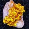
 Educate me please members. In Australia one of my goals is to detect a nuggie in every State. There are seven states in Australia. I have three States to go. How many States in the US is it possible to find nuggets in???. Have many of you managed to find nuggets from more then a few states over there? My first trip to the state of Queensland yielded gold....and my first taste of beautiful paper thin leaf gold. Some of the thin sheets have crystal faces that look like "sergeant stripes " on the gold. (the flat nugget at top right only weighs 3 grams....yeah they are thin....but give good signals. Cheers RDD
 -
Hard Rock University http://www.hardrocku.com/videos
-
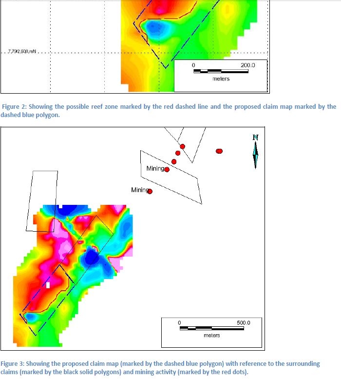
Is there anyone out there who can interpret the result of a magnetic survey below? It terms of prospective gold mining.
-
Quite often l have seen detectorists arrive at a new spot full of enthusiam and upon arrival jump out of the car, grab their detector and race off hurrying here and there like a headless chook swinging aimlessly in their excitement to find that first elusive bit of gold. Only to be dissapointed at the lack of gold finds and quickly ready to write the area off and move on. I speak from experience because l was one of those. However several of those spots kept calling me back. And when I did return it was with a contolled enthusiam. Instead of jumping out of the car and racing around I took the time to look about and read the ground. I took the time to get the detector running smoothly and most importantly I took the time to carefully detect the area I had chosen, thouroughly working the area in a unhurried manner. And on most occasions I was rewarded with gold. Yes gold from an area I was too quick to write off initially because I was in too much of a hurry to properly access the potential that was right in front of my nose. So all l can say is slow down, plan you attack and have patience and work the area properly and don't be too quick to write a spot off or you will leave it behind.
- 21 replies
-
- 16
-
-
- recovery devices
- geology
- (and 2 more)
-
From too much geology study 25hrs a week.worth of GeoBabble. But Did Find a new spot to detect Today Without Snow.. Southfacing , near an area that I witnessed w crossbedding in sedimentary sandstone( all firsts for me! applying sedimentary petrology learned recently to the structure! i.e.roadcut of a maybe? To try and detect? what appeared to me to be an ancient streambed covered by ash.....Any Thoughts out there Experienced Operators care to share any thoughts be appreciated....that you are willing to about this exposure...Eye didnt have darn camera and phone was dead. when i spun around and parked the Cherokee,. the gravel looked out of reach??? it was prob. and average of 6ft below the top of the bench...ancient stream..pinched out sitting up there 45ft. straight up.. and 6-10 ft. below the scrub grass bench Surface....the 100yd exposed roadcut seam is 2meters thick baseball, softball,football, size cobbles w/some soccerball size boulders.down below a 4-6ft.ashy yellowish peach crumbly rhyolite I also assume....? those 2 layers are sittin ontop of the more "massive 40-50ft exposure of crossbedded sandstone!! It's Beautiful to Me and its color is Grey...was goin to try the .45 00 w/ the 20inch NF Round or the 14inch NF round? I havnt actually havnt swung any detector Ever" "yet" over a piece of 'Nativegold" I'm A Newbie only in the sense of never hada season or day " yet" of 8hrs inthe field or 24 or 72 straight... just plinking around while learning as much from the Forum as well as The Best Minelab Operator's and Geologists i could find! have theright gear and playing the Exploration Geo" wannabe First before I "breakdown in tears and have to be a Spot Guy" and Go to Rye Patch... to get Lucky...for my first piece.(no offense) but I'm more of a Pattern" Fisherman. And I'm Looking for Pounds Of Gold" Only place i can detect w/out snow for 100 miles...What Have I Got To Lose...Break myself in early.....where i wana go is 8 weeks to 4months before those areas open and the season begins for me....You Know "The Start"! Share Anything You Want Even About Your "Start Preperations or Pre-tuning Your Gear or Your Head!
-
We all talk about gold and fault lines BUT how do you go about finding these fault lines exactly? They are not shown on Topo maps that I know of. What maps should I be looking to acquire? What do they look like in person? Sharply uplifted rock areas I am guessing? -Tom
-
 Just Wondering if the Forum has any good wild plant stories? Care to share any Tips' of Real Nugget Digs associated w/ plants , flowers, trees.etc. I don't besides Horsetail(see pic) is supposed to grow in Gold" ground. "Geobotany" Starts Here: Vegetation as a Guide. Sometimes the vegetation on the two different rocks, especially when decidedly unlike in composition, is so different that the line of contact may be traced by it alone. In open countries free from heavy timber, like Arizona, this is strikingly the case. Probably the most distinctive vegetation in those localities is the various forms of "yucca," of which the "Spanish bayonet" is a sample; and the "ocotilla" (o-ko-te-ya). The yucca is confined to the granite or quartzite rocks, evidently liking a soil abounding in silica (quartz); the ocotilla is as decidedly confined to the clay-slate regions, the line of contact being often drawn on a hillside by these two plants as if defined by a fence; while the cactus frequents the limestone outcrops and the areas of eruptive rocks. In other words, for successful growth, the yuccas require quartz, the ocotilla clay, and the cactus lime. In the broad washes or beds of summer torrents, called "arroyos," where the rocks are mixed, all three may be found growing if the debris is of a suitable character. A fissure may also be defined by the vegetation growing on it being different in character, or a line of contact may be traced by the same means, as in California, where the rim rock of the gravel channels, even where covered and obscured by dense brush (chaparral) can be followed along the mountain side by the elderberry bushes, the white flowers of which are very conspicuous in the gray brush in spring. These bushes require permanent water and have located themselves along the bed rock rim where the water in the gravel flows over it or on the top of the pipe-clay just below the lava cap. Cheers to All from IdahoGold
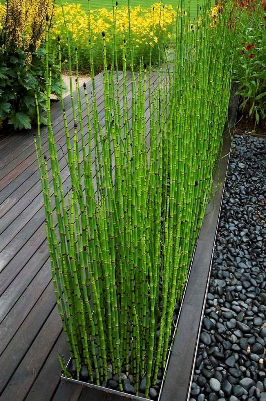
-
Just curious as to whether a gold detector can detect through several inches of bedrock?
-
Why does California have so much gold that is seemingly just laying not far below the surface of the topsoil?
-
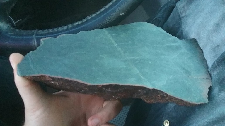
 This isn't about gold and I know this is a gold oriented forum but there are a few geologists and miners with a lot of experience in many things so maybe someone can help... My question is, how exactly do you go about mining and seperating a material like vein jade without destroying it? Seems like with blasting you risk blasting the vein apart too. Even if I did blast and broke the diabase into manageable cobble sizes that I could remove and process, how would I remove the actual vein itself without destroying the jade? A little backstory, one of the minerals I'm prospecting for is jade and I've found some veins (nothing economic or gem quality yet) finally so I think I'm on track to finding something better and potentially worth mining. But it got me thinking - with ore mining you can just blast it apart since it's being crushed anyways. But with something like jade where the vein is in place in rock and you want to keep the gem material as intact as possible, what would be the best method for mining and extraction? I have finally located a few veins, they are low quality material not worth mining and far too slim anyways. But even if these veins were good material I'm not sure I see a good way to remove it. I tried chiseling with very little luck. The veins are in either basalt or diabase and the rock is very hard and durable and the jade doesn't want to seperate easily. Most jade mined or even just collected by hobbyists is float in alluvium it seems like, so I'm not finding much useful info online on how to approach this. I'm attaching a photo of a small vein I found as an example, it's only 1/2" wide and low quality olive jade so not worth mining, but this is still the same rock and material I'd need to mine and work. Also here is some gemmy good deep green material I just cut off a boulder I found. This is Wyoming nephrite, it was float but still had vein material attached so I think I'm getting close.
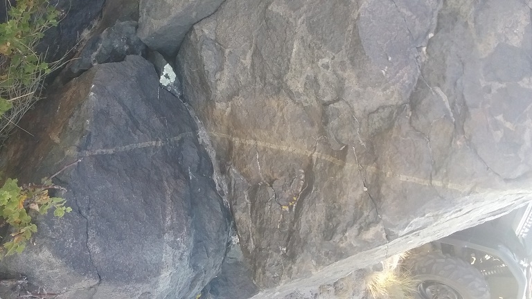
-
First off, I'm talking about placer gold. Secondly, I realize this is a simple question with a very complicated answer. But in probability/statistics/percentage terms, I think it's not that crazy. Most, if not all gold is going to end up in the ocean if it's not recovered by one of us. But even once loose from it's origin that could take many 10's of millions of years. In the meantime, gravity is pulling it towards the earth's center. Even dense clay can stop it for a while, but usually it sinks until it reaches bedrock, and even then it can be horizontally displaced unless it falls in a crack/crevice. If you're using a metal detector there is a minimum size that can be detected. "Young gold" (that which has only reached its current location in the last days, months, or even few years) tends to be sub-threshold gold in terms of metal detecting (I think -- please correct me if I'm wrong). So if you're going to find placer gold with a metal detector it most likely has been at or near its current location for a long time, meaning on the order of tens or hundreds of thousand of years at a minimum. (Obviously there are exceptions, but I'm talking in general.) So, to cut to the chase, if I'm using a metal detector to find placer gold and I'm not getting to bedrock, am I just spinning my wheels? Postscript: I'm no expert on this. Maybe my assumptions and conclusions are completely bogus. If so, I welcome/encourage you to say so. I'm trying to learn, not protect my ego.
-
 Best gold hunting video I have seen of pocket gold hunting in NW USA. Always wondered what this serpentine/greenstone really looked like plus contact zones, how to read geology maps vs Natl Forest maps, etc.. http://www.goldpannersguide.com/#!bookstore/mvjm7 Looks like I will be buying some more gold books/videos for my library from this place...not much info around on Pocket gold hunting.. One of their online videos is from ICMJ and explains how the western states got to where they are today, mining wise, and why all the hassles vs 1872 and whats being done to try to resolve it.
 -
https://student.societyforscience.org/article/gold-can-grow-on-trees-pointing-rich-deposits-precious-metal-below-ground I was doing some research on Stunted trees as related to possible Plant indicators for gold and came across this website. Eucalyptus trees in Australia found 1 lucky geologist a big gold strike . I was told some trees I found that looked like they belonged in an evil enchanted forest could be indicating a rich mineral deposit close by? The same trees, just 150 feet upstream on this little gully are so stately by comparison, 100+ feet in height and maybe 2 foot thick trunks and thick leaf cover, whereas downstream the Evil trees have thick branches within 2-3 feet of the ground and might be 25 feet tall, short, fat, and UGLY. The gully starts out as black soft mud by the stately trees and is brush covered and dry by the stunted trees. The adjacent fields are gravel and there is a gravel quarry just north maybe 1/4 mile. And a large gravel bottom creek runs thru the area to the nearby river. I haven't been to the area in a long time cause there were hand size paw prints in the sand with 3 BIG toes and following a deer. I am assuming it was a cougar, not a coyote? I didn't feel like being cat food. I don't like guns either. -Tom
-
I accidentally found the online course notes for a class in introductory geology. This is not the class itself but a set of Powerpoint slides that accompany the class, also available as pdf files. The presentation makes for a very well illustrated and simple overview of basic geologic processes along with some terrific animations. Well worth a look for those with an interest in geologic processes. The one that lots of you might find most interesting is on minerals at http://www.appstate.edu/~marshallst/GLY1101/lectures/5-Minerals.pdf The link below has the full set of lecture notes. Course Description Modern civilization and life in general are inherently tied to geology. This class is designed to give you an introduction to geology and geologic processes. By the end of this course, you will have an improved understanding of topics including the formation of the Earth, Earth's inner structure, movement of tectonic plates, the materials that make up our planet, the various landscapes on the surface, water resources, and the ways in which the planet has changed through time. In addition, you will become experienced in critical thinking. Yes, that’s right. I will ask you to think in this course! The first half or so of class will focus mainly on basic geologic principles, such as the Earth’s formation, plate tectonics, the rock cycle, major rock-forming minerals, and general stratigraphy. Later on in the course, we will discuss natural hazards and water resources and their impact on the landscape and society. Remember, this isn't rocket science; it's rock science! http://www.appstate.edu/~marshallst/GLY1101/lectures.html Scott T. Marshall ASSOCIATE PROFESSOR 111 Rankin Science South Department of Geology Appalachian State University 572 Rivers Street Boone, NC 28608
-
I had posted the following in another thread recently but it did not get much traction maybe because the thread was about something totally different? LOL If you have an opinion let's hear it! This thread is not titled for experts only! I wonder if there is a difference in performance in tailings depending on the type of tailings. Do we need to differentiate between hard rock tailings and placer tailings when talking about the relative merits of PI versus VLF. For instance tailings from ancient river deposits as opposed to a hard rock tailings deposit consisting of iron rich ultra-mafic rocks. Or is it a moot point in all ground types of hard rock tailings due to no electrical conductivity in hard rock tailings because they are busted up? I think quartz tailings can be very benign almost to the point of an inability to GB on them. In regard to depth on tailings between PI/VLF being basically equal, is that true in all instances except for say a GPX or GPZ due to the battery power enabling a much higher level of gain? Like VLF = TDI but VLF < GPX? HH, Merton
-
WOW, Just read the article in ICMJ and got to agree with Steve, good article. I spend a fair bit of time in the Santa Rita Mountains and belong to two different clubs for the claim access and can't believe how many club members will congregate in one small area, I stand there looking and think, Ya right. I usually go out during the week, when its quiet, I am talking nobody around. This is the part that really bugs me, I have found some virgin ground and small 1/4 to 1 gram nuggys, and just when you think you have found the mother load, you don't find nothing else. It really makes ya wonder how did that one little nuggy get there? Where is the rest of that little nuggys family? Ivan