Search the Community
Showing results for tags 'research'.
-
Hello all, Some of you may be way ahead of me on this but I am just now trying to actively use LandMatters for researching areas to prospect.... Mining claim info is a top priority in a new area I am looking at-- I need to know what is claimed so I don't go high grading.... The fact is, I almost did until I opened the maps up thru LandMatters---and saw there was an obvious claim exactly where I was intending to go!!! I was struggling to understand the mapping software because I never listen to tutorials or read instructions...when i tripped over a you tube video explaining some very basic easy to understand tools to use the software... so i will post it,,just in case any of you are "challenged" like me....lol Thanks again to Ruby and Miner Diggins for putting all this together in one spot-- my donation is on the way...
-
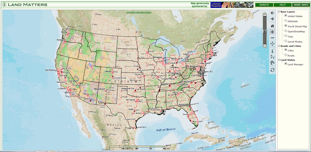
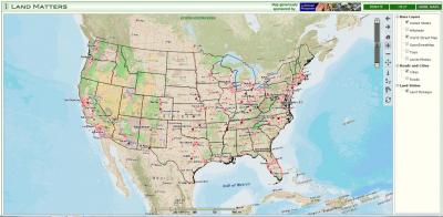
 When Chris Ralph and I were down in Phoenix I was fortunate that Chris lined up a dinner with Barry and Leigh, the brilliant couple behind the new non-profit educational organization, Land Matters. The website at http://www.mylandmatters.org/ is your constantly expanding source of land related information, including: Library - A Library full of free maps, guides, books, tutorials and reference materials. Maps - Interactive maps for your area of interest. More being added every week. Articles - Factual articles written by those in the know. Information that you can rely on. Resources - Links and contacts to other communities of knowledge. Outreach - Programs that engage the community directly. Seminars, outings, trainings etc. I am far from done checking it all out myself, but this looks like something we should all consider getting on board with and supporting if possible. Check it out. I have added this banner to the rotating collection in the upper left corner: and added them to my links list Barry and Leigh, very nice meeting you, and keep up the great work! Here is a link to the new interactive land management status map http://www.mylandmatters.org/Maps/Management/GetMap
-
Hello everyone, my book "Detecting for Gold, Adventures, Trips and Tips" is now for sale at http://www.trinityau.com Thanks, TRINITYAU/RAYMILLS
-
I found a TOP NOTCH Prospecting video that answers most of my desert prospecting questions in terms I can understand vs geologist mumbo jumbo. Unfortunately, Rob Allisons website says the video has been discontinued and he has only 2 copies left at 15 bucks each. It is made by Chris Ghoulson from Arizona and the title is " Nugget Hunting Essentials,Volume 2, From the Ground Up " and is 90 minutes long with intro by Jonathan Porter. Answers about 75% of my recent questions on this thread and then some. Too bad it is discontinued?? !! I wonder what Volume 1 was all about? The video covers such things as detecting recent dry washer tailing piles-what to look for and what to ignore, red dirt and white quartz rocks, ironstone or magnetite rocks,detector coils and what makes them work, what hotrocks, trash, and gold sound like on a Minelab GPX machine, rock formations to look for to improve your nugget finding chances, and plenty of video examples of these things so no guessing...when to use large vs small coils, dangerous critters in the desert, etc, etc -T
-
Welcome to the Bureau of Land Management(BLM), General Land Office (GLO) Records Automation web site. We provide live access to Federal land conveyance records for the Public Land States, including image access to more than five million Federal land title records issued between 1820 and the present. We also have images related to survey plats and field notes, dating back to 1810. Due to organization of documents in the GLO collection, this site does not currently contain every Federal title record issued for the Public Land States. http://www.glorecords.blm.gov/default.aspx This site is going to eat up a vast amount of my time!
-
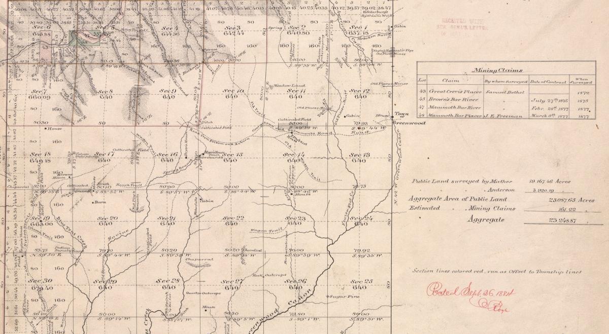
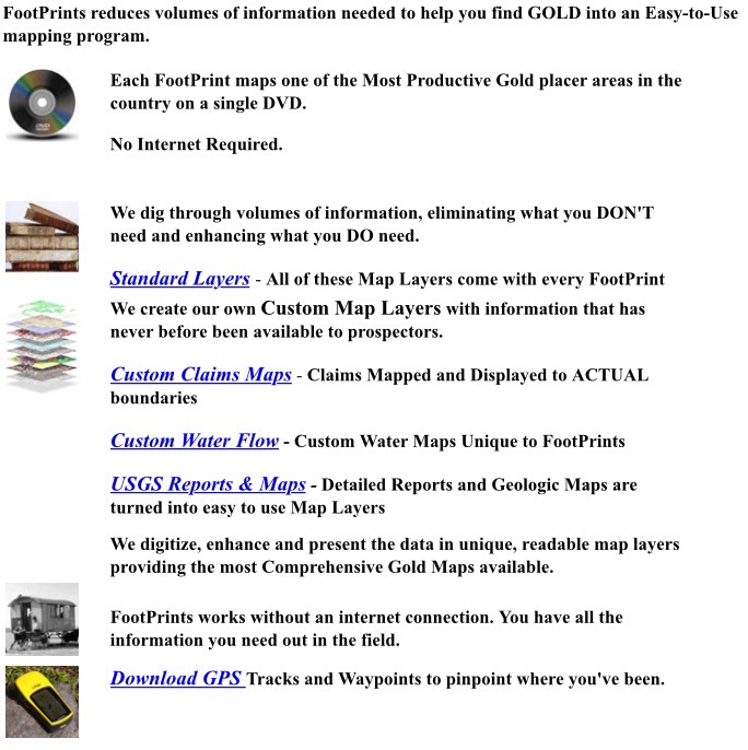
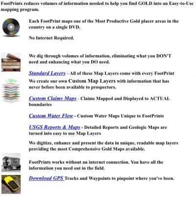
Last fall I ordered the North Fork American River edition of the FootPrints mapping software produced by Miner Diggins at http://www.minerdiggins.com/ I am far from expert with the software, but my stock in trade is research and I immediately saw the value in this series. In theory it is information I could find on my own for "free" but my time is valuable. Any shortcuts I can take when getting the information I need to go prospecting I am more than willing to invest in. I just ordered the Middle Fork American River, Gold Basin, North Bradshaws, East Bradshaws, and Black Canyon editions, all for less than the cost of a Minelab coil. The most valuable part for me is the current mining claims mapped to more than section level accuracy, which is all you get with other software. Not knocking the other guys - I subscribe to them also. There is a lot of additional value in geologic and historical map overlays. All in all, an excellent product well worth the investment. Now if Clay and Ruby can just get those other California editions completed and available, the sooner the better, I will add to my collection. Great stuff - I just love maps!
-
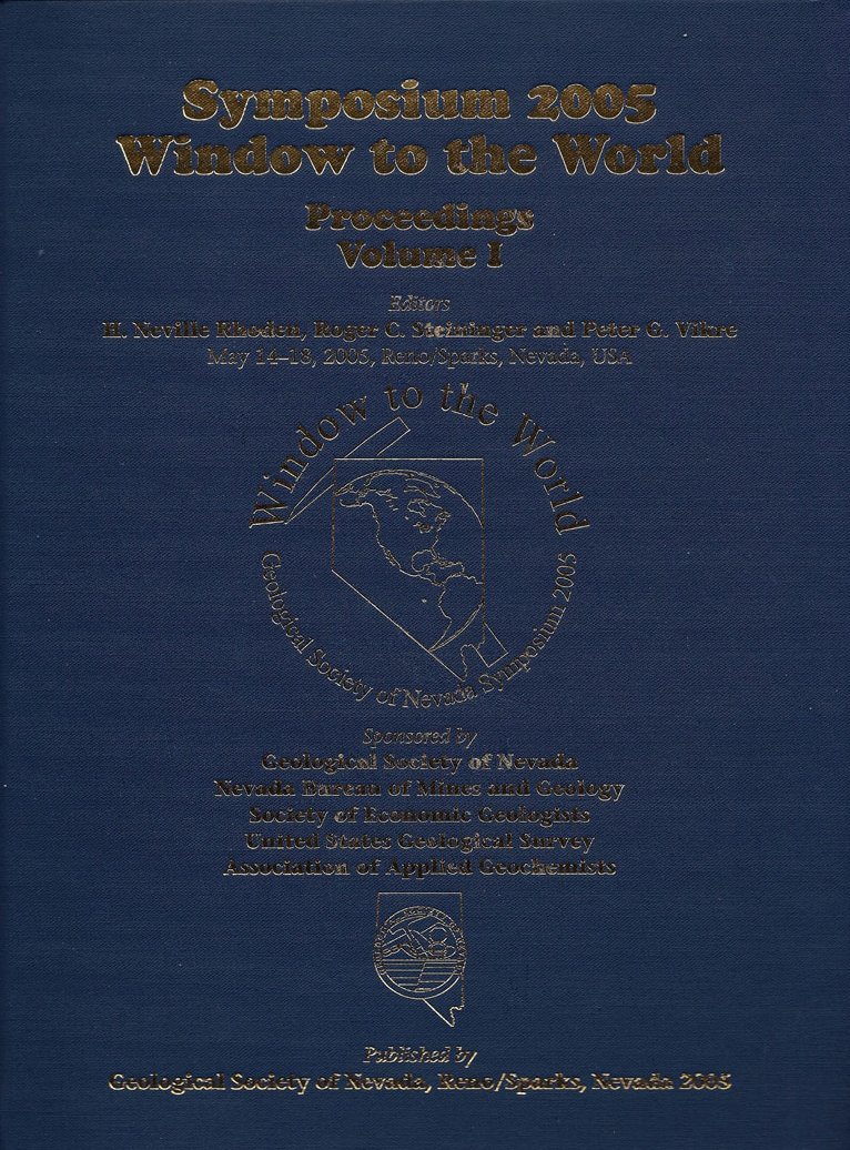
This is some recent information about the ancient tertiary stream channels of California. It updates ideas about where the gold in the channels came from and theorizes about upper extensions of the channels all the way into Nevada. "Speculative upstream continuations of various branches of the Tertiary Yuba and American Rivers enter Nevada near the Fort Sage Mountains, Hallelujah Junction, Reno(?), Little Valley, and Hope Valley (via Echo Pass). One branch of the Little Valley channel can be speculatively traced to the vicinity of Yerington." There are also a few very good maps included that alone make the article worthwhile. Garside, Larry J., Henry, Christopher D., Faulds, James E., and Hinz, Nicholas H., 2005, The Upper Reaches of the Sierra Nevada Auriferous Gold Channels, California and Nevada, in Rhoden, H.N., Steininger, R.C., and Vikre, P. G., eds., Geological Society of Nevada Symposium 2005: Window to the World, Reno, Nevada, May 2005, p. 209-236 Download as a pdf at http://www.ucmp.berkeley.edu/science/profiles/garside_paper.pdf

-
I just finished reading the second of a three part series written by Steve...the first two were excellent and I am sure the third will be a bang-up job also. Steve has the talent and patience to detail every aspect of the points he wants to elucidate...and does so in every article. The information is good for beginners and not-so-beginners alike...I always enjoy his writings. Ray, also has an article about coils that is great information for all detectorists... A subcription is really a great way to get continual reminders and upgrades to your gold hunting,mining and detectors knowledge... fred
-
Looking for first hand info about Libby Creek in MT.. I am not interested in the public panning area, but looking for information about claims of GPAA and NWMGP, or other possibilities. I am mostly interested in detector prospecting but also enjoy highbanking. Does anyone know what folks find in the way of nuggets? Also size of claims, access, area camping opportunities for small RV's. Any and all information would be appreciated. I am considering joining a club if that is my only option to access claims but would like to get some feedback from anyone who has worked the area. I have gotten info from Steve along with lots of other Montana stuff, but would like to hear from people that have been there. Libby is my closest gold patch and I wouldn't have to plan a weekend every time I want to swing my detector.
-
For an interesting read on pocket hunting posted on a Canadian forum- http://gpex.ca/smf/index.php?topic=12499.0
-
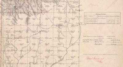
I am looking for geological reports for a specific patented property. If I understand correctly before a patent is issued a survey has to be done and I am having difficulty finding one. Anyone know the process to obtain this kind of info?
-
 Our government keeps an inventory of abandoned mines. You'd think they'd want you to know where they are so you could steer clear and stay away. Oh, no, this is a top secret database, a real spy the caliber of James Bond would not have the clearance to see. Locations of abandoned mines are a deep dark secret, never to be revealed. You might go out there and find something and that would be terrible! Here is as close as you can get without being marked as the target of a government hit. http://www.blm.gov/wo/st/en/prog/more/Abandoned_Mine_Lands/abandoned_mine_site.html Maybe I should volunteer to be the "site steward" of some formerly productive gold mine. On the other hand, maybe that's too dangerous - If I show too much interest, I'd probably disappear this summer and be taken off in a black helicopter never to be heard from again. OK, so maybe I am being a bit tongue-in-cheek with this, but there is an element of truth in my sarcasm.
 -
 Hello Cy, it is very difficult to try and narrow things down for you. The problem in trying to discuss pockets or lines is that they show up differently at different locales. I can tell you what to look for here at my location but it may be completely different where you are at. We both may have opposing geology while we may also have some similar features. When I take a person out training I try and show them what is happening on the ground. The geology of your local area may be different but the set-up in my mind is probably pretty similar anywhere. Let me try a different approach. Lots of people are on the lookout for a contact zone. This is good but too many people read too much into it. Some will see a quartz stringer running across the surface and call it a contact zone. While this may be true to an extent there is bit more to it. The area that I am located at has a general push from the NW to the SE. This push is the general direction in which the most prevalent base material is heading. In my neck of the woods this is shale, any color shale. So, as I am walking along I am watching the ground near and afar and seeing that common trend from NW to SE. While walking I notice that there is a dike or a seam, whatever you want to call it, of a different material crossing or cutting the general trend of shale that I have been looking at. This different material can be three feet wide or thee inches wide or it can be tiny seams that are matchbook wide, does not really matter. Here in my area it is usually Granite, Diorite, or Quartz and I have even seen shale crosscutting shale. As I stated earlier what you are watching for is the odd body of material that is cutting your general trending material. Once I have come across a location like this I slow down and try to find its limits. At times an area can be very small and precise while at other times the area could be very large, literally square acres. Let me break down (limits). When you have one material crossing another, let's say shale being crossed by diorite, most times you will have a change in the color of the immediate and surrounding area. I try to line this area out so I can determine the likely erosion path. Remember, what is the down side of a hill now might have been just opposite millions of years ago. Finding these limits can be very frustrating when you are in an area that has lots of grass and foilage. Sometimes you will have outcroppings of the crossing material and this can really help to identify a direction. This may sound way out there, but there are many types of vegetation that grow only in certain ground conditions. This too can be a possible lead to a location. Once determined what direction that erosion has taken place I start to detect. If I am on a slope I go down the hillside several hundred feet and then start back up detecting as I go. I like to zig zag across the slope until I come across that first piece. At that point I start to concentrate on that area and up the hill. Yes, there are times that I do not get a piece and I may have to change my hunt tactics and become a little more intense with my search efforts. Of course there are times that all the pieces of the puzzle come together and there still just is no gold to be found. This happened to me a lot when I first started detecting for pockets. After a few years things became clearer and began to go my way. Once on a line/pocket you can almost run it out with a compass. I am talking about a sometimes straight line that will throw detectable gold on the surface accompanied by a clay or ironstone seam. These lines or pockets occur around the contacts that I have mentioned and can be traced for miles. An interesting scenario that I encounter in my area is that a lot of the most productive areas that I have located seem to always show up on the southeast facing slopes. So much so that I tend to seek out just those slopes. Many people are too engrossed in looking for the quartz on the surface. In my local area there is virtually no quartz at many of the locations where pockets or lines have been found. This brings me to another point. When I say pockets most people are thinking of a single location where gold has been trapped and found, such as a crevice in bedrock. Others are thinking of an enriched zone of a vein that has pocketed out and left goodies behind. What I am after when I say pockets are these lines or very small areas that run immediately below the mentioned contacts. Are they worth it ? I think they are and many of my friends have learned over the years to become "one with the dirt", and the gold starts to show up. I will say that this may just be an anomaly to the Redding,Ca area but I know that is not true. I have done the same thing in other parts of California, Nevada and Oregon. It is not easy and it can be really frustrating but it has been very rewarding for me over the years. This is a different type of hunting. I do hunt the old diggings, ground sluice operations, gullies and creeks, hardrock deposits and any other locations that the old timers worked but I like the thrill of finding gold in places where no one is looking. I hope this helps some, these are my thoughts from thousands of hours on the ground that I have hunted for pockets and lines. TRINITYAU/RAYMILLS
 -
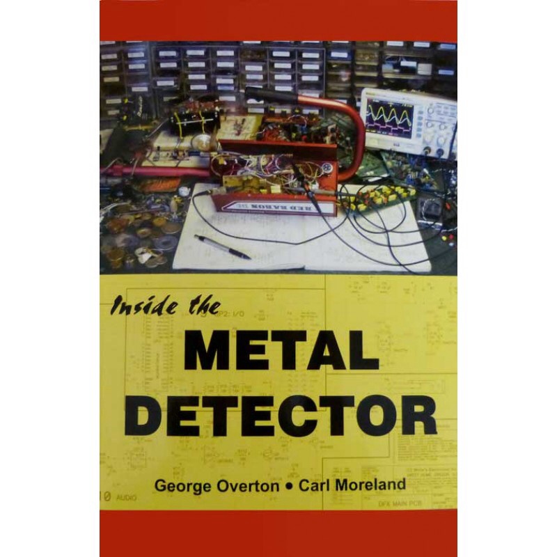
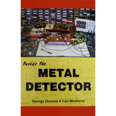
Before Carl Moreland was Engineering Manager at White's Electronics (and now First Texas), he created a website that has more technical information on metal detectors than any I know of. The Geotech website has lots of interesting stuff and in particular it has a lot of "build your own" metal detector projects for the electronically minded. I have never done this myself but if you were ever curious about what makes detectors tick a lot can be learned here. Projects http://www.geotech1.com/cgi-bin/pages/common/index.pl?page=metdet&file=projects.dat Info http://www.geotech1.com/cgi-bin/pages/common/index.pl?page=metdet&file=info.dat George Overton & Carl Moreland, co-admins for the Geotech web site, also wrote the new book, Inside the Metal Detector. This is not another "how to use a metal detector" but rather a look inside to the operating principles and electronics that make a detector work. Inside the Metal Detector explains theory and offers numerous experiments and projects that demonstrate the theory. You can build an off-resonance pinpointer, a GEB-discriminator, and a microprocessor-controlled PI detector. Even if you're not inclined to build a detector, the concepts learned from ITMD will help you better understand how your own detector works and what all those controls are really doing. The book can be purchased as paperback or Kindle format on Amazon
-
Does anyone know of an online source or website of maps indicating current federal and state claims in Washington? I would like to do some prospecting but don't want to trespass. Thank you.
-
In the ICMJ'S Prospecting and Mining Journal there is a fun article by Steve relating his early days of gold mining...I was amused by his description of his early excitement over itty-bitty gold specks...It reminded me of when I thought I was rich with my first pan near Downieville... And the article by Jonathan Porter relating his Father/Son competition was a reminder of my days with my own father whom I miss every day...we had great times together as does Jp and his family... The subscription is not much dinero. And Reno Chris always has informative articles as he is the Associate Editor. give it a try fred
-
Hobo mentioned in my other thread that he wish he had kept a record of his finds with various detectors so that prompted me to start another thread under the above heading. Keeping a record is something I have focussed on since I owned my 1st detector. I have written diary records of every trip I have ever taken to the goldfields and due to my statistic type personality I have also created an excel spreadsheet documenting the date of each trip, their destinations and remarks. Also I have another excel spreadsheet which displays dates, nugget sizes and the depth of each nugget found along with what coil and what detector (including its setting) that found them. A third excel spreadsheet has a record of the total number of nuggets and their total weight from a certain area including the total number of trips to that area using each of my detectors both previous and current. This therefore enabled me to compile the results I displayed in the “Pulse Detector Results” thread. Finally using the total weight and number columns I can then do a sum for an overall Grand Total Weight and Number of Nuggets found since I started detecting. Are others out there doing the same?
-
Recently moved to the Kalispell area, does anyone know anything about historical mining in this area, prospecting clubs, etc?
-
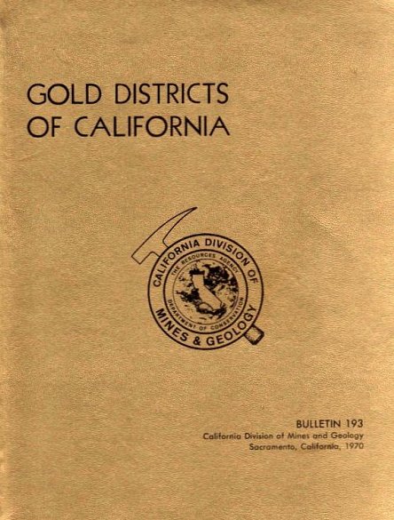
Gold Districts of California by William B. Clark 1970 California Division of Mines and Geology, Bulletin 193 This is a relatively up-to-date and comprehensive guide to the gold deposits of California. Although a vast number of publications have been written on gold and gold mining in California, there was no single report or treatise on all of the known gold-bearing districts in the state. This bulletin addresses that issue. In this report the principal features of each gold-bearing district are described. The longer district descriptions contain sections on the location and extent, history, geology and character of the ore deposits, a list of mines, and a bibliography. Production figures are given whenever possible. https://www.detectorprospector.com/files/file/137-gold-districts-of-california/ More free books can be found in the Metal Detecting & Prospecting Library

-
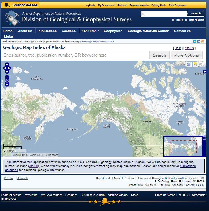
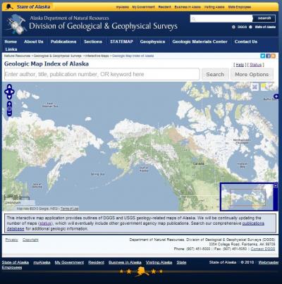
Alaska is trying to make as much information as possible available to prospectors on the internet. The latest offering is an interactive map index for state Division of Geological & Geophysical Survey (DGGS) maps and US Geological Survey (USGS) maps. It allows searches of the database by geographic area of interest, keywords, publishing agency, dates, etc. Results of a search provides a list of free, downloadable maps. The current database status (a work in progress): Maps published by the Division of Geological & Geophysical Surveys (DGGS) Percent of DGGS maps uploaded by theme: Geology 96% Geophysics 95% Hazards 98% Other 25% Resources 85% Maps published by the U.S. Geological Survey (USGS) Percent of USGS maps uploaded by theme: Geology 65% Geophysics 25% Hazards 50% Other 12% Resources 25% Check it out here - http://maps.dggs.alaska.gov/mapindex/
-
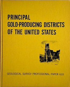
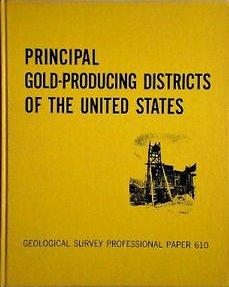
USGS Professional Paper 610 by A. H. Koschmann and M. H. Bergendahl - A description of the geology, mining history, and production of the major gold-mining districts in 21 states. This 1968 publication obviously lacks the latest production figures but it still is a great overview to where an individual prospector can look for gold in the United States. It is a huge 283 page pdf download so be patient! Pay particular attention to the listed references in the extensive bibliography for doing further research. I have the original out-of-print hardback but what I paid for you get for free! You can download this here and find many more useful free books on this website at the Metal Detecting & Prospecting Library
-
You have to love the internet. This book was a rare gem only to be found in libraries or used book stores. Now you can download this classic for free. Anyone with an interest in California gold should download this invaluable reference and study it. The Tertiary Gravels of the Sierra Nevada of California, 1911, by Waldemar Lindgren USGS Professional Paper 73 Download the pdf file here You can find this and many more useful free books on this website at the Metal Detecting & Prospecting Library