


chrisski
-
Posts
26 -
Joined
-
Last visited
Content Type
Forums
Detector Prospector Home
Detector Database
Downloads
Posts posted by chrisski
-
-
On 4/3/2024 at 1:43 AM, Valens Legacy said:
The creeks around me has a lot of silver in them in larger size nuggets. I have to be careful when sluicing for the gold. When I notice the silver in my pan I stop and try to get all the silver I can. We have recovered almost 4 ounces of it so far this year, compared to a quarter of an ounce of flour gold. That's 4 hunts so far this year in the creeks for about 3 hours each time.
Would like to see a thread with pics on getting silver.
locally, native silver doesn’t exist, although historical production is more silver produced, but the silver is from chemical extraction.
-
17 hours ago, John-Edmonton said:
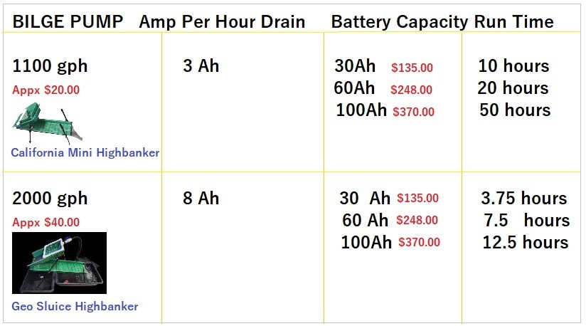
A couple of things to bring to your attention. Drop riffle highbankers require less water flow then your standard riffles. Drop riffles allow the gold to drop out of the water flow, like it happens in nature. Standard riffles require more water flow, to create a low pressure zone, hopefully capturing gold. Larger stones can knock flour gold out of standard riffles, but just roll over drop riffles, where the gold has already dropped out of sight. Because of less water flow, drop riffles run very well on bilge pumps. The California Mini runs nicely using a 1100 gallons per hour pump. The Geo Sluice runs well on a 2000 gallons per hour pump.
12 volt lithium ion batteries are really coming down in prices, and bilge pumps are not a great expense. The lithium ion batteries can purchaced on Amazon or Ebay.
I did the math and pricing for running either the Californiaa Mini or the Geo Highbanker with different batteries. You could also run a 6" standard riffle unit on a 1100gallons per hour unit. These are in Canadian prices. US prices will be less.
Using a bilge pump is quiet, no gasoline, no oil, no tune-ups, no oil changes and the whole complete system is so light that you can carry it on your back and go just about anywhere. And drop riffles have excellent retention rates for flour gold.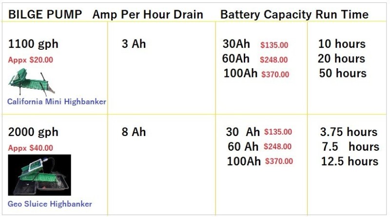
How much material did you run?
Was this pay dirt or concentrates?
-
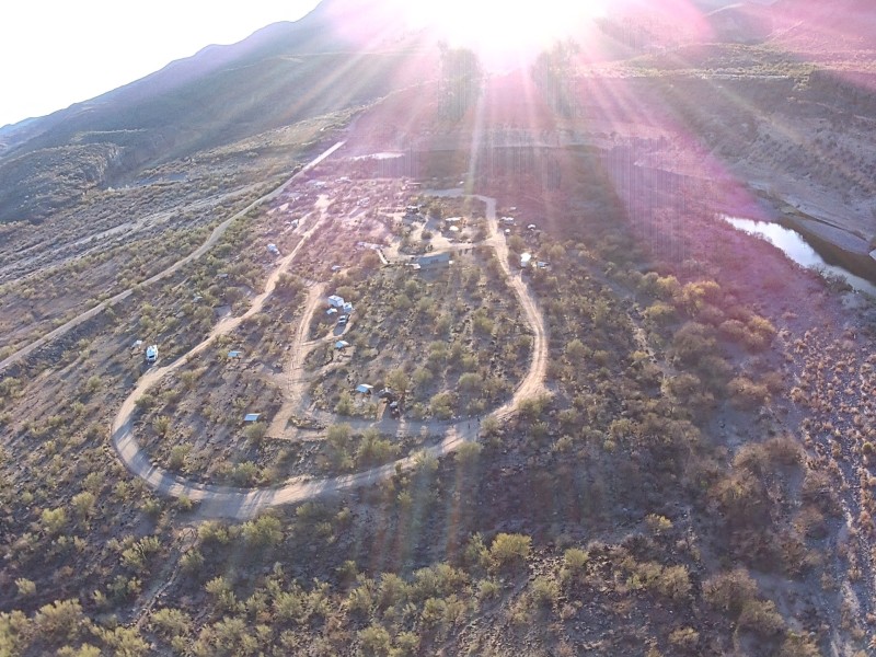
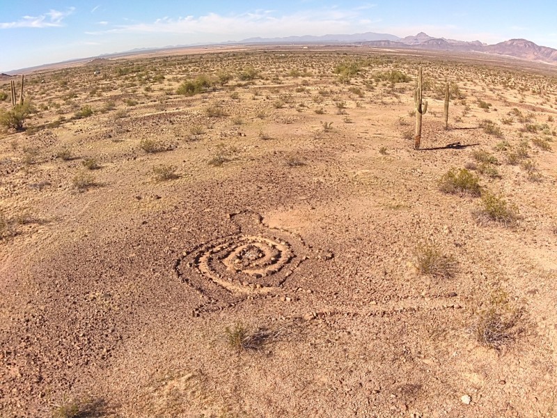
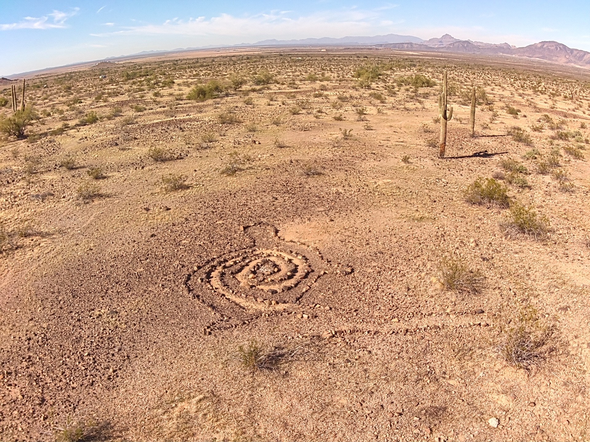
As a drone user of a lower end 4k 3 axis gimbal with electronic image stabilization, ( the HS720 drone), it is wholly unsuited for any prospecting work.
I can’t see any value added to a good google map survey or actually walking the few hundred extra feet from where your flying would bring to you.
Higher end drones with better cameras and surveying/mapping, maybe.
I’ve attached a photo from a jasper and obsidian bearing area and the time would be better spent walking around boots on the ground.
-
IMO; what you have has no commercial value.
I suspect it may be a type of chert, a jasper like pastelite or perhaps something opalized.
I would chop it up until it fits in a couple of ziploc bags and run it through the vibratory tumbler through four cycles and a couple weeks later I’d have a few polished stones.
IMO, at best you may be able to swap it at a rock show for something else interesting.
I’ve found a couple of rocks I think would make a good sculpture material, but not much of a demand for that.
-
What is the second and third from the bottom showing? Looks like a rusty spoon and rusty dish.
Other than the rocks that look good wet, will look better tumbled, I can’t help you.
-
3 hours ago, Valens Legacy said:
With all the circuit boards that I have, which are bad, I will be looking into this because I know there is a lot of gold contacts and plating used on most of the boards I have for my equipment.
I’d like to hear what you recover, but am a bit skeptical.
There were a few vendors at a GPAA show over 10 years ago that were selling to remove gold chemically from circuit boards. Seemed like a lot of work. He said he removed pieces from the board and tossed them in the solution while watching TV. He also showed me a hunk of grey metal a couple inches big he was sending off to be refined, but would not guess at how much it would be worth.
I’ve also plated nickel, zinc and copper, and the amount that goes on is insignificant. Also, when I can pay a few extra cents and get a gold plated contact for projects, I don’t expect much gold recovered.
Apologize for the off topic rant, but removing precious metals is a road I almost went down.
-
After two and a half weeks in the vibratory tumbler
-
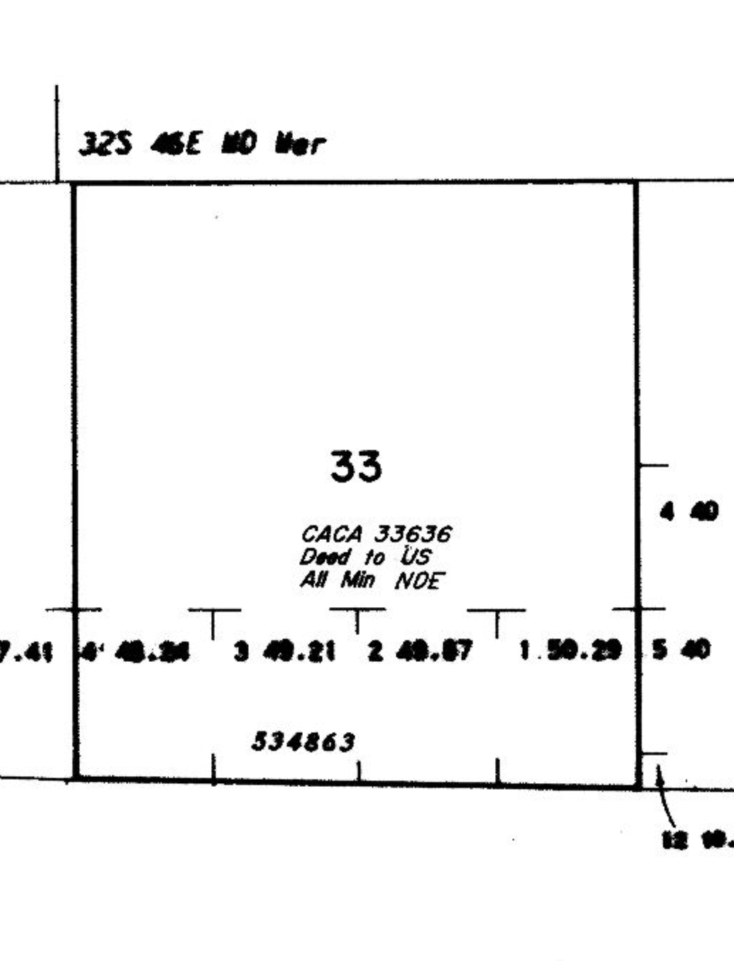
4 hours ago, Clay Diggins said:
Night detecting on that Placer Pete "claim" might be the best bet.
12N 2W Section 33 is not open to entry (NOE). There are no valid claims possible there.

Does “Not Open to Entry” also mean no metal detecting?
Or is it like the Lynx Creek Mineral Withdrawal area where limited panning and metal detecting is allowed, but no sluices or powered tools?
Thanks Clay.
-

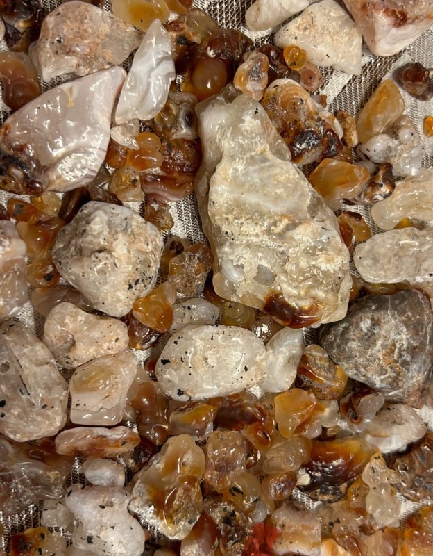
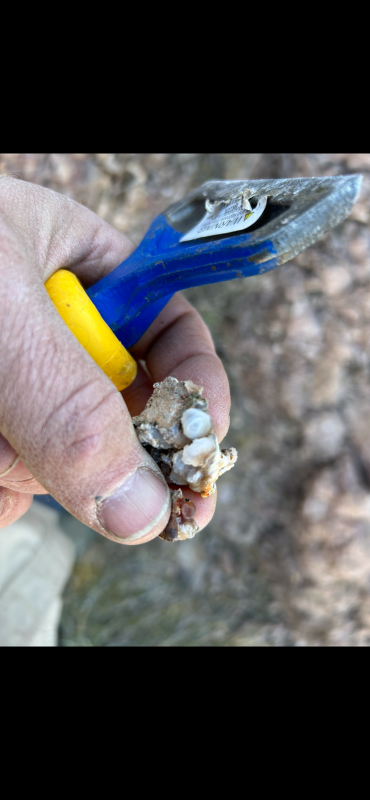
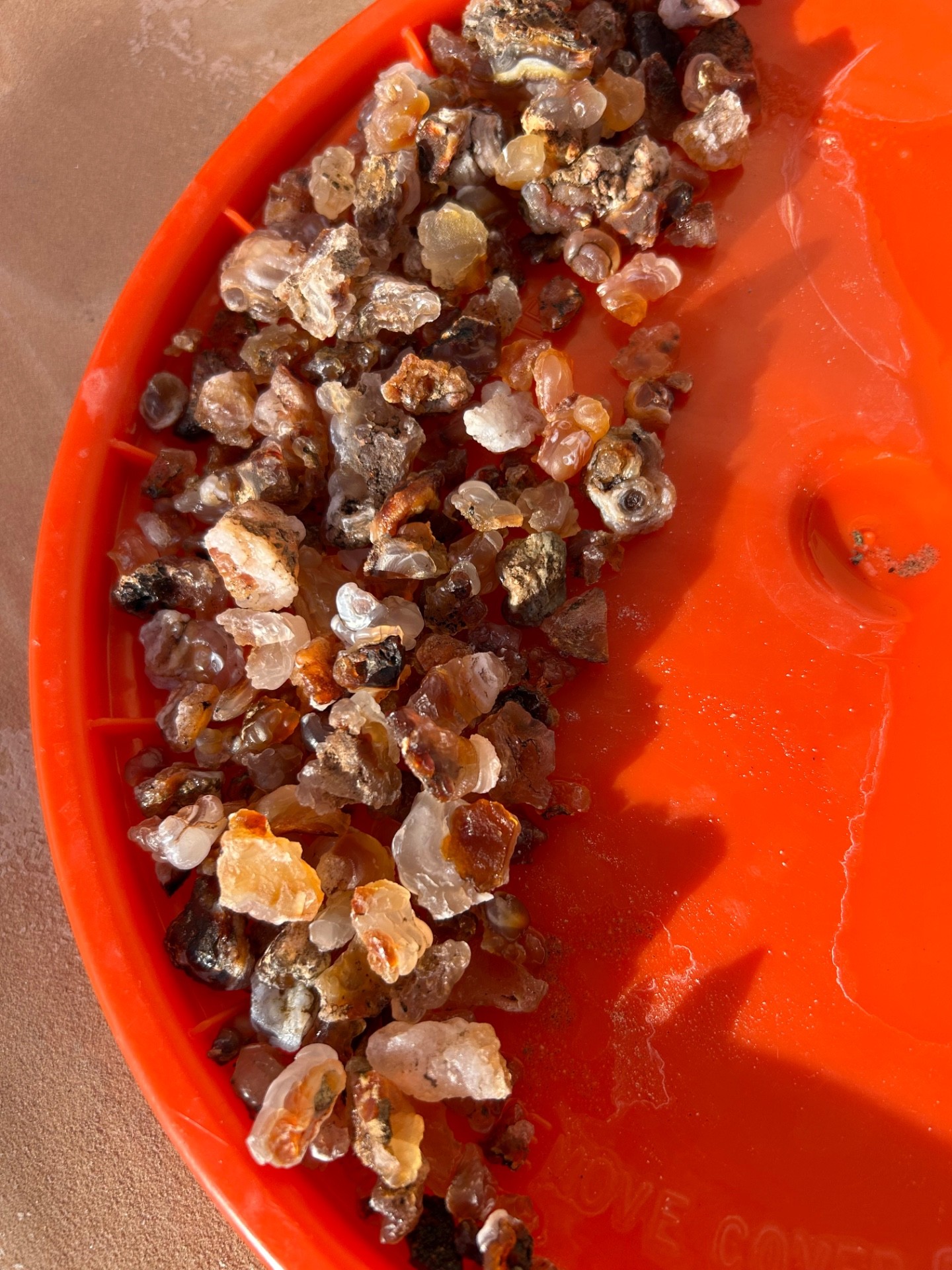
These are the “placer” agates picked off the ground, cleaned, and soaked in diluted Murcia acid.
Nothing left to do with these except perhaps tumble, make a couple better ones to jewelry or both.
The hard rock I agates I got were not so good. Not sure what I’ll do with those.
-
5 hours ago, Beeper Bob said:
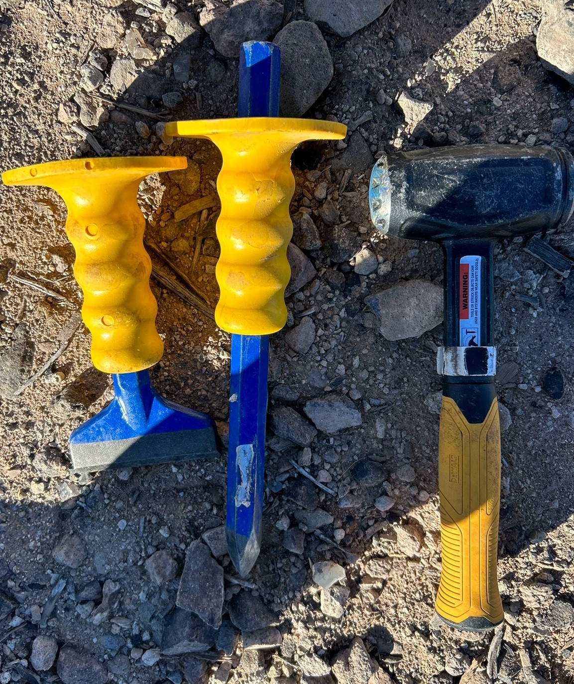
Got to bust some rock. Usually the best fire agate is not on the surface
I’m trying to figure which rocks to bust. I think I also need a sledge.
These are the tools I’m using

I found these lying in the flats away from the mountain on the desert pavement.
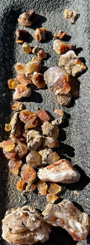
Did much better on the flats and saw nothing worth busting up today in the different area along the mountain I went to. No visible quartz veins and in a mile walk only about four pieces of chalcedony or quartz in the pediment along the mountain.
Was nice views though.
-
Just taking up hard rock gem mining. I got a small sample of fire agate.
The fire agate is the smaller red bulb in the picture. Chalcedony is the main matrix.
Before
 After
After
-
-
9 hours ago, Ndplumr said:
From all the replies on here, I can see what NEEDS to be done. Sounds like our govt agencies need to start being forced to record all this info electronically in a place people are able to access from home. I've dealt with the blm in the past with permits to do offroading tours. They tend to sit on their hands until a member of congress sends them a letter. I know this by personal experience. I think if the prospecting community put some effort into lobbying for these changes, it could be accomplished.
The BLM is doing what they are required by law to do. In there eyes they are simply a place that keeps a record and bear no responsibility for actual location.
Of the hundreds of thousands of claims, I’ll bet there are over 100,00 claim owners. Of all those claims and all those people, only a handful are worth the yearly fees paid to the BLM for actual minerals extracted, the rest are speculation or just someone wanting to have a claim.
I don’t think many would support any real change to any real effort.
What is your plan to lobby these agencies?
The AMRA on their Facebook page seems like they are active.
-
-
This topic comes up every once in a while. I think building an app is futile with claim location to the states allowing Mining claims with location within a 100’ is futile.
If you are interested in starting a claim app, volunteering for Clay and Land Matters.
There is somewhere around 350,000 active claims in a dozen or so mining states that allow claims. At the federal level, At best the BLM locates them to within a mile. At worst, its in an unsurveyed area, or the guy just did not file the right paperwork. I think I am camped on top of a claim filed with the county, but since the filer did not include the map, I have no idea where it is because of the non-existent markers. Guy has two claims he pays mining claim fees for every year.
At the county level, there’s dozens of ways counties files which involve you going through paper books, or claims located to the mile, and every way in between. In Yavapai county, I can sort by the mile (actually called township) and find claims filed in that area. Has nothing to do if they are active or not. THat is the BLM. In Maricopa, they do not have that, so I go back a couple of months looking for new claims in the county open EACH one individually to see if its located in where I want to look.
To open find a claim, all 350,000 of those maps have to be entered manually. But of course it’s nto that easy. A few of those claims will be adjusted over time, with paperwork filed with the BLM and no exact location map. An example, I ran into is the claim was 160 acres with a map with the county, but was adjusted much smaller about 40 acres. Of course the paperwork at the BLM said 40 acres, but the claim map at the county is blank, so it’s anywhere in this 1 mile by 1 mile sector with no markers visible.
The BLM has a new way to file claims where you put int the exact Quarter quarter section etc. Last time I filed a claim, I called the state office up and was told not fuse that and send a copy of the claim paperwork I sent to the county.
There was a company that did what you’re saying, Perhaps miner diggins. The software was called footprints. For a dozen or so gold claim areas, they would produce exact maps with an awesome geological overlay for the maps. These areas were several square miles, and might have covered a town size area, and certainly not a county or state. This involved a lot of manual entry on there part and pulling claims maps, and then plotting. They might have updated every six months. The county updated there database daily. So, I still had to search for recent claims at the county and federal level prior to going out.
If you want to start an app, choosing an area like Little San Domingo and getting good data could be the way to go. I have not seen footprints in a while, biut that database nd platform may be available.
-
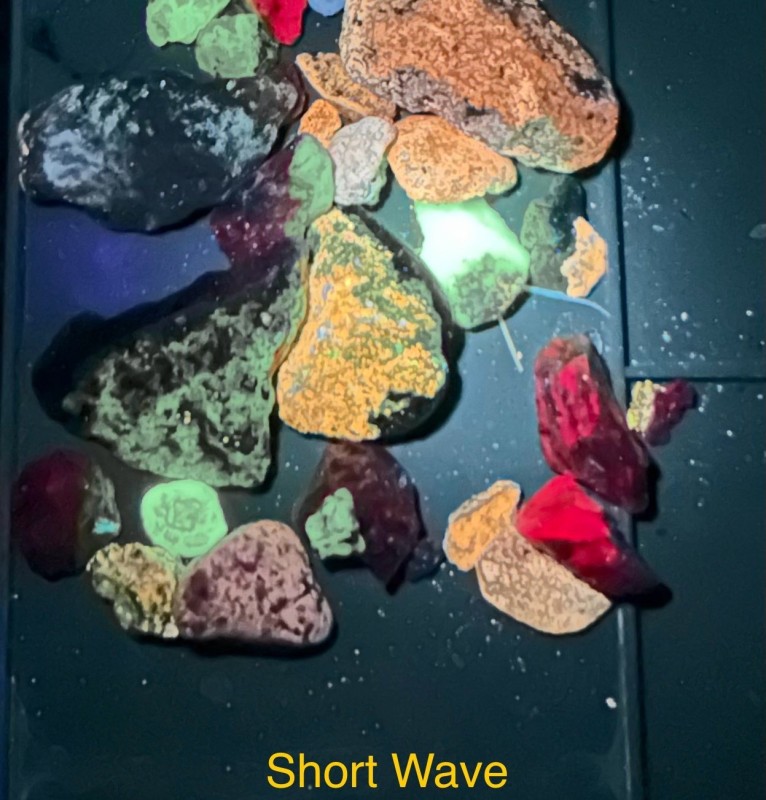
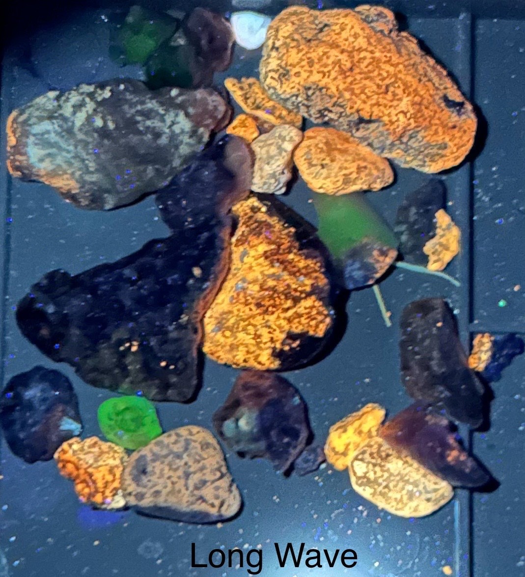
Here’s some recent fluorescent finds shown in long wave, short wave, and natural light. The pictures only show a fraction of the real colors. Location is Morristown AZ.

-
7 hours ago, Phillips_R said:
spider egg sack 🕷️
I thought you were joking, but looks correct
-
5 hours ago, mn90403 said:
solar interests, wind interests
Is this federal land? How do these keep you from mining if not being in use?
AFIK, the federal govt leases land to both myself and cattle grazers. I’m unfamiliar with rules of wind and solar leases on federal land.
-
Except for perhaps the ICMJ magazine, I have never seen a decent claim for sale. I can’t speak to larger scale mining, so I have no idea how good those ads were.
Adds for claims in things like craigslist and EBay all have a lot of words that explain the history of mining in the area. Most say they are located in the vicinity of the great producing historic (insert name mine). None of them have any data about what was pulled from the claim itself.
When I’ve looked at the actual location of this advertised, often there are open claims around it. Once, there was even a GPAA claim on better ground next to the one for sale.
When you look at a list of who owns claims, there is one guy who’s name appears a lot; he sells these claims he has. So many there is no way these are anything but paper claims. Not only will he sell them to you, if you forget to file the yearly paperwork, he will claim it again and then sell it to you a second time.
The area I am at, central AZ by Wickenburg, has thousands of claims with no active mines I see. On a rare good day, People can pull nuggets off these local claims and some grams dry washing, but in the whole state of 8 million people, there are probably less than 10 people making a living off small scale placer mining. I’m not saying this so someone thinks they will be #11.
I have staked claims myself based off gold discovery on them. I have let them all go because none of the nugget detecting, dry washing, or trommel mining I did would make it worth it.
-
That’s a 1200 wh 100 ah battery.
How much runtime do you get?
-
11 hours ago, Coffeeguyzz said:
My understanding (possibly incorrect) is that the 20 square acres can run outwards from the creeks 500 feet each side.
20 acres is typically recorded as 1320’ or 660’
The creek could be on the east side of a 20 acre claim. That leaves barely any feet to the east and most to the west. Same if it was on the middle.
Im also betting that many of the markers on your area are still valid. With claims opening and closing so much, at one time it was a valid claim, but five years later, may not be. People are under no real obligation to remove these markers.
-
Fighting off rattlesnakes or dealing with claim jumpers could spice things up a bit.
-
I see nothing resembling gold.
-
I did not see any news of an 89 kg nugget on Google. I did find gold production for the mine, and each of the last five years total production was less than 89 kg
-
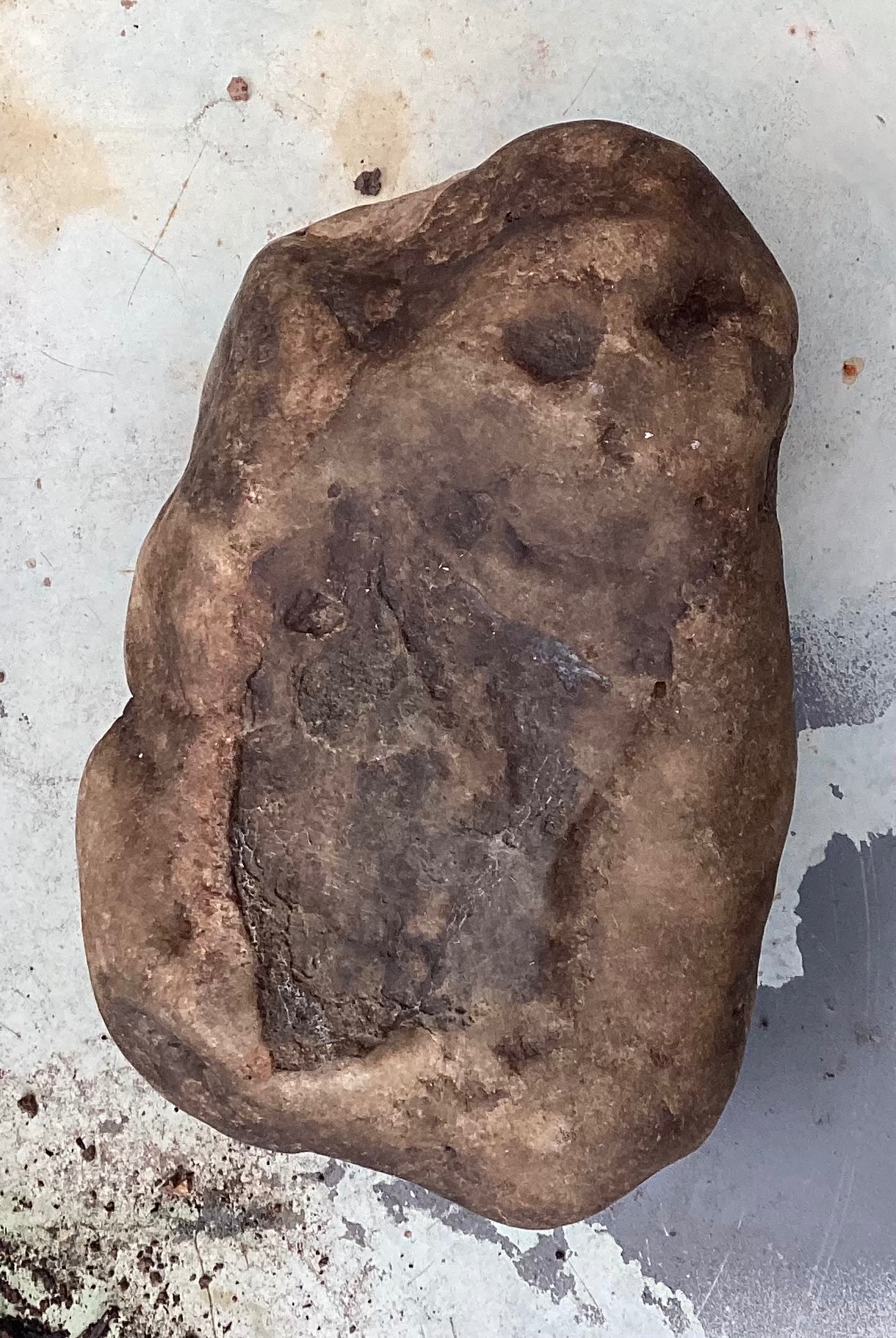
1 hour ago, brys said:
This rock is heavy and dense ,it’s from the beginning of time ,tungsten burrs won’t touch it it’s so hard ,indentation from when it was in a liquid state

Are you saying a tungsten chisel has no effect? We’re you tapping to split it smoothly or whacking with force?
To me it looks like a rock that has been rolled in a river or glacier to get rounded out.
-
I wear gaiters with all leather boots, a set of leather gloves, and clothes are a thicker weight cotton material.
Like the OP, I’m in AZ. Gaiters were originally for snakes but they help so much with the thorns.
A few times with cholla cactus stuck to my hands and it’s the gloves.
The thicker cotton lasts longer against brushing against thorns. I’m still looking for a material as durable as winter weight BDUs/ACUs.


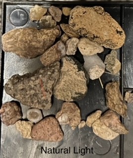
What's This ?
in Rocks, Minerals, Gems & Geology
Posted
I’m torn between pastelite, a type of jasper, or quartz.
Most pictures look like quarts but the way it fractures in one picture makes me think pastelite.
Where did you find it? Looks like pastelite I found in central AZ.