


Kodiak
-
Posts
67 -
Joined
-
Last visited
Content Type
Forums
Detector Prospector Home
Detector Database
Downloads
Posts posted by Kodiak
-
-
Thanks for taking the time to share Jed's adventure with us, as well as your modern day adventure. I ran out of likes for the day and will be back for more tomorrow.
-
On 2/27/2022 at 4:52 PM, opalboy said:
At the Denver gem show, I have several friends that are opal dealers. It’s a terrible addiction!
Nice Yowah Nut. I'm sad to say Ive become an Opalholic myself. Very expensive addiction.
-
I saw that it sold 125k. Amazing opal.
-
Amazing find. I bet you weren't expecting to dig that. Good recovery job.
-
I like the name of the nugget. It adds even more character. Sad ending though. Thanks for sharing.
-
1 hour ago, GhostMiner said:
We have decided to parce out 10 acres over Jed's diggings and name it Jed's Gold Vault.
You any data back from that phsist? If the data is good. I wount mine takin out 1 acre parce if price is write. As Bob Barker says, Come on Down.
-
6 minutes ago, GhostMiner said:
He did several types. I wasn't out there when he did them but my partner was. Some were arial and some were on the ground. We also had a geologist out there. They spent 2 days working. I'm going to contact him this weekend and talk further about all this. I don't want to do a formal plan on this project so my concern is how to get down 50 feet below the surface. The flooded hole Jed dug is collapsed. There is also gold left in that huge trench they dug back in 1936. I don't think they got to bedrock everywhere in it. That's where the high graders were stealing gold. I can't even imagine the digging they did. A clue - the crew gets larger. I Beside that digging to the south is the drop zone fault. They are saying to maybe dig a descending drift but I have no experience with that kind of mining. It would have to be timbered. You'd have a starting point way back from the target and work your way in. Or you go straight down. It's all sitting on bedrock. They are telling us it could be as much as 10,000 ounces.
Thanks for the answers, I hope that Physicist has some good data for you. Good luck with everything. Just curious, but were you sharing this same story on Treasurenet? about a year ago? There is alot familiar with a poster over there whom they banned eventually.
-
4 hours ago, GhostMiner said:
A phisicist using arial lidar worked at Jed's old site awhile back & we have his results. According to him there is a large gold deposit at the diggings that Jed worked. As good as Jed did & it was very good it appears he only scratched the surface & there is a bigger deposit beside his dig in a small drop zone fault. The amount that could be in there is big but deeper than Jed's workings. Jed probably would have called it a kettle - a very deep one. It will require some tipe of verticle or sloping drift. He is working on some ideas for a hand digging operation. He told us it won't be easy.
I am enjoying this thread, but I fail to see how a physicist could determine there was a large gold deposit using ariel Lidar. Lidar only measures the ground surface, perhaps he was using different equipment besides Lidar? Is this fellow a GeoPhysicist? There was a good thread awhile back from some Romanian fellow with a ground penetrating radar.
-
Congratulations is that nugget turns out to be platinum. Quite the find.
-
I dont see this thread lasting very long.
-
Great pictures. Congratulations on the peruvian real cob, it looks like you found a spot with hundreds of years of history. Good luck and thanks for sharing.
-
For heavy rain Grundens cant be beat. They dont breathe, but you wont get wet either.
-
Looks like Jerry Garcia.
-
Original Rock looks like an ordinary rock to me. Thats a good thing, no reason to shut down progress because of ancient claims over rocks.
-
Great finds. Thanks for sharing them.
-
Great Find. Nice Fish. Congratulations.
-
Wade sounds like a great guy glad you guys found some gold. The story lead me at first to believe he only had one arm, which reminded me of a guy I met who was a an actual amputee, with only the stub. He was a log truck driver, and would drive, shift, and use the CB to call out mile markers, all with one arm, and a little stub.
Stay cool and hyrdrated.
Kodiak
-
I remember reading that in the during the Alaska Gold Rush in the Klondike, that the miners would just hand their poke to the bartender, and the bartender would take out the needed pinches. You were supposed to turn your back to the bartender when they did the actually pinching, as otherwise you were showing them disrespect. It was the honor system. There were tricky bartenders though who would run their hands thru their hair after every transaction, and then wash their hair at home to collect the gold dust.
-
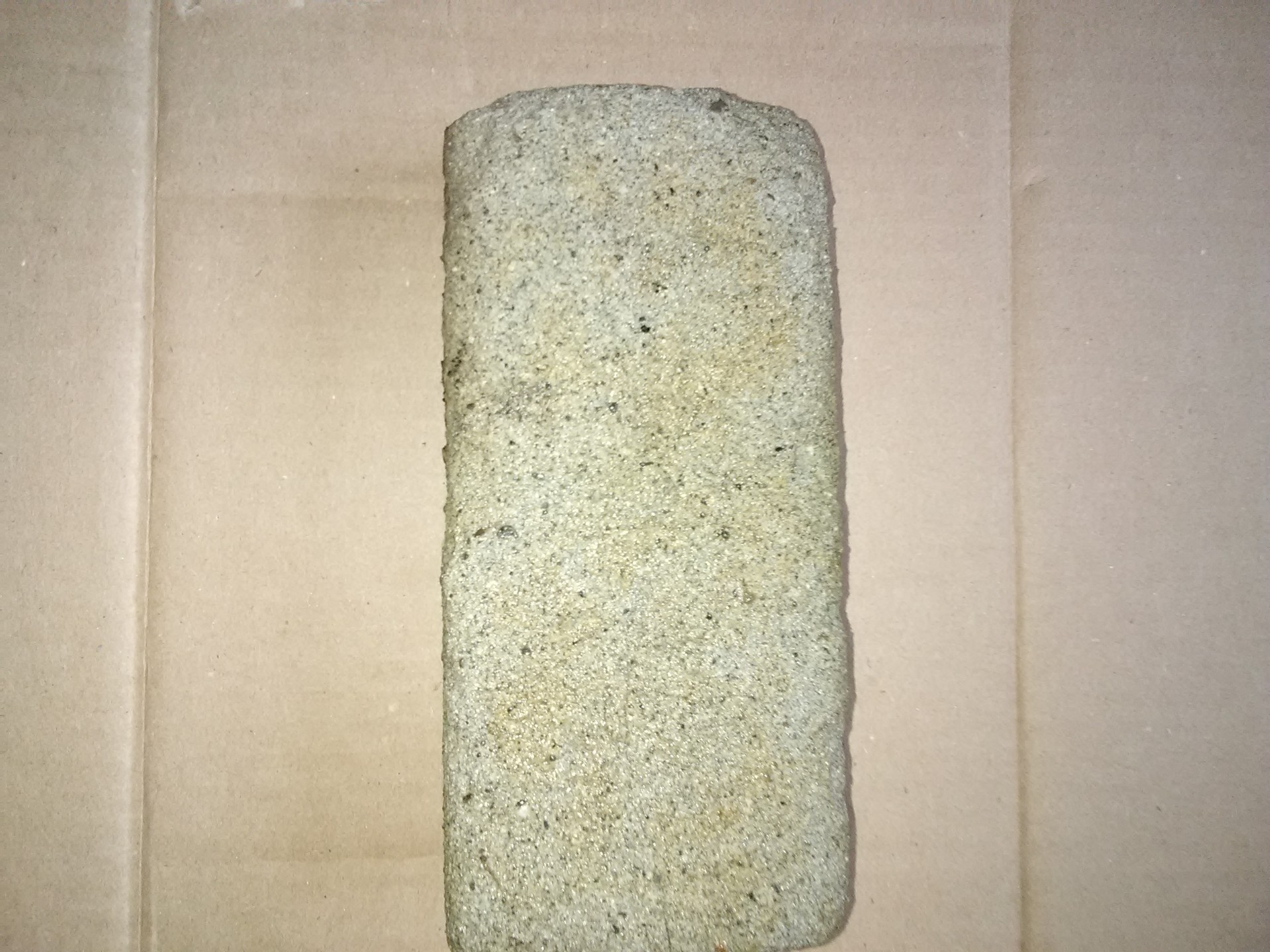
Found in remote Alaska, near the site of a WW2 Sawmill. It would appear this is a global phenomenon.

-
Nice video Karelian,
Have you tried using your drone and mapping software to create any high resolution maps yet? There are drone mapping programs out there both pay to use, and free to use, that can create high res imagery that can be overlaid in google earth etc. You can also create and overlay DSM's, Direct Surface Models, and DTM's, (Direct Terrain Models). Its just another way to visualize the ground, and can make spotting depressions and surface disturbances easier. Its a good solution for a closer overall look at a larger area, and then if it warrants furthur investigation, you could send the drone to the areas of interest to take video. All without leaving the truck.
-
To quote Todd Hoffman's father Jack, "No Guts, No Glory!"
-
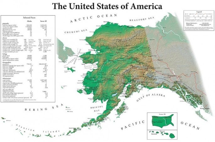
Every Map of America always has Alaska way out of scale, and placed in a box somewhere near the Hawaiian Islands. This is the most accurate map I have found from an Alaskans perspective.
-
Great looking Whip Saw. That piece looks like great backing for an artistic display.
Kodiak
-
Hello Denver Bryan,
I do alot of mapping using ArcMap and shapefiles on the desktop. I have also used the free version of Gaia GPS for the smartphone. Its pretty easy to use, as you do all the work on the computer, and only use the phone for viewing. You just upload your .shp or .kml files to your account and it will load on the phone when you open the app. It comes with a Topo / trail Map. One big benefits is that it does not require cell phone coverage to operate.
I also upload and download shapefiles and .kml files to my Garmin handheld GPS. I used to use the free Garmin BaseCamp software, but I recently found this good tool from the DNR University of Minnesota that converts the tracks/waypoints from my handheld GPS straight into shapefiles and .kml files, as well as lets you load those files straight on the handheld. I really wish I had found this tool earlier.
https://www.dnr.state.mn.us/mis/gis/DNRGPS/DNRGPS.html
DNRGPS Application
Description
DNRGPS is an update to the popular DNRGarmin application. DNRGPS and its predecessor were built to transfer data between Garmin handheld GPS receivers and GIS software.
DNRGPS was released as Open Source software with the intention that the GPS user community will become stewards of the application, initiating future modifications and enhancements.
Best of luck,
Kodiak
16 Grams Of Silver
in Metal Detecting For Jewelry
Posted
Interesting finds. Looks like you found some "Tough Guy" wannabe gangbanger bling. When I saw that TS, it made me think of T-Money. Too bad it wasnt platinum and full of diamonds. Good hunting.