Search the Community
Showing results for tags 'drones'.
The search index is currently processing. Current results may not be complete.
Found 9 results
-
Does anyone here use a drone to help cover more area when looking for places to prospect? If so, how helpful do you think it is?
-
My first day out of Melbourne Australia for a long time was spent exploring Nuggetty Hills near Maldon in Victoria. Felt good to get some fresh country air. Rocky hilly terrain meant I used a drone to get a better view. The drone has proven itself a very useful tool, for prospecting and more. All the best.
-
The importance of using a good quality metal detector suitable for prospecting has been widely explored in great detail. The introduction of the GPX 6000 highlights the gains in technology and thank goodness, ergonomics. Weight and Balance, at last. Matched by performance and cutting edge technology.. The one fact remains that at the end of the day the key is to get the coil over the gold. Some truly magnificent gold that has been found, could have been detected by any half decent prospecting machine. Still we should invest in quality and the new Minelab sounds superb. We need to utilize every tool at our disposal. Often after extensive research, Google Earth images, maps, books and word of mouth can all lead us to a certain goldfields. When we arrive there is a lot of suitable ground to explore. Perhaps too much ground and not enough time to give it the attention it deserves.. In an effort to narrow the search I have started to use a drone when exploring a new area. It allows me to gain perspective, to more clearly focus on areas and features of interest. When the terrain allows it, this will same me a lot of time and increase my odds of putting a coil over a target. Viewed from the ground vegetation can mask features which kind of pop up when viewed from the air, the drone allows me to focus on a smaller area of interest.
-
Have you ever wondered what the cutting edge mining drones are doing these days? Here is one company that gives an idea at the large scale level. They call it Hovermap. https://www.emesent.io/industries/mining/?utm_campaign=Mining Campaign Dec'20&utm_source=EDM-AM-7May2021&utm_medium=EDM-AM-7May2021&utm_term=EDM-AM-7May2021&utm_content=EDM-AM-7May2021 What if you don't have any lidar? Make your own. Does anyone know anything about placer mapping?
-
 This is a really great paper describing how you can use the latest technology (AI) and algorithms to locate meteorites. Now just imagine what else you can find if you have the time and knowledge. There are a few here on this forum who will be enlightened by this article but certainly not surprised. It is just a matter of time that we process massive amounts of data quickly. https://arxiv.org/pdf/2009.13852.pdf
 -
I'm looking into getting a quadcopter for photogrammetry, but have no experience with them at all. Are there specific features that are better than others? What kind of camera resolution is best, and are shutter speeds and drone stability usually good enough to capture good quality, usable photographs? I'm at the beginning of my research, so any tips and recommendations would be greatly appreciated. I saw some information about drones in this article: https://thedigitalcamera.net/best-drones-with-camera/, please tell me which is the best.
-
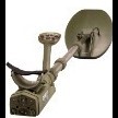
Simon do you have one of these? or have you set up the QED on a Drone already
-
Recently my wife and daughter gave me a drone for my birthday. Being a bit of a technical dinosaur, I am still getting the hang of it. These things seem to be rapidly advancing, and it occurred to me that it may provide a way of seeing what is over the next hill without all the footwork. Seeing how America seems to be leading the way with this technology, this seemed to be the ideal place to pose this Question. Any ideas?