HardPack Posted January 31 Share Posted January 31 A few years back while working on a “S” bend of the Klamath River immediately south of Cottage Grove, two locals related their experiences during the “Christmas Floods of 1964”. We were all standing along an outside bend looking up at an old freezer box hung up in a tree a hundred feet above the summer flows. The day before across the river a 1964 nickel had been detected on an old cabin flat, the cabin being long gone. According to their stories, cutoff and isolated upstream near Happy Camp at the confluence with Indian Creek, the flood flows were pushing giant boulders down the river channel. They both stated you could hear the boulders gridding against the river channel bedrock over the roar of the flood waters, the ground was vibrating. Later it was estimated 24 inches of river channel bedrock was grounded away during the 1964/65 floods. At the time (of the stories) I was ferrying “play” dirt across the river from another outside bend down stream of the freezer below the tail-out of an old upslope gold operation. The gold was deposited thin sheeted (gold leaf thin) in the cracks of the bedrock above the summer water level. The “Great Flood of 1862” and the “New Years Flood of 1997” no doubt grounded loose floods of gold trapped deep in the channel bedrock cracks and cervices of many a river beds in both the Klamath and Sierra Nevada mountain ranges…. Only to find a deeper deposition crack beyond the depth of reach. It took days to pan the leaf gold from the coarse sands which is directly responsible for a downfall into detector addiction. This is not a call for help. 3 Link to comment Share on other sites More sharing options...
rled2005 Posted January 31 Share Posted January 31 1 hour ago, HardPack said: A few years back while working on a “S” bend of the Klamath River immediately south of Cottage Grove, two locals related their experiences during the “Christmas Floods of 1964”. We were all standing along an outside bend looking up at an old freezer box hung up in a tree a hundred feet above the summer flows. The day before across the river a 1964 nickel had been detected on an old cabin flat, the cabin being long gone. According to their stories, cutoff and isolated upstream near Happy Camp at the confluence with Indian Creek, the flood flows were pushing giant boulders down the river channel. They both stated you could hear the boulders gridding against the river channel bedrock over the roar of the flood waters, the ground was vibrating. Later it was estimated 24 inches of river channel bedrock was grounded away during the 1964/65 floods. At the time (of the stories) I was ferrying “play” dirt across the river from another outside bend down stream of the freezer below the tail-out of an old upslope gold operation. The gold was deposited thin sheeted (gold leaf thin) in the cracks of the bedrock above the summer water level. The “Great Flood of 1862” and the “New Years Flood of 1997” no doubt grounded loose floods of gold trapped deep in the channel bedrock cracks and cervices of many a river beds in both the Klamath and Sierra Nevada mountain ranges…. Only to find a deeper deposition crack beyond the depth of reach. It took days to pan the leaf gold from the coarse sands which is directly responsible for a downfall into detector addiction. This is not a call for help. Sounds like a tall tale; those locations don't mesh. 1 Link to comment Share on other sites More sharing options...
HardPack Posted January 31 Author Share Posted January 31 3 hours ago, rled2005 said: Sounds like a tall tale; those locations don't mesh. I am not talking Cottage Grove, Oregon. I admit being from a family of the South I may take liberty to make a story entertaining. However, it was their story and like you I originated a skeptic from Oregon. The location is on Highway 96 between Clear Creek and Somes Bar. The Klamath River mining claim is K-25B Cottage Grove (mylandmatters.org). Check it out for yourself, wonderful country. Here are the GPS coordinates for the Klamath Cottage Grove: N41* 36.156’ W123* 30.335’ Cottage Grove isn’t much more than a cottage. There is a summer camp of sorts to the NE on the river. Here are the GPS coordinates for the old cabin flat: N41* 35.890’ W123* 30.522 Here is the approximate GPS coordinates for the freezer box tree: N41* 34.605’ W123* 32.453’ Sorry the locals kept the nickel since at the time I did not own a waterproof detector. Here’s a recent web photo of the South Yuba River at flood stage (not mine). 5 Link to comment Share on other sites More sharing options...
HardPack Posted January 31 Author Share Posted January 31 Here’s a word of caution based on personal experiences when venturing into the Klamath and Salmon rivers as a prospector or miner of gold. The 1884 Sawyer Decision did not apply to the California North Coast rivers. As a result hydraulic mining continued on the Trinity, Klamath and Salmon rivers. The Karuk ancestral tribal lands extend up the Klamath river from the Bluff Creek confluence including Happy Camp then up through Siskiyou County. The Yurok ancestral tribal land extend down river to the mouth of the Klamath and along the Pacific coast. The Hupa ancestral tribal lands extent up the Trinity River through the Hoopa Valley from the confluence with the Klamath River. The impact of hydraulic mining in these watersheds has not placed miners (old or new) in the favor of these North Coast tribes. There have been occasions in the darkness of night relocating a campsite was a good move. They are good and generous people but they place a high value on their way of life. This is not a tall tale, be respectful, be careful and be aware of your surroundings. An amazing place to explore and fish. 3 1 Link to comment Share on other sites More sharing options...
rled2005 Posted February 1 Share Posted February 1 3 hours ago, HardPack said: I am not talking Cottage Grove, Oregon. I admit being from a family of the South I may take liberty to make a story entertaining. However, it was their story and like you I originated a skeptic from Oregon. The location is on Highway 96 between Clear Creek and Somes Bar. The Klamath River mining claim is K-25B Cottage Grove (mylandmatters.org). Check it out for yourself, wonderful country. Here are the GPS coordinates for the Klamath Cottage Grove: N41* 36.156’ W123* 30.335’ Cottage Grove isn’t much more than a cottage. There is a summer camp of sorts to the NE on the river. Here are the GPS coordinates for the old cabin flat: N41* 35.890’ W123* 30.522 Here is the approximate GPS coordinates for the freezer box tree: N41* 34.605’ W123* 32.453’ Sorry the locals kept the nickel since at the time I did not own a waterproof detector. Here’s a recent web photo of the South Yuba River at flood stage (not mine). I will definitely check it out! 1 Link to comment Share on other sites More sharing options...
HardPack Posted February 1 Author Share Posted February 1 35 minutes ago, rled2005 said: I will definitely check it out! Along Highway 96 a 1/2 mile south of Cottage Grove at Elliot Creek there is a short road on the river side. At the end of this road on the right is a dirt road that will take you to a river bar. USFS Dillon Creek Campground is 2 1/2 mile on the west side of Hwy 96. In Happy Camp there a grocery store, a card lock for fuel and USFS Curly Jack Campground. Some folks camp at Windgate Bar between Happy Camp & Cottage Grove. In the summer months the road along Indian Creek between Hwy 199 to Hwy 96 at Happy Camp is open. Great area 3 Link to comment Share on other sites More sharing options...
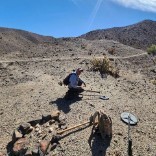
HardPack Posted February 1 Author Share Posted February 1 If interested here’s a link to the New 49ers Mining group in Happy Camp. They have the majority of mining claims in the area. A $100 buys you a week (7 days) of claim access during the summer months. It is cheap way to explore the Klamath. They also have a mining supply store with fresh water in Happy Camp. https://goldgold.com/ On the website there is a quick link menu on the left, Hit the “What’s New” to view the latest newsletter, there is also a list of claims by area, Facebook link, RV camping, etc. The old timers hydraulic the benches in both sides of the Klamath. As a result the gravel bars are deep but there are pits, tail-outs, tailing piles & jade. At one time there was a pack trail from the port at Crescent City to Fort Jones. If you are in the area stop by the 49er store for Information, the staff has mined and detected the area. Link to comment Share on other sites More sharing options...


.thumb.JPG.b46839319dc8de4aefe1f42407094dbd.JPG)
Recommended Posts
Create an account or sign in to comment
You need to be a member in order to leave a comment
Create an account
Sign up for a new account in our community. It's easy!
Register a new accountSign in
Already have an account? Sign in here.
Sign In Now