GotAU?
-
Posts
1,102 -
Joined
-
Last visited
Content Type
Forums
Detector Prospector Home
Detector Database
Downloads
Everything posted by GotAU?
-
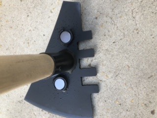
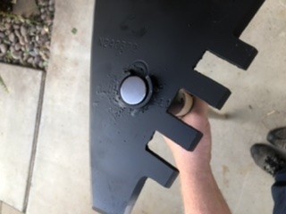
Finally got around to welding some rings onto it to make it work with magnets.Well, those things aren’t going to come out! I think this is going to work well.
-
Oh never mind, it won’t work for me because it’s one of those droids only programs... 😞
-
Its not “Backcountry Navigator GPS Topo” - people posting bad reviews are saying it is a fake broken version of the other one. I think he meant “Backcountry Navigator Pro”. It looks good, but I think there’s a annual membership fee. My free topos on the “Topo Maps” app have more details as they are actually real digital USGS quad maps that are the same images as the paper ones have, so things like quarries and adits are marked on them.
-
Awesome, thanks! Interesting shot by the way, the Cushenbury Quarry was one of my project areas when I used to work for the Forest Service.
-
That’s a good suggestion, OnXHunt works very well and shows property ownership and all, but it’s not cheap. BLM mapping data is out there and usable, just have to find out the way to obtain it. @jasong It’s too bad your links lead to incomplete BLM files, it looked promising at first. Thanks for trying though!
-
What I really want is the road/trail designation names. Aerial photo's just show all Trails- legal and illegal.
-
Thank you, really appreciate it!
-
Do you have an iPhone or iPad? As I pointed out earlier, TopoMaps App works really well off grid as you pre-load it with downloaded free low and high resolution USGS topo quads. Here is a copy of what the output looks like with a low resolution quad from my iPhone. I use it on my 64gb iPad and it looks much better in low res too. I and have pretty much the entire set of USGS quada (over 100 of them) for the California deserts preloaded on it. The maps can be easily joined together with a single button push too, makes navigating between two quads seamless. If your iPad does not have GPS, you can buy something like a Garmin NUVI bluetooth gps to receive GPS locations off grid for navigation.

-
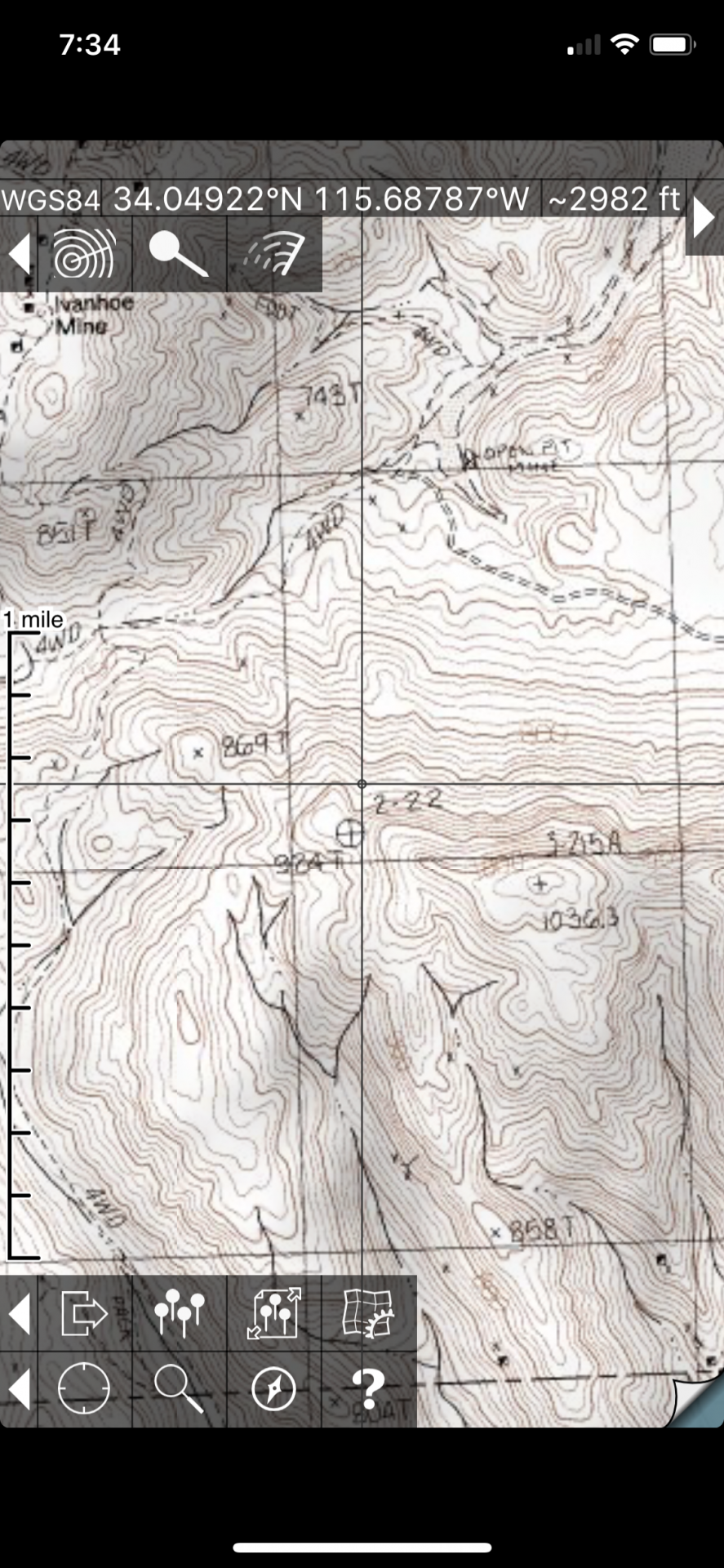
Hello, I am using an iPad as a topo map when I’m out in the field, and also GoogleEarth, and have already downloaded the BLM’s active and inactive gold mine and prospects KML database for Google Earth and was wondering if anyone has found a good source for downloading BLM and/or National Forest KML files? I only seem to have found some local ones for Alaska on the BLM map server website, but nothing for any of the lower Western states. Thanks!
-
 The Creepshow short about Jordy Veryl (played by Stephen King), a country gentleman who discovers a meteor and proceeds to contaminate himself with “Meteor sh(bleep)” was a newer classic. You will have to google it for the more funny parts that happen after this first scene, the title is not postable here...
 -
Thanks! Now looking at Apex pick closer, I see how the gap in the ring allows one to remove or replace the magnet from it. Thanks for your input, I appreciate it.
-
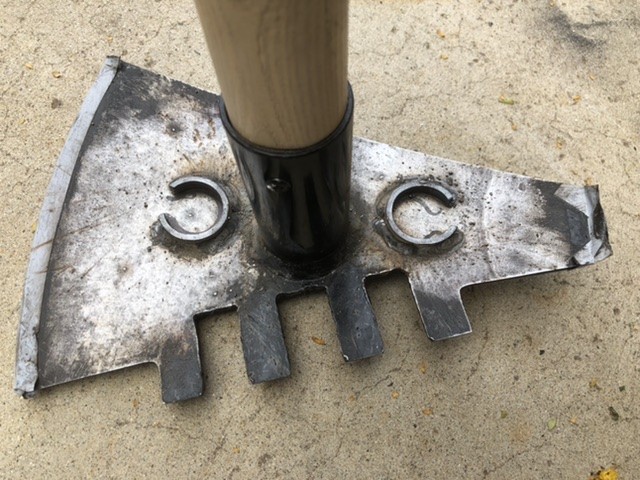
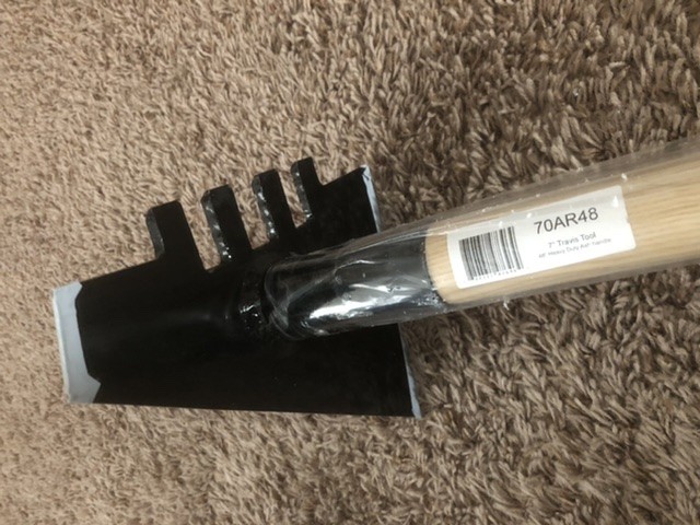
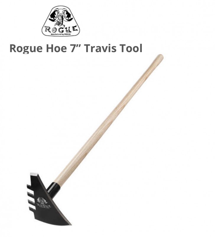
OK so it came and it is very heavy duty. Question: what would be the best way to attach magnets to it like an Apex tool has? I see they weld on small rings and put the neodymium magnets inside them, but what is holding the magnet, epoxy? They are just stuck in there by their own attraction are they?
-
Scams Out There
GotAU? replied to Johnnysalami1957's topic in Metal Detecting & Prospecting Classifieds
I “sold” a expensive item on FleaBay and was asked to premail it to a Western Union store for preinspection before their payment was made. They provided an address. I sent them a return email saying I just mailed it overnight to a different Western Union in their town - it was actually an address for their police station! 😄. For some reason, I never heard back from them. -
This means my old SmartTrekerXR8 could have found gold?! 😆
-
This is in the mail as a birthday gift, will have to figure out how best to magnetize it when it arrives. Its a pick, scraper and rake in 1. My wife saw me looking at it a while back and just surprised me! I think she wants me to use it for the garden. Too bad it’s delayed a bit, so I only got this picture for my present so far...
-
Andreas, just another thought - It’s good that Jim Straight wrote those books, otherwise his knowledge of such things would have been lost forever. As I grow older, there are more and more people around me who have experienced so much in their lifetimes and know ao much about places in the desert and so many things that I have even yet to have discovered, but they are fading away as each of them passes. Some of my old Ham radio friends that used to live in Ransburg pretty much all their lives are gone now, and with them their stories of their lives. I also have a friend who can describe every turn and feature of practically every mine in the Mojave desert, and can name them correctly if shown a photo of the entrance or given a description of the interior and general location. Their name has been in every sign in logbook I have ever seen in the mines I’ve visited as well. Such local knowledge is invaluable and should be preserved, I only wish all of those people were also writers like Jim was.
-
Andreas, Thanks for the James Klein’s reference. I appreciate it! Big Bear is an interesting area, I actually worked on the forest for six years back in the 90’s, part of which I was doing mine surveys. We visited and documented the conditions at every recorded mine and prospect between Fawnskin and Yucca Valley, including the desert slopes of the forest. Do you get out there very often? We’ll have to PM about it sometime. Thanks again for your help I really do appreciate it! -Anthony
-
Hello, Thanks for the welcome and this very helpful post! I have been reading up on this for a while here on this site and others, watching Bill Southern on YT (he’s the reason I finally went with a GM), reading Jim Straight’s books, and browsing the Prospecting and Mining Journal for awhile, but never really started anything for it until recently. We have been doing a lot of camping trips in the past where Detecting may have been successful, and now I want to go back to some of those places again. I originally thought that Modern detectors were better at discriminating but boy was I wrong. I certainly will use everyone’s suggestions to dig everything, there’s a lot of examples online where people did just that and were successful. modern detectors were better at discriminating but boy was I wrong. I certainly will use everyone’s suggestions to dig everything, there’s a lot of examples online where people did just that and were successful. I would love to get more references for books, particularly if you know of any good ones that might help out in my region of Southern California. My immediate area is rather scarce, however there are some old prospects with abandoned claims that I can poke around in, plus a lot of old farm houses and other interesting historic places that I can also check out. I guess you’re right, I may end up looking for a second lower frequency detector to be able to look for artifacts as well. Also, I appreciate the warning! I’ve always loved looking at maps and this is another good reason to do it even more, they are just so interesting! I am interested, what do you use for those online USGS minerals maps? I played around with the LR 2000 system and the free mylandmatters.org mapping platform online, but I haven’t seen the commercial one you mentioned. I think for now I should keep the annual subscription rate for it based on the amount of time I actually get out, but will definitely check it out when and if I get to go prospecting a lot more! Thanks again for your reply, that was really informative and please send me references if you have some good ones for books or other materials. Cheers, Anthony
-
Thanks for the welcome! I picked up a ML GM1000 as I am just starting out, and am most interested in gold and meteorites out here in the desert where I live. Haven’t had much time yet to use it properly enough though, as always! I did manage a few hours to visit a couple gold prospects in my area, and found mostly bird shot and iron flakes - probably from the picks and other tools being used to break up some quartz veins I found nearby. No gold though... as the prospects were shallow, I guess they played out quickly (they were listed on the BLM mine register). My next real trip I plan to go on is to check out the Rand Mountains near Randsburg in the NW Mojave- getting out to this popular gold hunting site will be a successful day, and a better one if I even get some tiny flakes of color!
-
Thank you for the welcome. This forum is really interesting, and I’ve been enjoying reading some of the old posts. I have to admit, I really regret not doing this earlier because I’ve been to a lot of sites where I could have, would have, and should have done some detecting on my free time while I was out there. Well, at least I know they’re still out there - I just have to get going! By the way, turquoise is just gorgeous. Do you do anything with it or keep it in its natural state?
-
Forum Usernames - How Did You Choose Yours?
GotAU? replied to Jin's topic in Detector Prospector Forum
I don’t know, I had a glass of milk and it just came to me! 😉 -
Totally understand being careful. Also respectful of others copyright property, good for you! Wow, those photos are great, I need to put aside some time for to study those. Thanks for the link!
-
Hi Steve, copyright duration in the US is 95 years from first publication, so he’s probably OK with those. It would be good if posts cited their sources for the interested ones here though. Amazing photos, they are a valuable historic account of mining!
-
I used to live on property that was an old mining camp near Angel’s Camp where each of the relict miners’ cabins left on the property was built on top or in front of their shaft or adit as to protect it. They also wired in alarm cables from their doors to the back of their mines to pull and ring bells, and some even had hidden rooms built off the side of the adits with doors that were cemented to look like the rock side walls. Those guys were obviously afraid of getting robbed or even murdered while they worked in their mines. For good reason too, there was a historic site nearby where seven miners were robbed and shot for their findings. Those were dangerous times and led to the well known nickname of “Hangtown” for nearby Placerville, California.
-
You couldn’t be any more correct, and I will always work up any hit to see what it is. I just had my first long day with a new MD, and my first time doing it in 40+ years, and went to scope out some old abandoned gold prospect claims near me, and it was just a giant modern illegal trash dump. Dang, even the prospect was buried! So I hiked around the hill for a while and found some exposed quartz and tried that. I did get some hits and got excited. It was obviously broken up previously, so that was an even better sign to me. I kept getting hits in some of the cracks and took a lot of time digging them out. Next time I need to bring a brush or an air blower bulb, and a strong magnet to clean those out instead of breathing in a lot of dust. So there I was digging away and finally I figured out what it was that I kept hitting. It wasn’t hot rocks or anything like that, it was tiny little flakes of iron, probably pieces of the pick that was originally used when breaking up the quartz. Once I cleaned those out there was no longer any type of signal coming from the quartz exposure. Anyway, it’s exciting to know how small of a iron flake my MD can pick up when in non-discrimination mode, so I know I’m doing something right and that it will pick up even tiny small bits of gold when and if I ever come near any. Maybe next time...