Search the Community
Showing results for tags 'geology'.
-
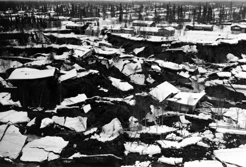
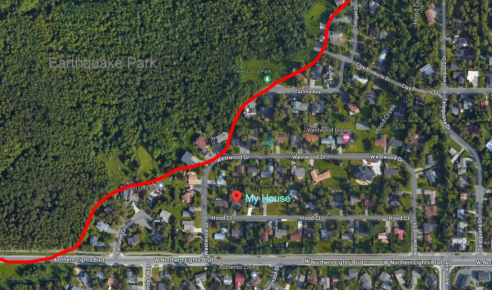
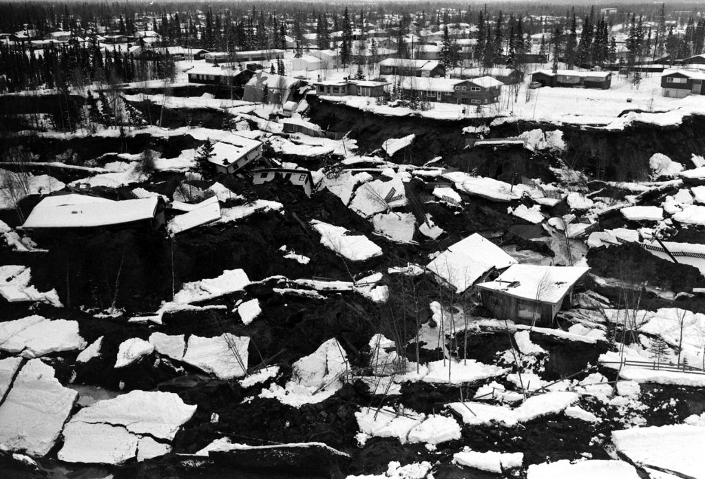
 Well sort of. Good Friday was on Friday March 27 in 1964. I was 6 years old at the time, living at 4149 Hood Court in the Turnagain neighborhood of Anchorage, Alaska with my parents, a brother, and a sister. I was the oldest and was getting my first dose of science fiction by watching Fireball XL-5 on the TV set. We only had two channels to choose from back then in Anchorage, no live television except locally. Anything in the Lower 48 like football games was taped and played later in Alaska. My only other option as a 6 year old was Davey and Goliath on the other channel, and I was definitely more a Fireball XL-5 type. Still am. I'm laying on the couch when the TV goes out. The old tube sets would sort of flash, then the picture would slowly shrink to a small white dot, then pop, it's gone. The power had just gone out. I remember being puzzled and then hearing a roar in the distance. And then the house started going way up in the air! Everyone was home and my parents gathered my youngest siblings immediately into the living room, where I joined them huddled in the middle of the room. Our dog was going crazy running around barking. It was impossible now to do anything but huddle on the floor. The house rose up high then dropped fast, literally falling out below us. It was exactly like being on a large cruise ship in heavy seas. It was not shaking, it was a slowish go way up and then way down as the house rode giant waves. It was waves in the ground. Everything fell off every wall and shelf. Every cabinet door in the kitchen opened and the refrigerator door also, and everything ended up in a pile on the kitchen floor. Everything in the house that could fall over did. It was the end of the world in progress. It took long minutes to subside and somehow when it was over we all were fine. I don't have the greatest memory of the past but some things are etched in memory forever, and those few minutes I will never forget. The aftermath is fuzzier. We were two houses from the edge of what is now called Earthquake Park, a huge chunk of northern Anchorage that subsided and half slid into Cook Inlet. From our backyard there used to be some houses and a forest.... now it was gone from view. Two houses went over the edge, one flattened completely, but luckily nobody was home. Giant cracks and fissures were in the ground everywhere. It is a testament to stick built wood construction that most houses were intact unless they fell into a hole, though cement pad and basement damage was common. Alaska was very lucky that day. When you look at the photos at the attached links and the magnitude of the damage, the 115 deaths statewide seems a miracle. Less than twenty died in the earthquake itself, crushed by falling objects, etc. The rest died in the subsequent tsunamis, mostly in Seward and Valdez. My father was in the National Guard and was called out immediately for rescue operations. Everyone else evacuated to high ground and we stayed with friends on the hillside, as it was feared that Cook Inlet would funnel tidal waves into the city. The quake however was in Prince William Sound due south and so Anchorage was spared the tsunamis that devasted the smaller coastal towns. Anchorage and the state slowly recovered. As a 6 year old most of that went over my head and it was soon life as normal - back to school. Yet my friends and I also had an amazing new playground in the form of what became Earthquake Park. It has eroded away to forested low rolling hills now, but back then it was an amazing topsy-turvy wasteland/wonderland of broken jumbled landforms. We were strictly forbidden from going there due to on going aftershocks and fears of more quakes. It was however an irresistible pull for me and my friends who explored this strange alien landscape. Truly an amazing place, now lost to time and erosion. I know this is off topic but I'll justify it by calling it one of the most direct and personal lessons in geology a person can get at an early age. It no doubt helped guide me to my interest in the earth sciences in general, learning all about plate tectonics and the real life effects of geology gone wild. From the Wikipedia link below: "Lasting four minutes and thirty-eight seconds, the magnitude 9.2 megathrust earthquake remains the most powerful earthquake ever recorded in North America, and the second most powerful earthquake ever recorded in the world since modern seismography began in 1900" https://www.life.com/history/the-great-alaska-earthquake-of-1964-rare-photos-from-an-epic-disaster/ https://en.wikipedia.org/wiki/1964_Alaska_earthquake Location of our house above, and photo below of what Earthquake Park looked like back then. Our house would be off the right hand edge of the photo; the area in photo is off end of Clay Products Drive. Obviously there were more houses lost there…. four people died in the general Turnagain area. Photo from article linked above
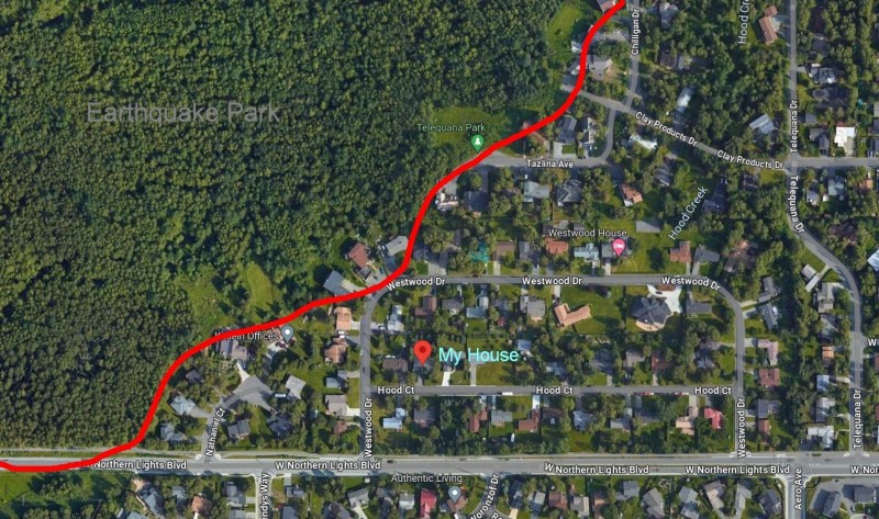
-
I noted this on another forum but want to do so here too so here goes. How many of you have experience with pocket gold? I've pocket hunted a few places hopping around with a little luck, mostly CA Mother lode country and AZ. Here are some good reads for ya if'n you're not familiar with it. Anyone from the east do this, like Georgia or Virginia? I'l be visiting Virginia for a few weeks this year, would love to hear some local voices. Pocket Gold - Prospecting For The Source POCKET GOLD - LOCATING THE SOURCE Pocket Hunting for Gold » Pocket Hunting for Gold Pocket Gold Prospecting Pocket Gold Prospecting Mud Men: Pocket Miners of Southwest Oregon—Part I Mud Men: Pocket Miners of Southwest Oregon?Part I - ICMJ's Prospecting and Mining Journal
-
There is a topic briefly covered in Chris Ralph's book "Fists Full of Gold" which I've been discussing with my prospecting buddy. When is it better to detect the hillside, ridge, or bottom of a wash for shallow gold nuggets? I usually go for hillside and ridge, but can see the logic in detecting the very bottom of a wash. It all depends on what kind of gold is present, how it was deposited, and what forces of erosion are present. However, I have dug nuggets on the steepest of slopes, in the very bottom of a gully, and also on the very top of ridge - sometimes all in ONE location! And despite my efforts to use logic to figure out a pattern, sometimes the gold surprises me. Usually my train of though goes as follows: If gold was found here before, was it found on bedrock, or distributed in the overburden? What kind of erosion factors into gold deposition (wind, water, faulting, etc)? What kind of gold is present (slugs or cornflakes)? How much trash is present? So, how do you decide the specific topography (hillside, gully, or ridge) you are going to target, based on known factors at a likely spot?
-
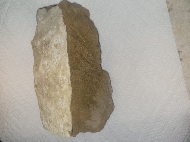
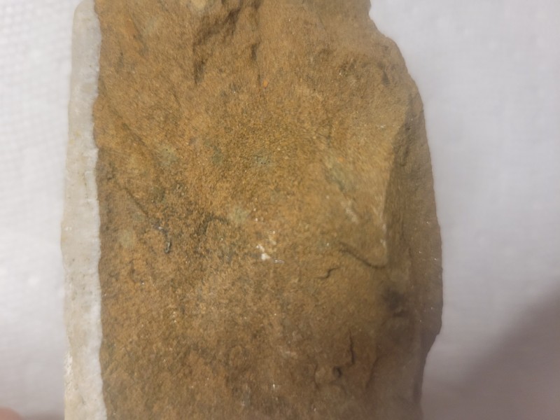
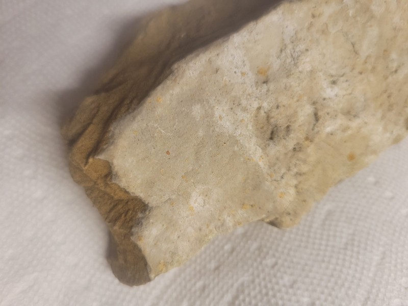
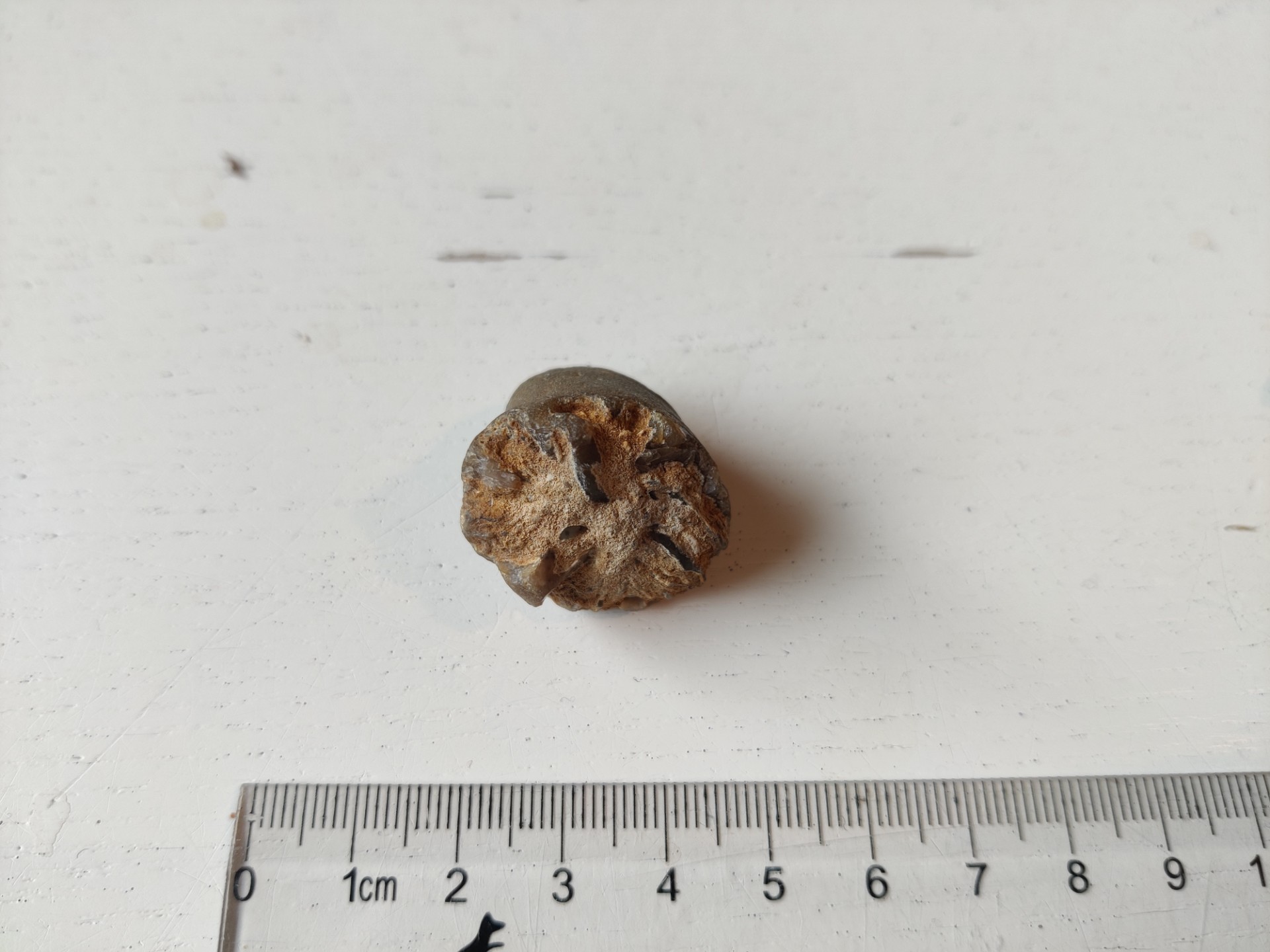
 Hello, My parents have this strange rock lying around and I am wondering if anyone could identify it (see pictures). It's a small, grey rock with orange tints and it has a distinguishable comic shape. The cone edges are smooth. The bottom seems to be broken off from somewhere and has a very particular pattern. From the core there seems to be lines protruding circular around the centre point. Sort of 'fanning out'. The space between the grey rock seem to be filled up with some type of beige curd sand. The top seems to be somewhat bruised and shows a spiral pattern going downward to the bottom. The core seems to be glacy like flint stone. It was probably found somewhere along the coast of Zeeland in The Netherlands. These may be manually deposited sediments. Could anyone help me out and identify this rock object? My guess is that it's part of a stalagmite but it doesn't seem to be just chalk... Cheers, Luc
-
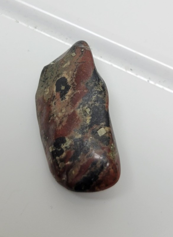
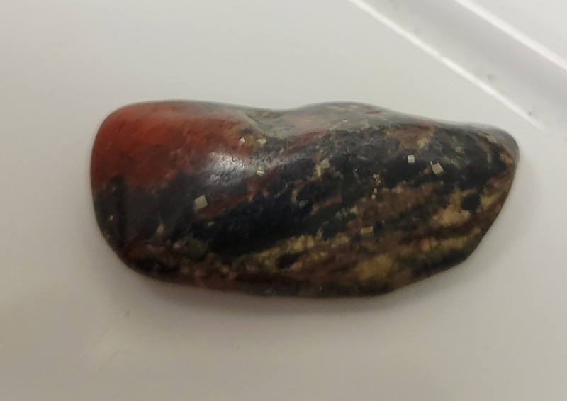
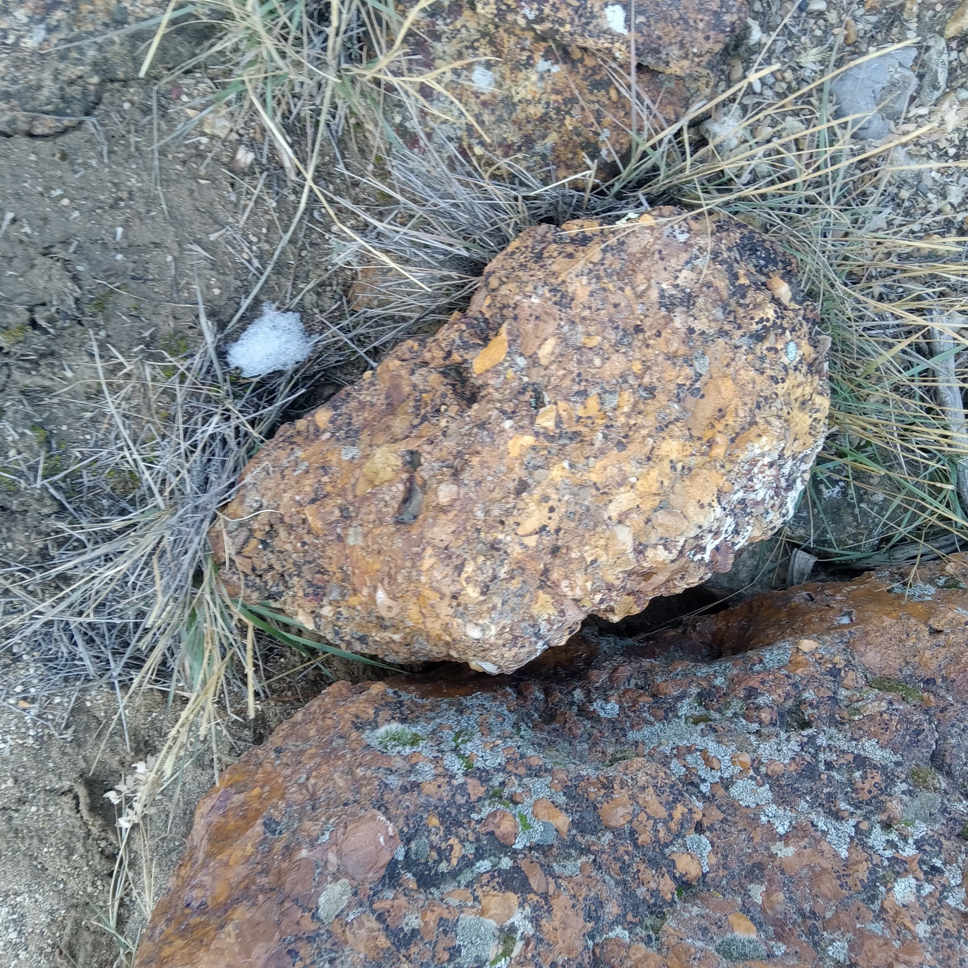
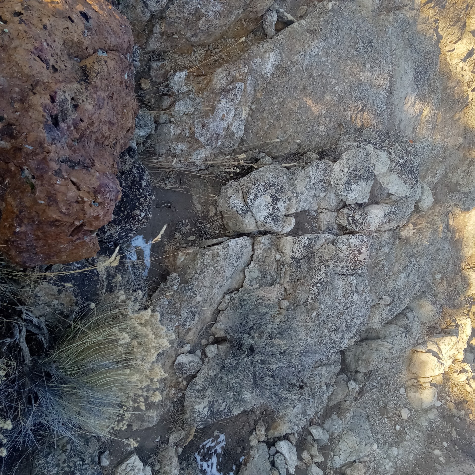
Is this conglomerated and ironized rock a good sign of possible gold?


-
The earth has been warming and glaciers retreating for over 15,000 years. Almost everything in the part of Alaska I lived in was recently exposed by glaciers and been prospected the last couple hundred years. Glaciers are nature's bulldozers and they destroy and mix. The gold distribution in glacial material is generally random and sparse. Where water has had time to work glacial deposits new placers can form, but the short geologic time spans we are talking about usually mean small erratic deposits. The good news is that also means you can maybe find a gold nugget just about anywhere in glacial material. If you watch the video a second time and pay attention to the area that becomes Alaska you will see that Anchorage, on the southern coast, was buried under 3000 feet of ice not too long ago. The interesting part is northern Alaska is largely ice free. This is extremely important. The placers are much older and more extensive in Interior Alaska than in the southern coastal areas. The northern US was heavily glaciated and much of the material was pushed down from out of the north in Canada. I find glacial terrain interesting because glaciers have melt water running under them and along the edges, which form small oddball placers in the strangest places, and other placers are possible in the large outwash areas. I am discovering there was a lot more glacial activity in the Sierras than I would have imagined and so this is still very relevant for me prospecting in California. These links may not be for your exact area but all contain good information about glacial geology and prospecting. Great freebie article Gold in Kansas And a small related article at the ICMJ Undiscovered Placer Deposits in Alaska Really good stuff starting page 117 on Gold Placers of Colorado Placer Deposits of the Yukon Geology of Tertiary and Quaternary Gold-Bearing Placers in the Cariboo Region, BC Here is some really technical stuff for those so inclined Glacial Geology & Prospecting Glaciers of California A much more prospector friendly version can be had in an excellent but pricey book by Chuck Lassiter, Midwest Gold Prospecting at http://www.midwestprospector.com/book.html I have a copy in my library of the best of the best. It is a high quality book with color maps and illustrations and a no-brainer at about half the cost. For $29.95 you have to just love books as much as me as that is as much as the Chris Ralph encyclopedia and this book would be a chapter in Chris book. That said, I have never seen the particular subject of glacial region prospecting covered better and more understandably anywhere else. It would be the go to primer for anyone interested in the subject.
-
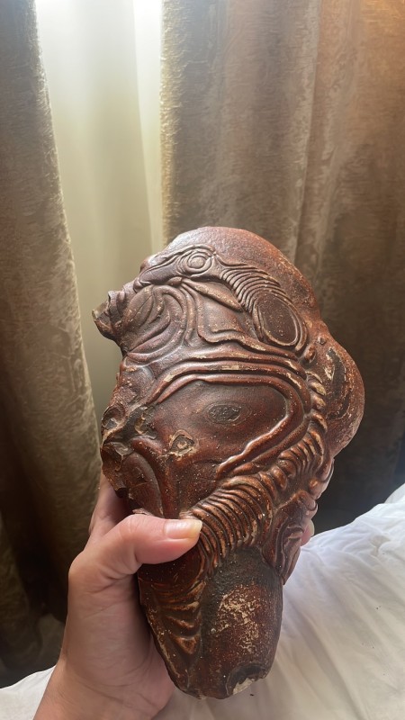
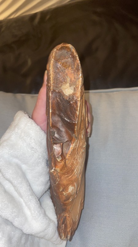
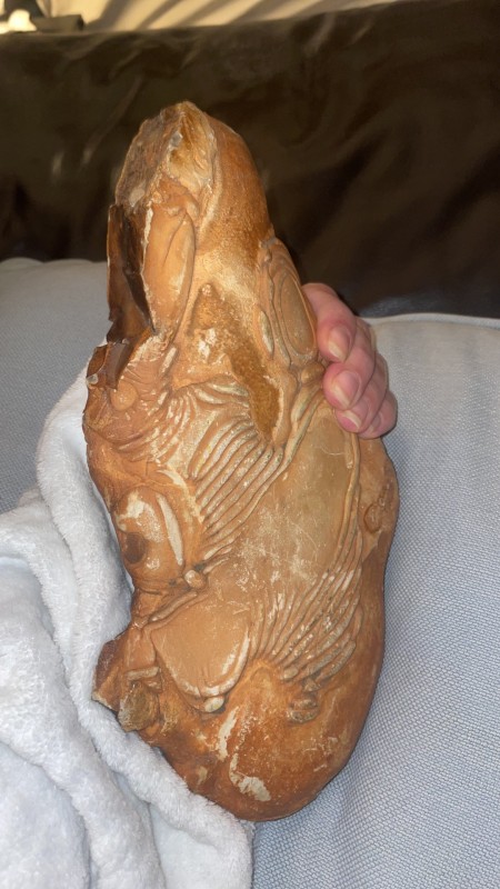
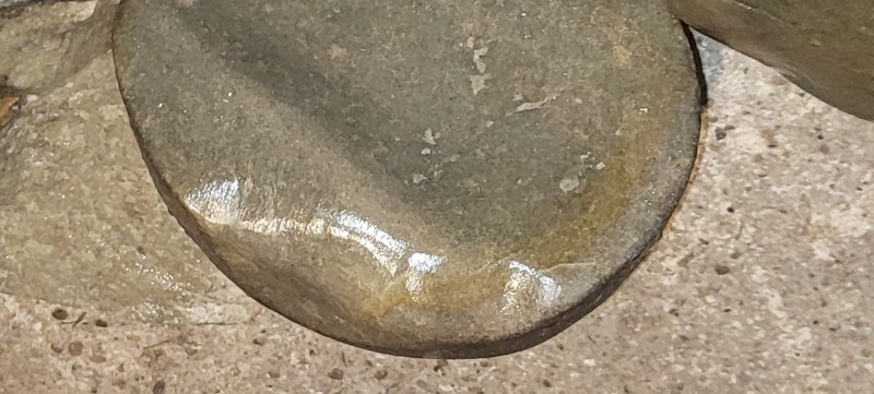
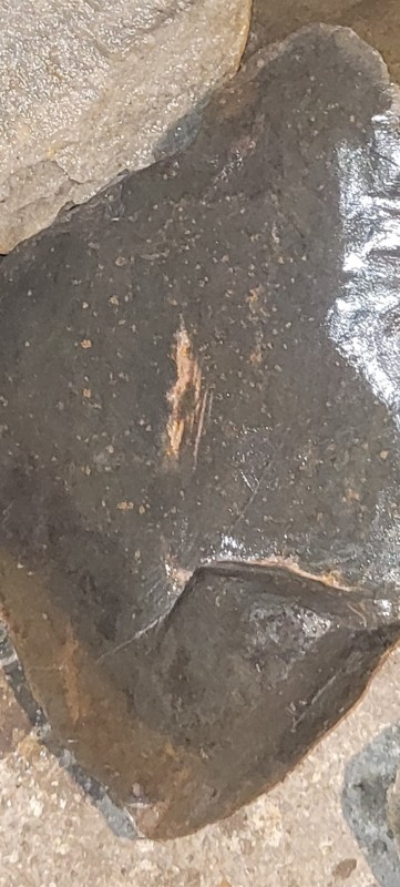
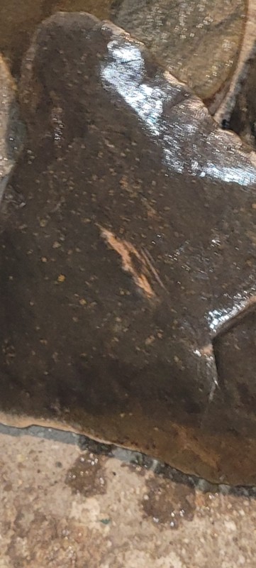
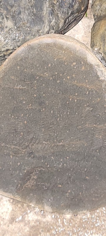
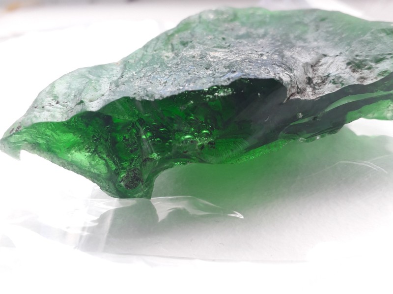
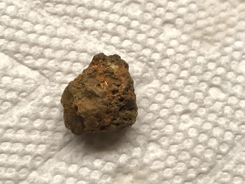
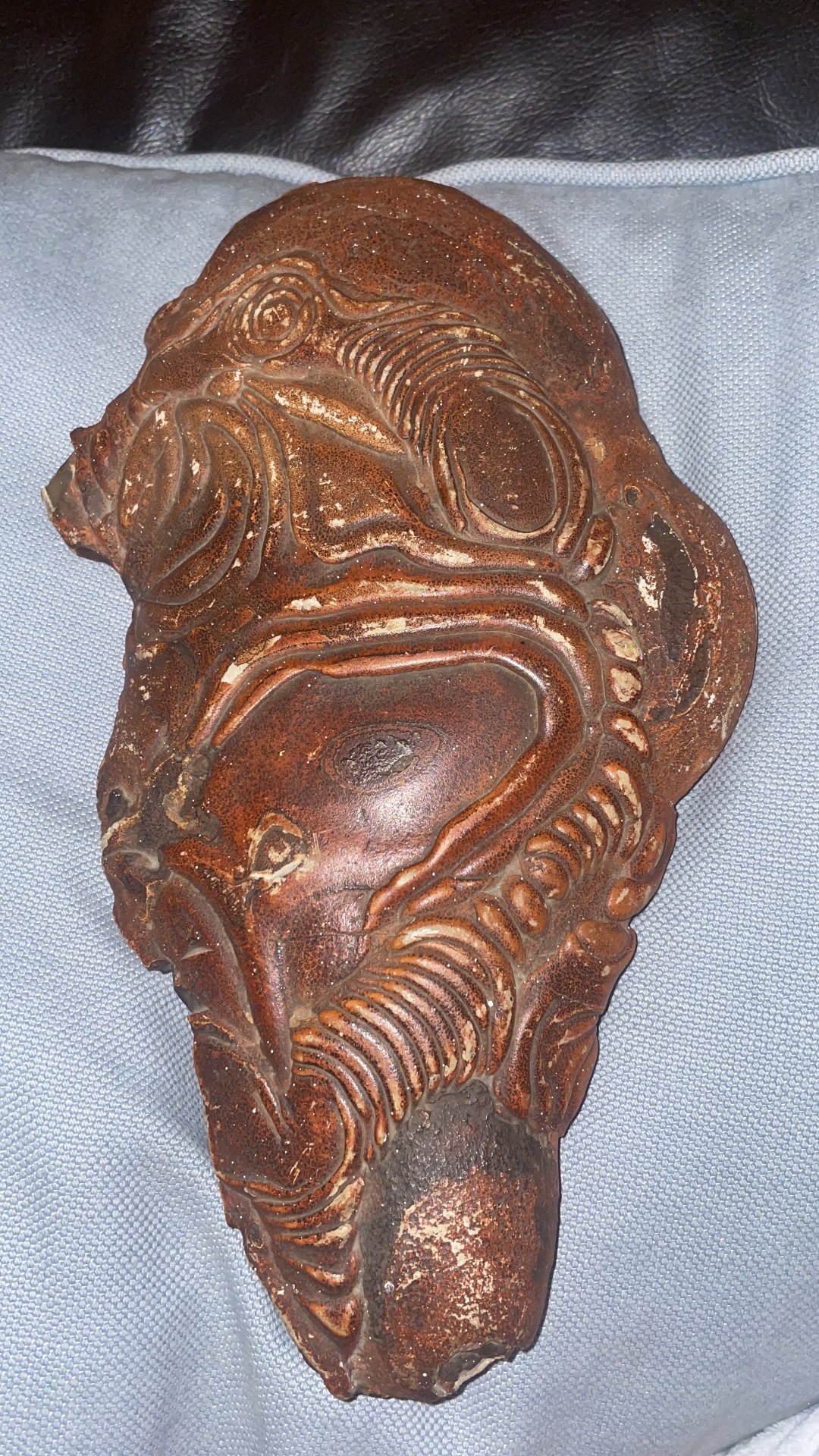
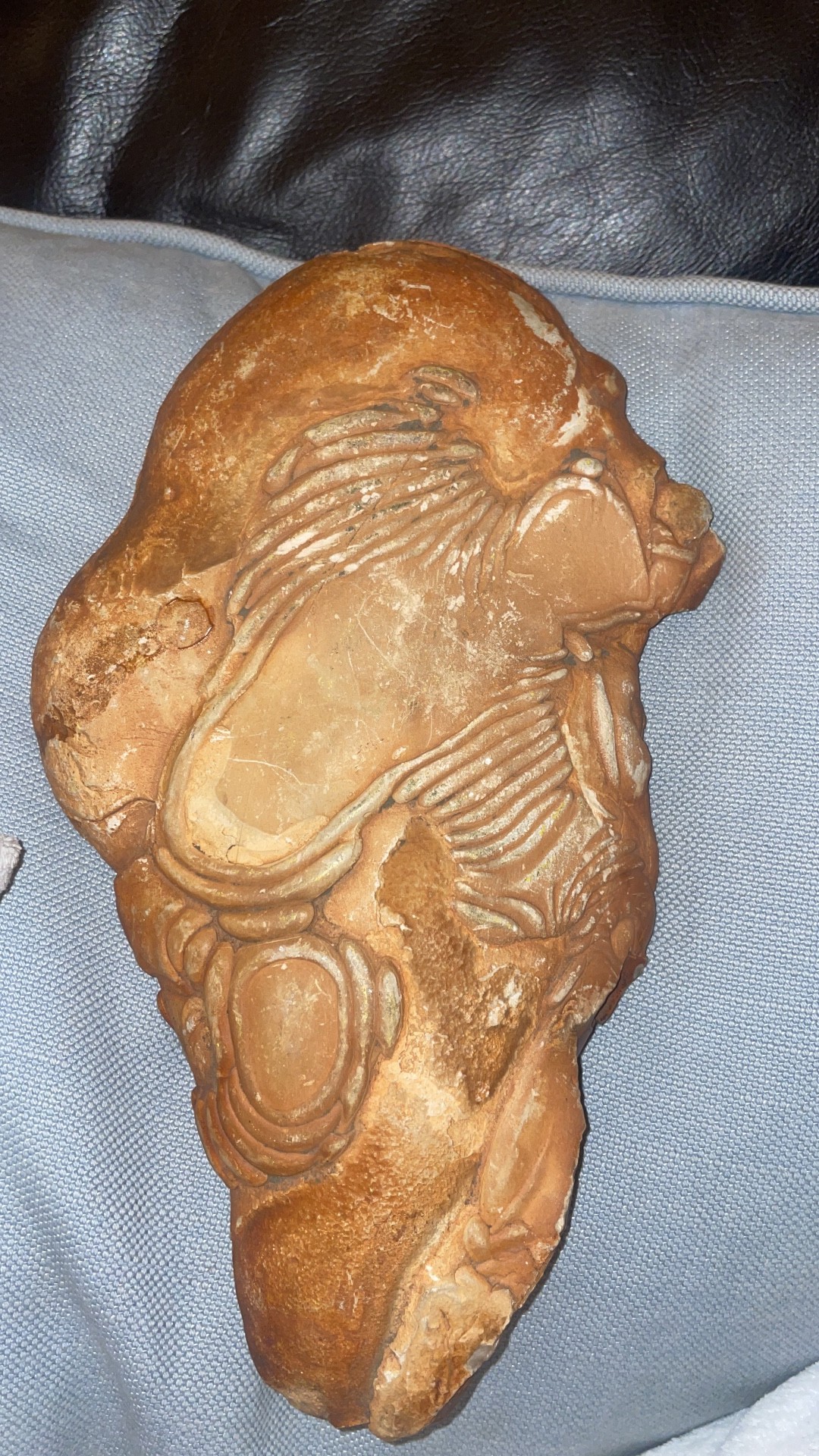
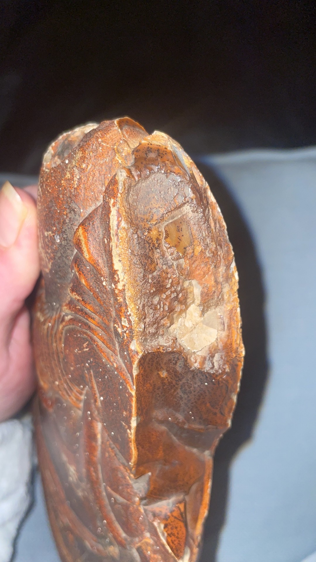
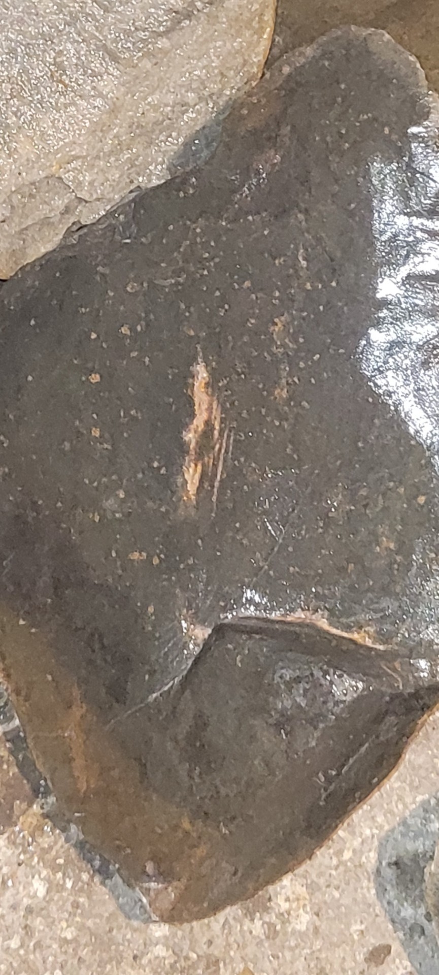
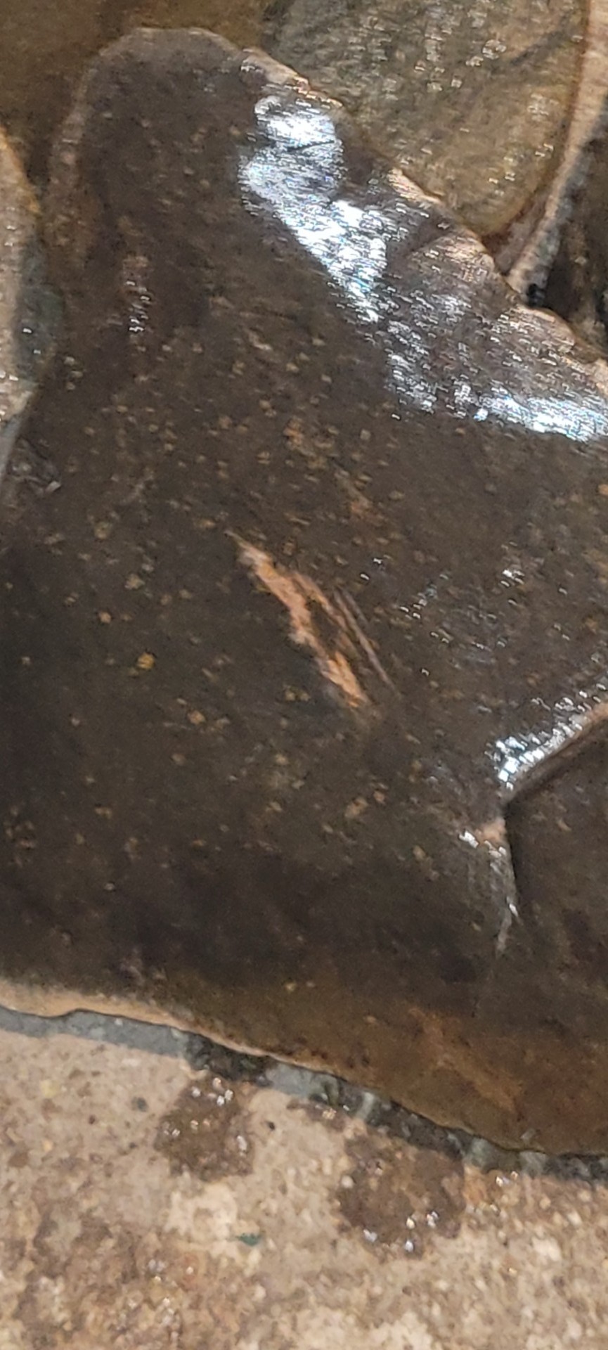
 Hi there thanks for your help. This stone was found in the Sahara desert. I thought it was a fossil but to be honest I have no idea what it is. Any help would be appreciated. seems carved but maybe could be natural markings, extremely heavy. Sound 30cm x 20cm, some sort of quartz stone embedded.
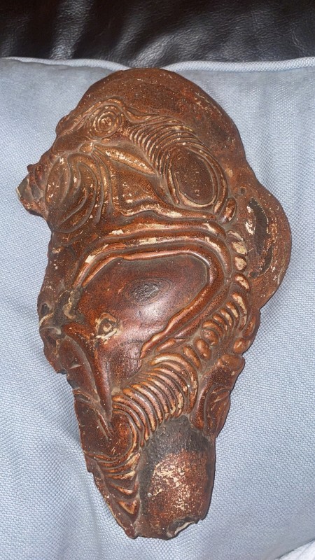


-
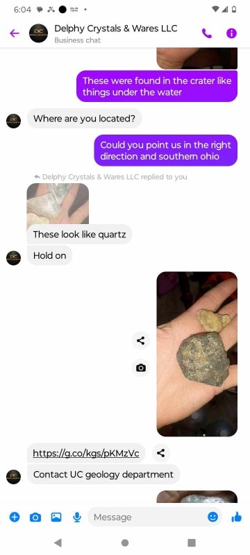
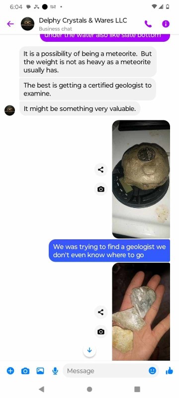
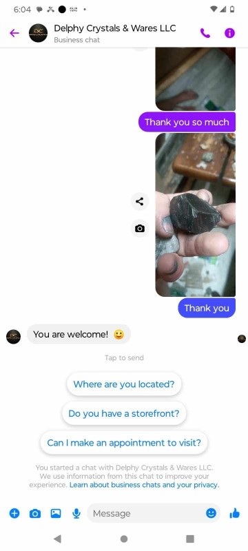
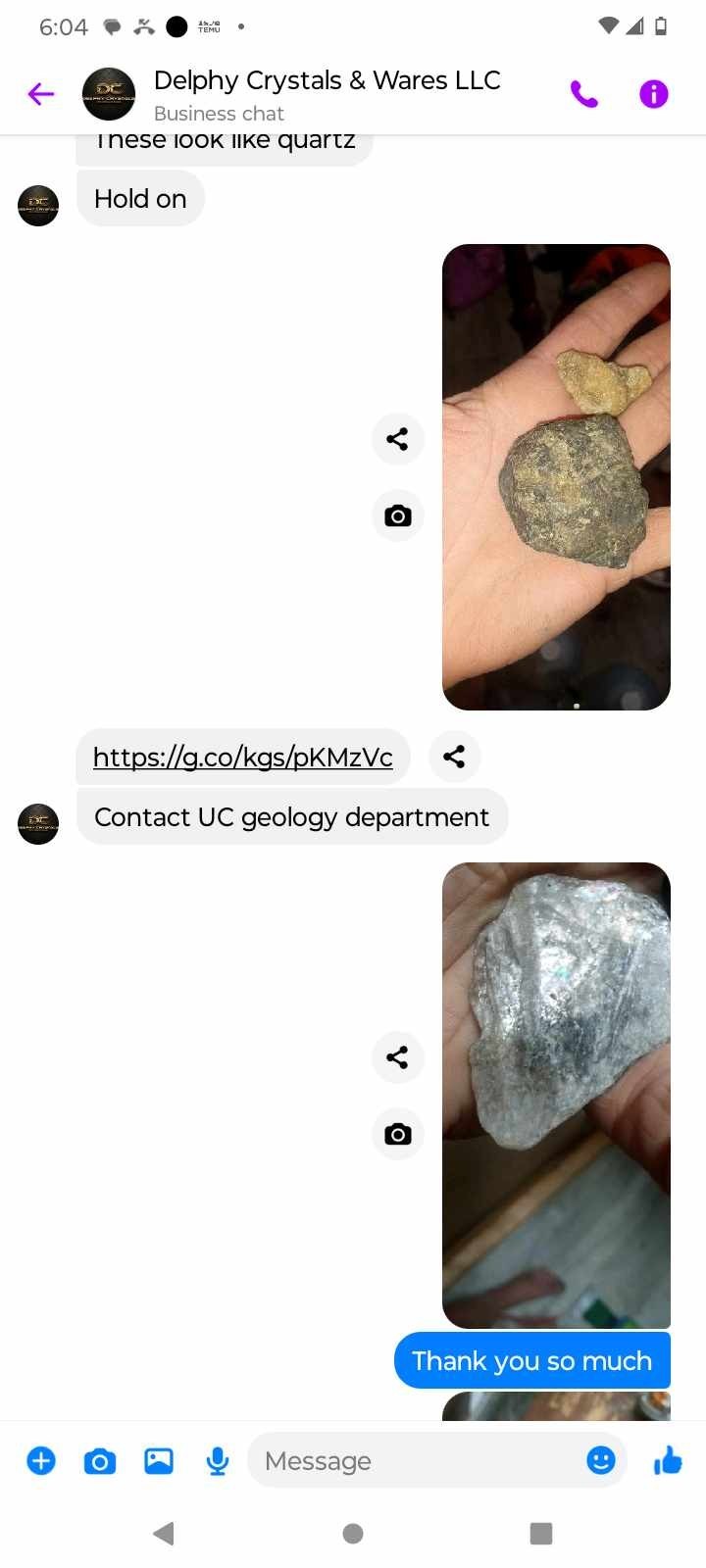
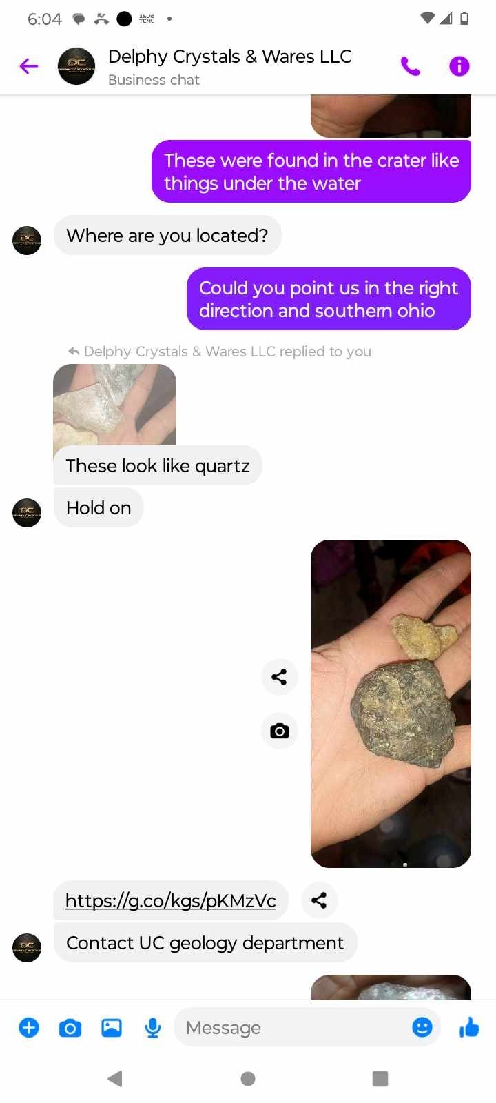
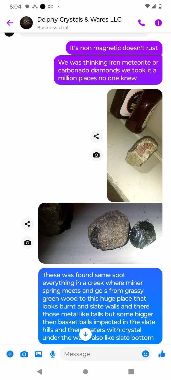
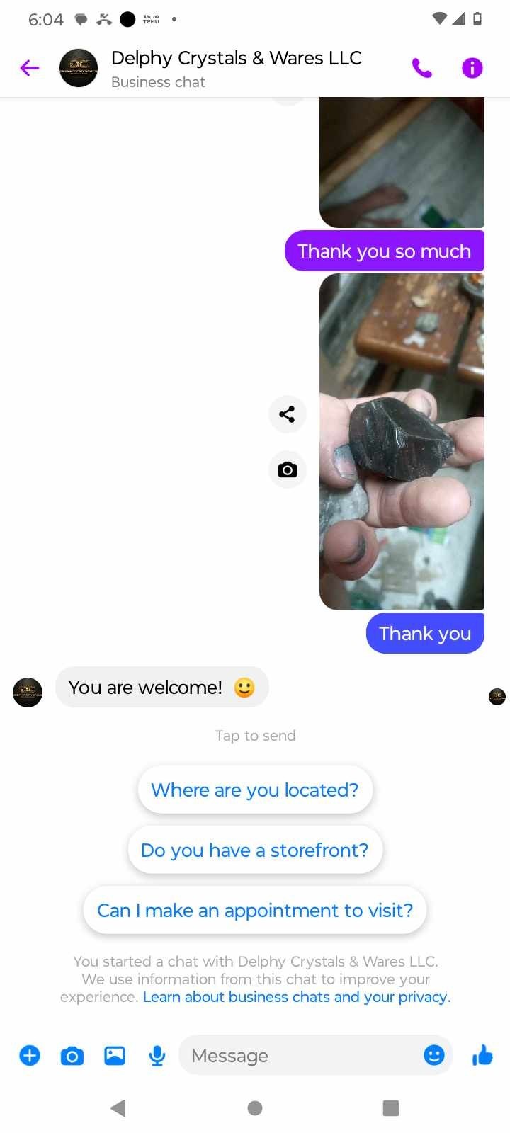
There is a place in southern Ohio where it's green grassy then it turns to black burnt slate with huge metal non magnetic balls and cratures just slammed in the grounds and under water with so many crazy rocks acid test for atinum and gold passed it can be heated o. Fire and not burn u when you touch it we had it xrayed and they were lost for words they could get it to stick to a magnet it had copper sulfade poured on them and they don't rust if hit tbey kinda will explode but can't really cut them there beautiful looks like liquid gold but not liquid most definitely beautiful also rocks that look lime black diamond and i found these small rainbow crystal not pictured in between a piece of what looks like gold tree bark and a a triangle rock i had pryed apart googled it and star dust came up could you help us to figure out what these are if you could help us no where we have went or talked to had any idea they were all lost for words


-

-

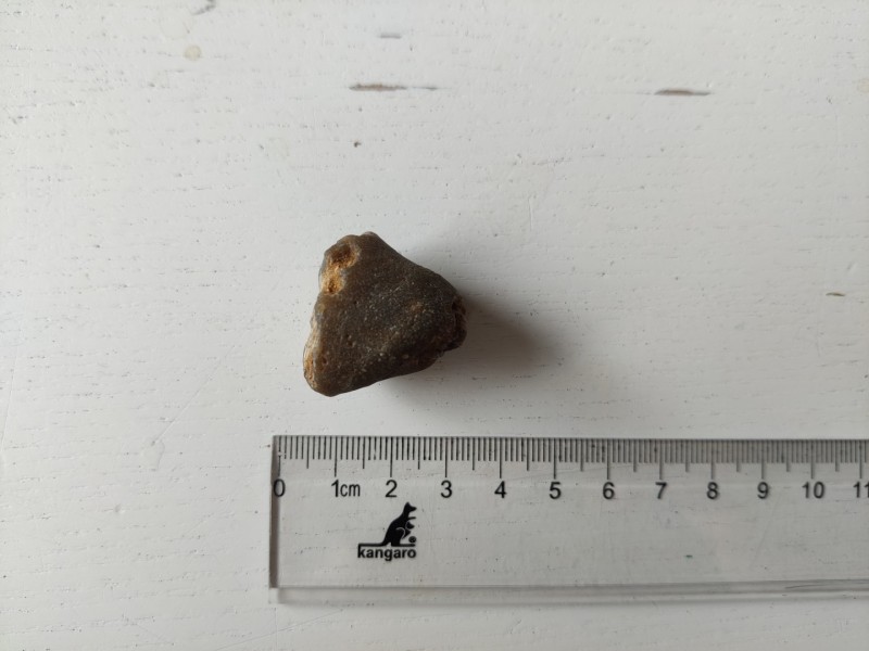
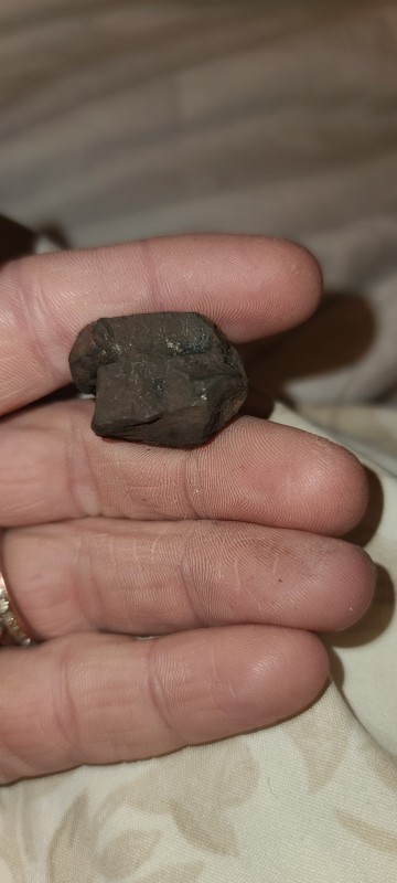
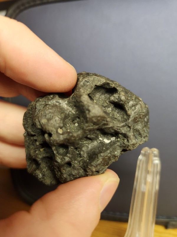
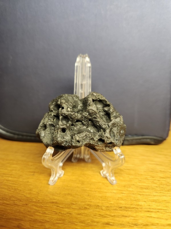
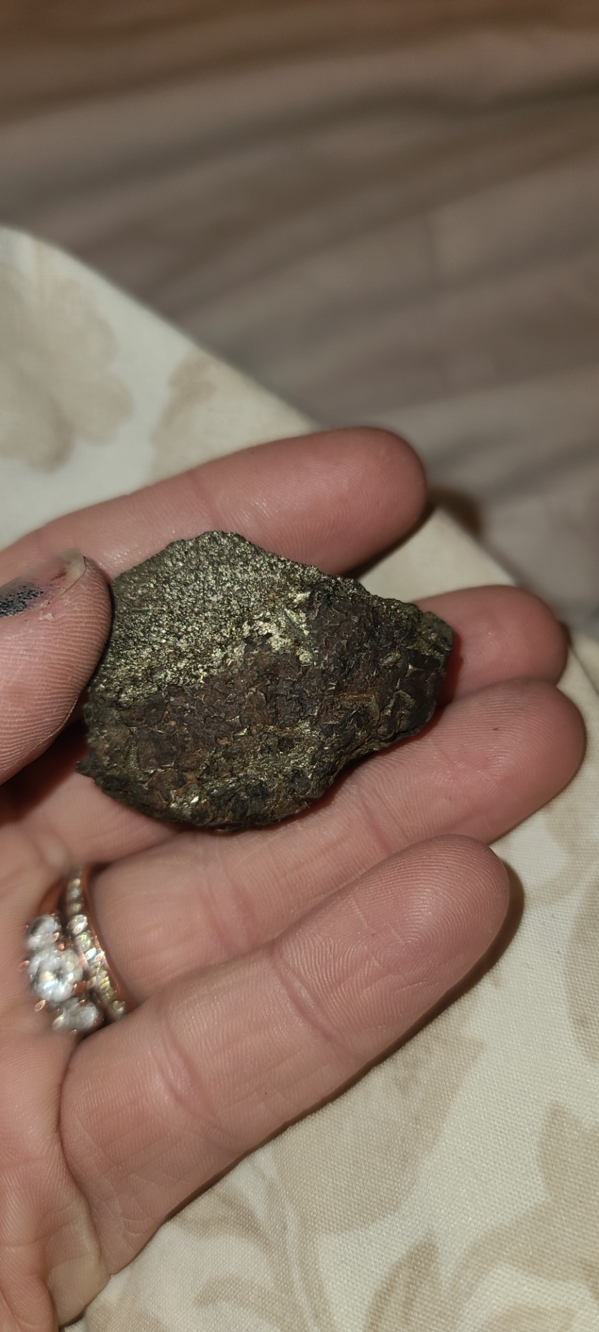
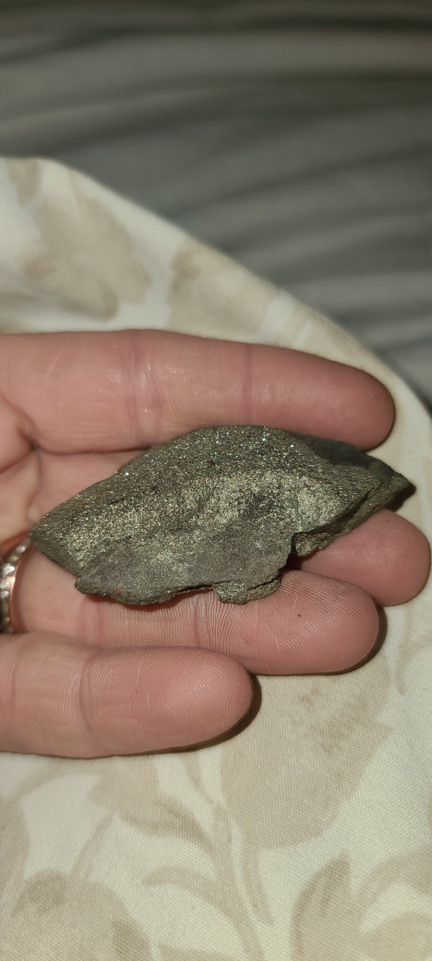
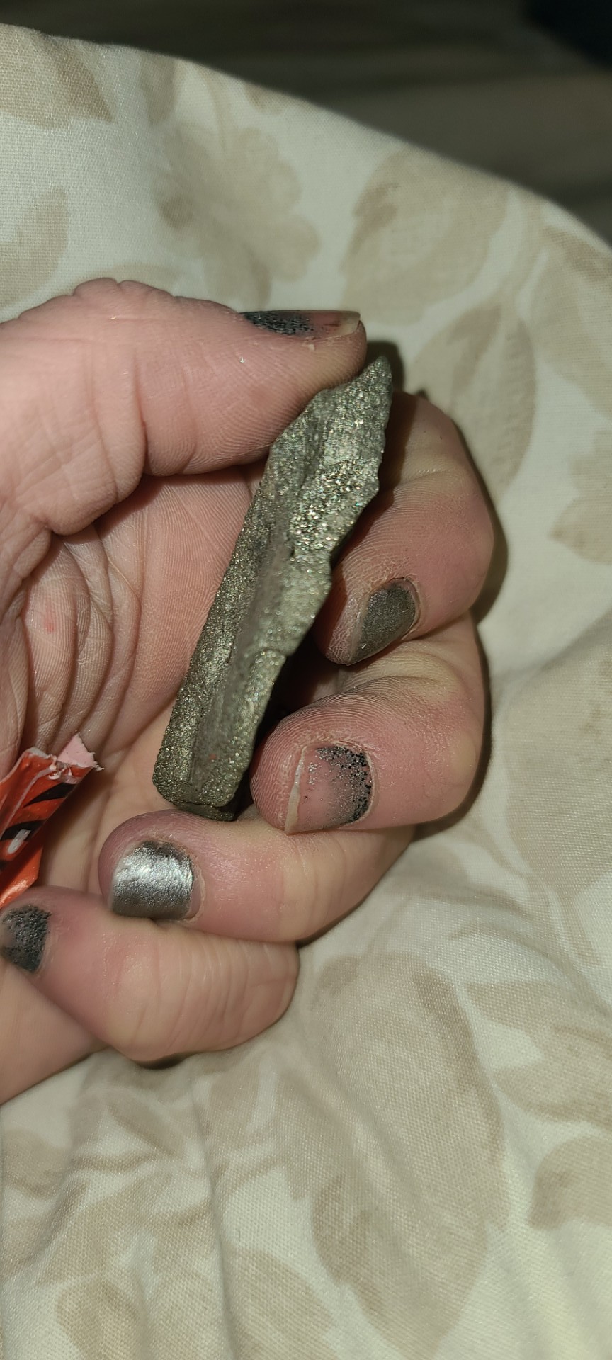
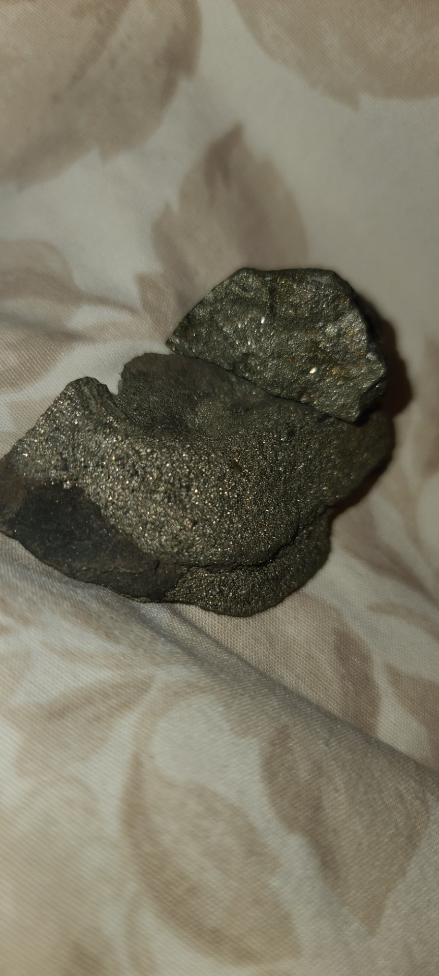
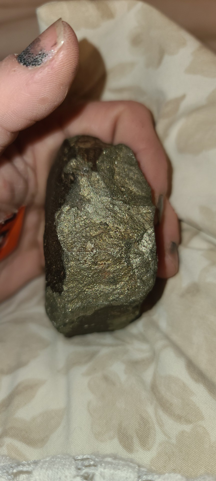
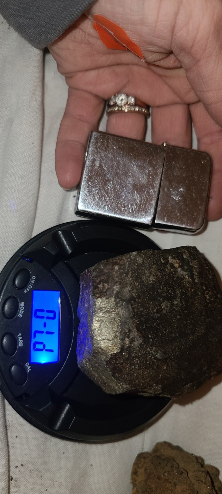
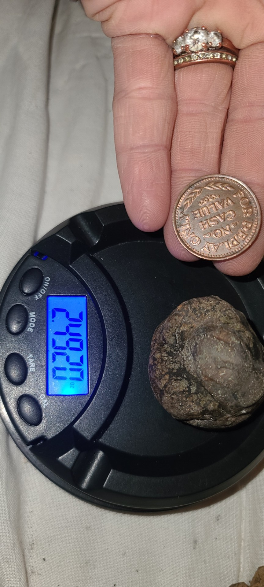
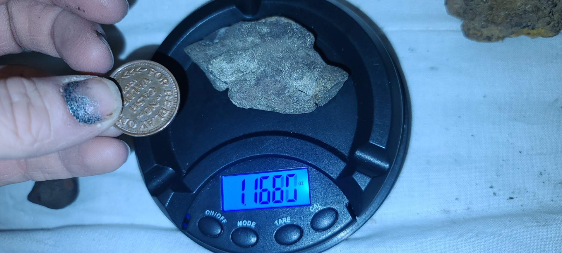
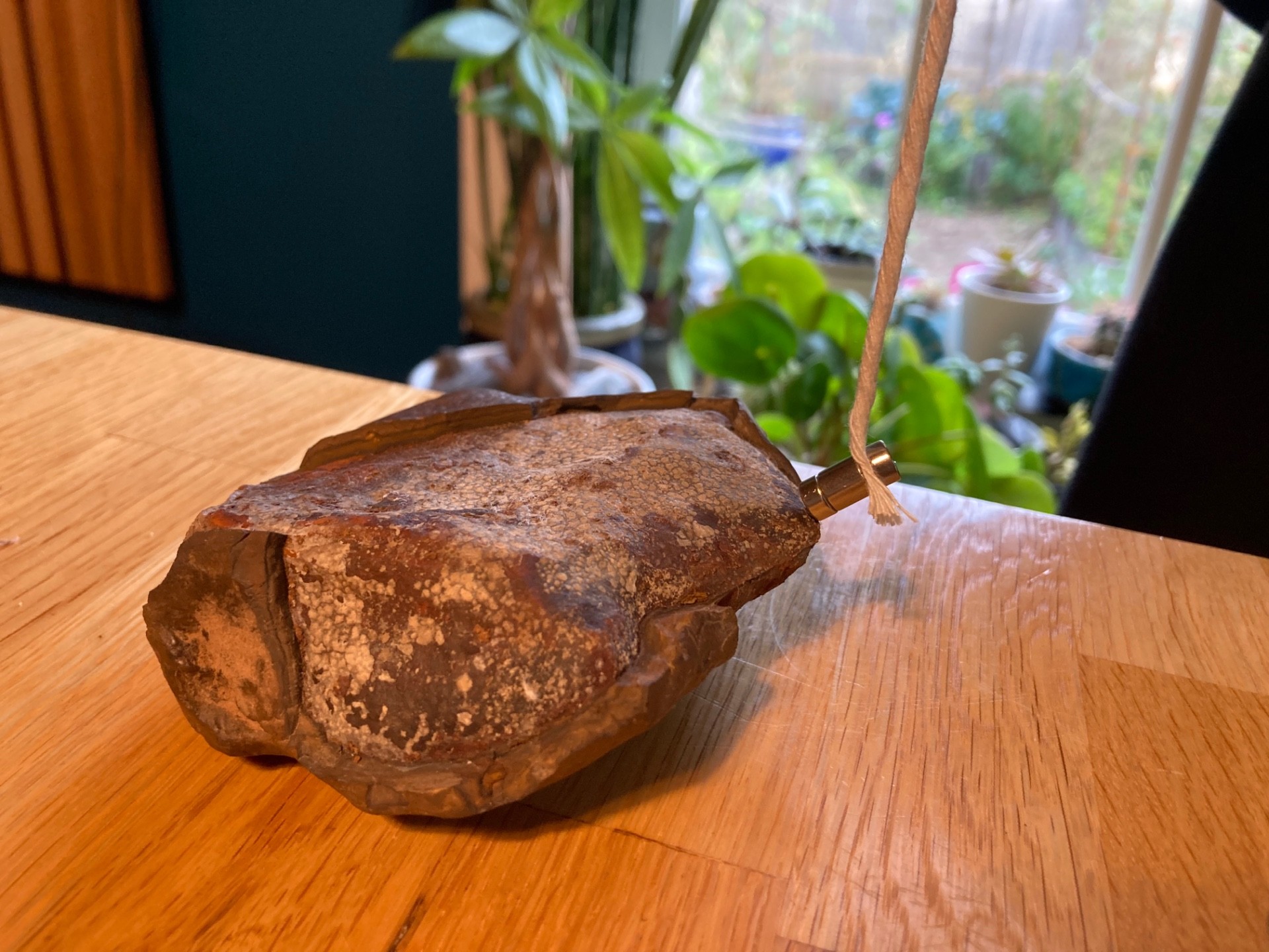
My Son Is Convinced This Is A Meteorite:
Garrett G posted a topic in Rocks, Minerals, Gems & Geology
I’m not totally convinced, but it does have a shiny outer crust, it seems metallic under that crust, and a magnet attached to a string is attracted to it. I found it while digging along my foundation wall. Any expert advice is very welcome!
-
Best wishes to our friends in Alaska after a rather large earthquake. A more than seven-magnitude earthquake has hit the Alaskan Peninsula this evening. The US National Tsunami Warning Center has issued a warning for some areas of Alaska. The US Geological Survey (USGS) said the quake initially measured as a 7.4 magnitude but was revised to a 7.2. The depth of the earthquake in the largest US state by area was recorded as 32.6km by the USGS. The USGS also reported a 5.7 earthquake followed the larger quake just three minutes later in the same area. The National Weather Service Anchorage warned that “significant inundation is possible or already occurring. Move inland to higher ground.” See more here: https://www.adn.com/alaska-news/2023/07/15/74-earthquake-triggers-tsunami-warning-for-gulf-of-alaska-coastline/
-
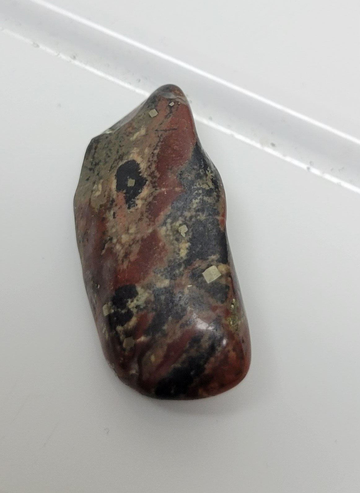
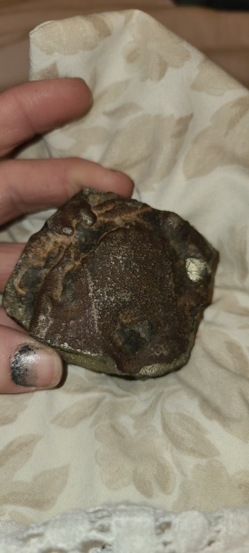
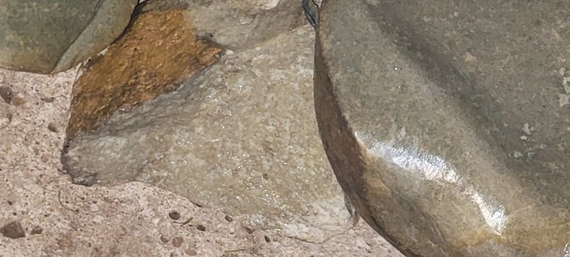
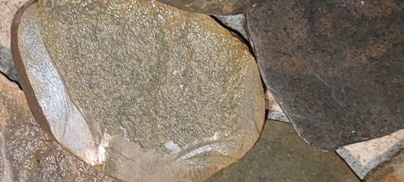
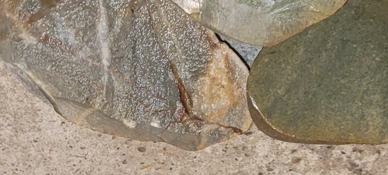
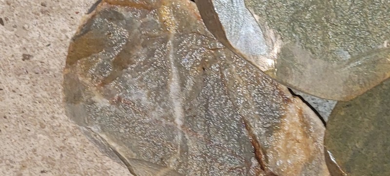
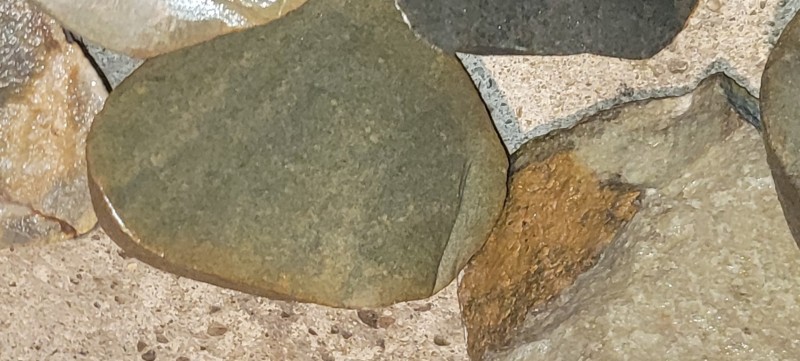
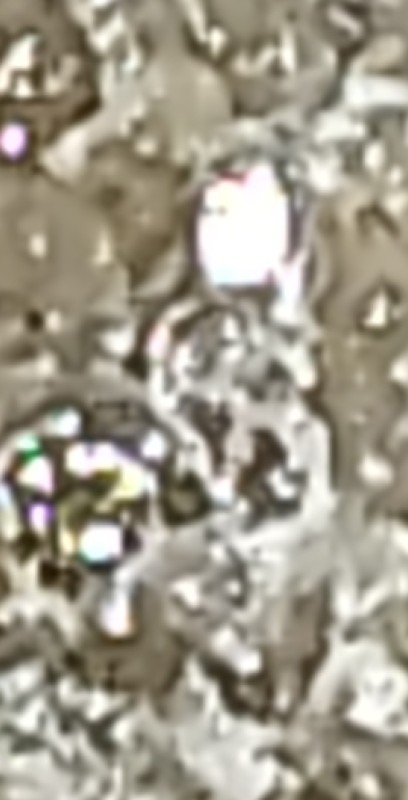
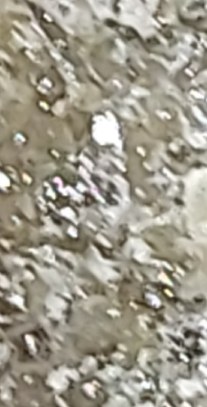
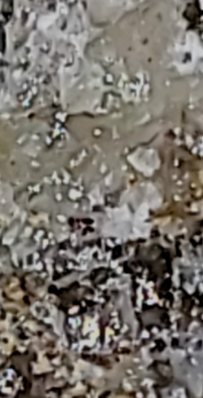
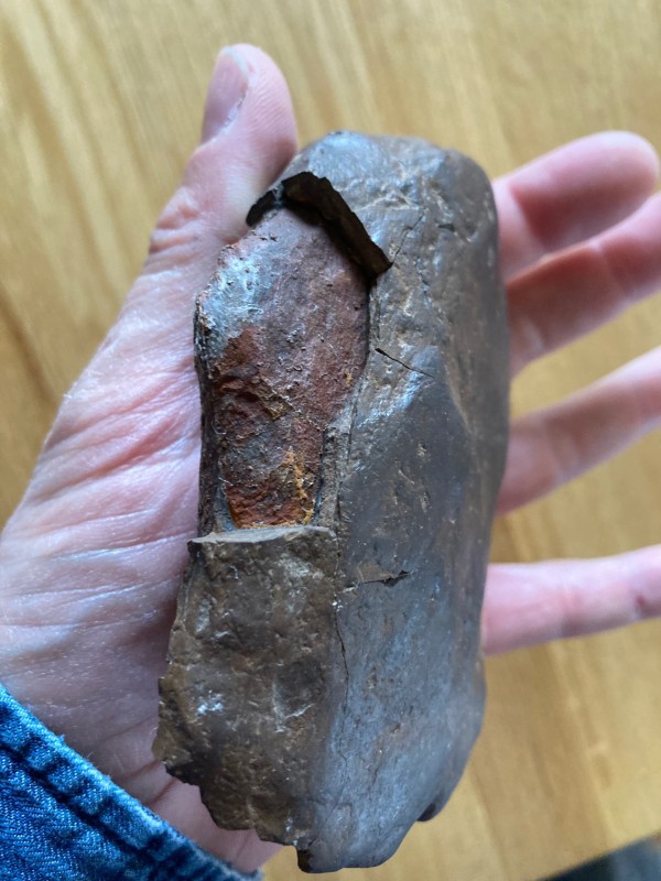
Wondering what this stone was if anyone knows

-
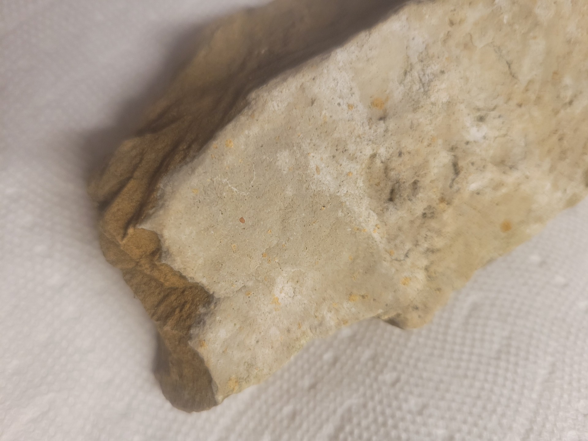
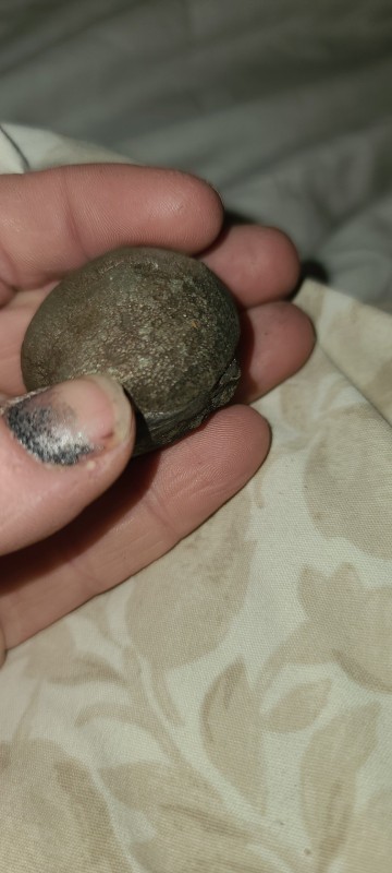
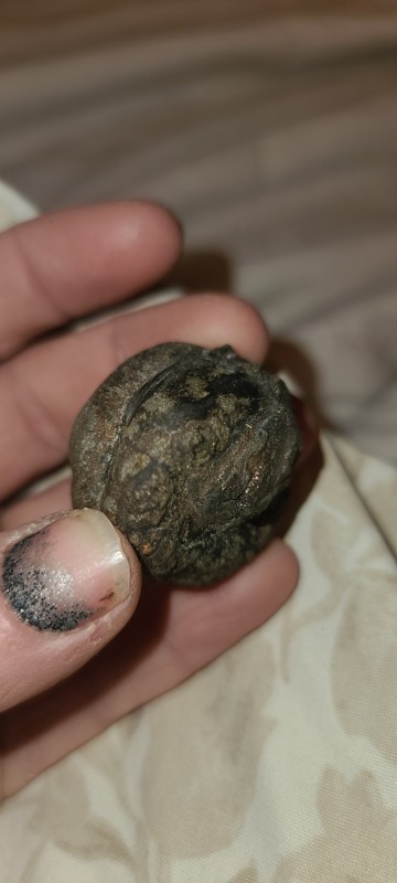
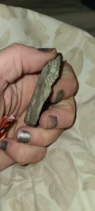
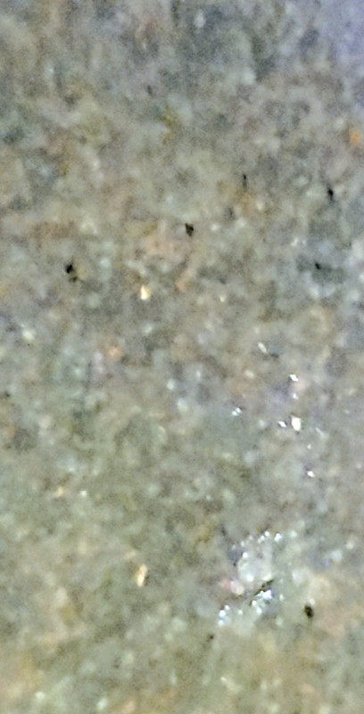
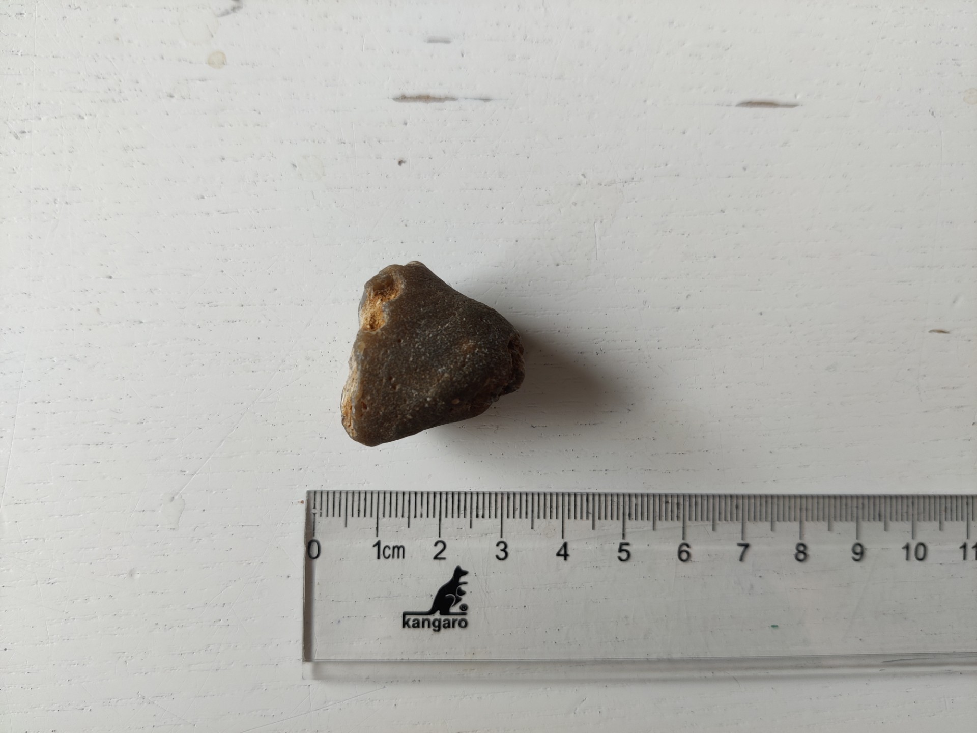
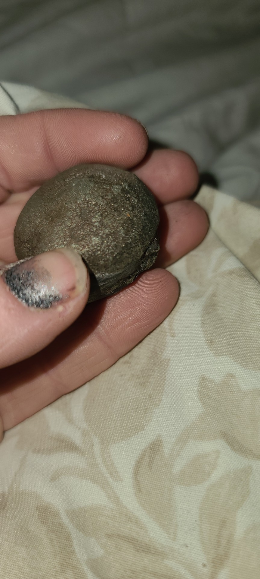
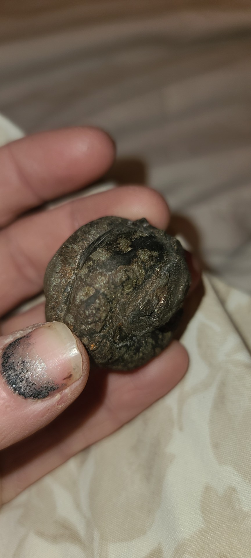
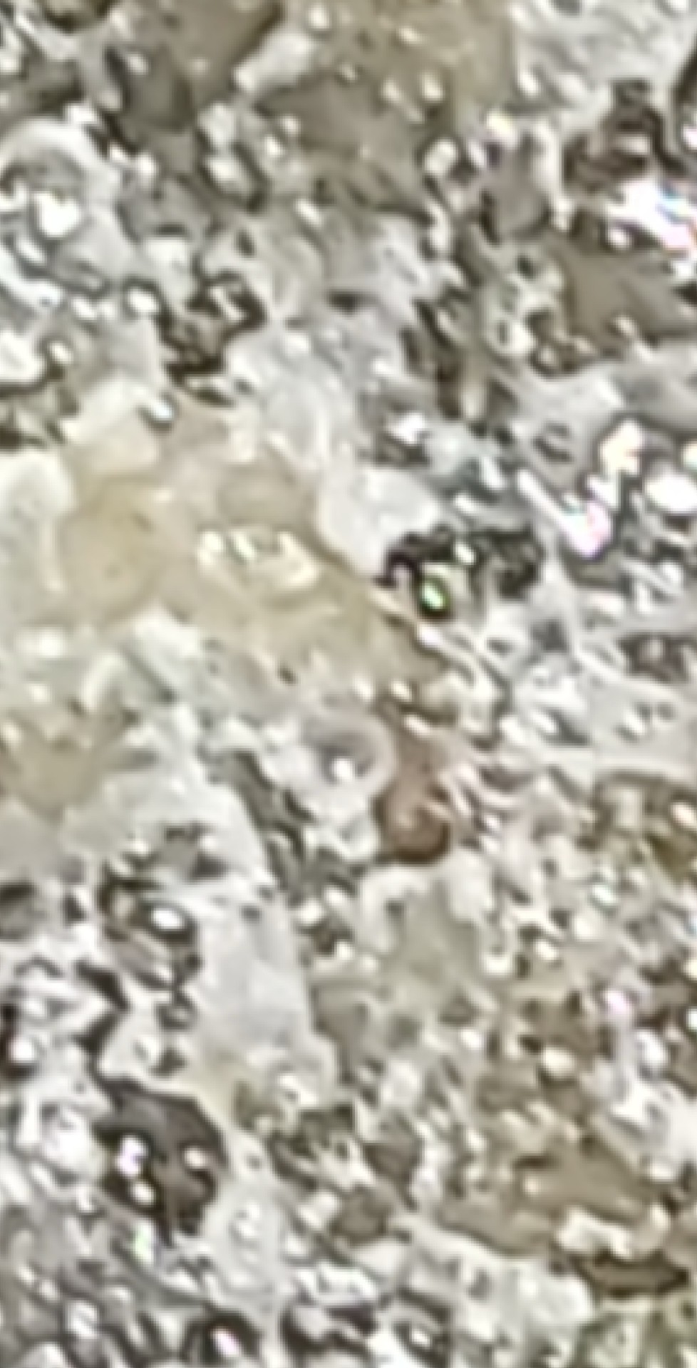
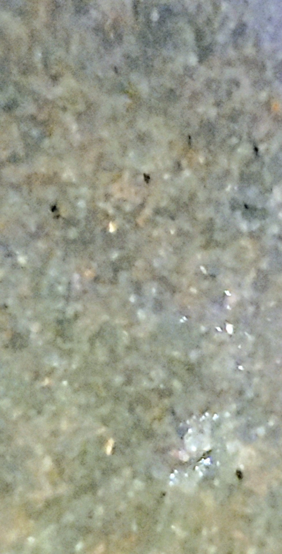
 Need a little help trying to determine what kind of rock this. Found this when I was younger and held on to it. Didn't think it was anything special until I noticed little crystals when I looked closer. It's kind of heavy too for being about the size of an egg.
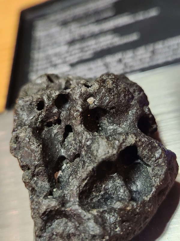
-
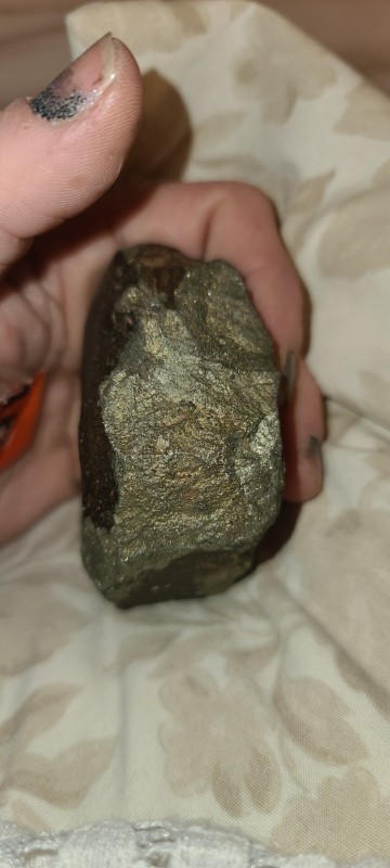
It looks like it could be Jasper? Interestingly, it has well formed crystalline structures which are very bright silver, are magnetic, and don't seem to oxidize. They are single crystal structures dispersed throughout the stone. As a reference, the whole stone is about 1.5" long. I actually found it metal detecting in a wood chip playground and it range up positive. I know it isn't valuable, just a curiosity. Thx, Brian
-
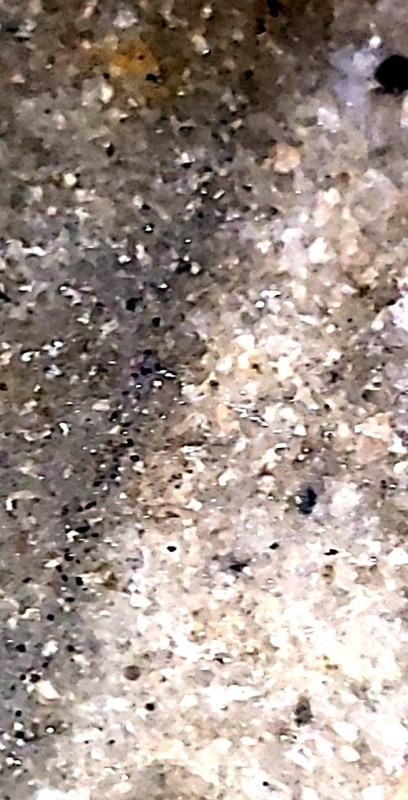
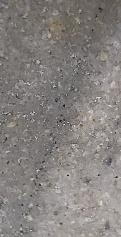
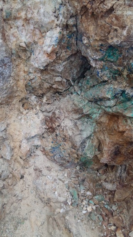
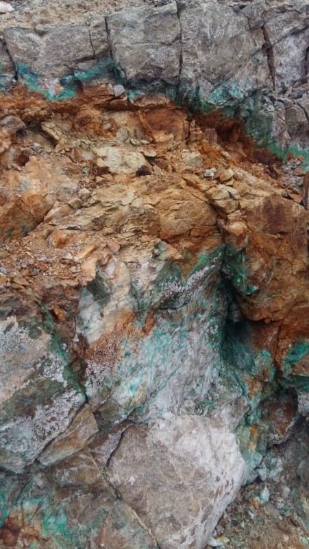
Kindly identify this mineral,
-
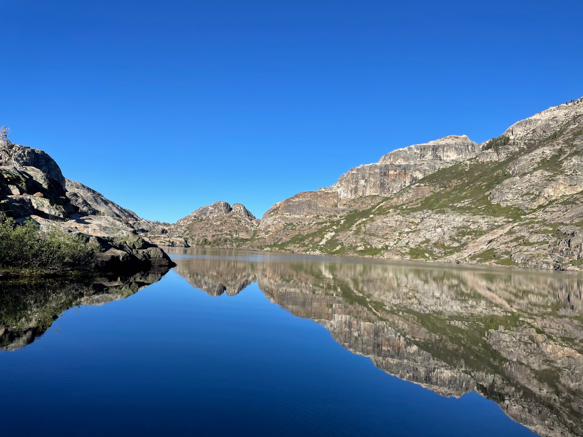
Here are a few references to articles, etc on the California & Nevada Palo-river valleys found on older forum posts you may find of interest. “The Tertiary Gravels of the Sierra Nevada of California”, Lindgren, W. 1911 (book) “The upper reaches of the Sierra Nevada auriferous gold channels, California and Nevada”, Garside, L. J. 2005, Nevada Bureau of Mines and Geology. (downloaded from older forum link?) “Origin of gold in placer deposits of the Sierra Nevada foothills, California”, Christensen H. W. , Nevada Bureau of Mines and Geology, 2015 (downloaded from sierrageology.org). The attached photo is looking south over “Benson Lake” located in the backcountry of Yosemite National Park. The ridge line on the left (west) in the photo extends south from Piute Peak as referenced by Lindgren beginning on page# 214 of the 1911 “Tertiary Gravels”. The Lindgren photograph found between pages #218 and #219 is of the Tertiary (Eocene) Tuolumne River channel crossing east to west down ridge (south) of the lake, above and west of Piute Canyon. If you were to go to “Google Earth” you can fly around this actual channel crossing in 3D. Located down stream, near Big Oak Flat, on the tertiary Tuolumne River is one of the two richest placer deposits discovered in California. The first of the richest placer deposits was deposited by a branch of the tertiary Calaveras river into Columbia basin (CA, Columbia State Park). Both of these placers deposits are located east of the main Motherlode belt but may have crossed portions of the east lode belt (if either lode deposit existed or had raised 55 million years ago.) As a side note: “Table Mountain” located in both Calaveras And Tuolumne counties is at least 30 million years younger than these Eocene channels. The Table Mountain channel picked up placers at the cutting of the tertiary Calaveras channel at Columbia then again at the lode crossing near Woods Creeks, Jamestown. Per the article on the “ upper reaches of SN gold channels”, 2005 the central channel of the tertiary Yuba River originated near Yerington, Nevada. Seems the majority of the 1848 California placers were taken before these ancient Eocene channels crossed the main California lode deposits. Although you are allowed to fish but not detect within a national park, I have heard you may still be able to detect in Nevada. Just keep in mind that unlike YNP park rangers, old miners are neither as well dressed nor nearly as polite. Enjoy the read.
-
 https://trib.com/news/local/casper/a-wyoming-crater-field-may-offer-insights-into-our-solar-systems-workings/article_0e0eae2c-4426-11ed-bcf6-e7dbc7b57469.html There are varying theories as to the origin - including that we once had a second moon! Or maybe smaller orbiting sub-moon type body which got shattered by an impact and rained onto Earth. The article doesn't cover this, but of note is that the formation in which this massive field of fossil craters is found in matches up with the largest extinction event in history - the Permian-Triassic extinction event - which is much larger than the one that killed the dinosaurs 200 million years later. In any event, this is an extremely interesting discovery. I believe this field probably extends beyond just Wyoming and may be a national scale, or maybe even potentially a global scale occurence with more research. The craters themselves are visible on aerials if you look closely, but are so old that any actual meteorite material has long since weathered away, but shock glass is still there.
 -
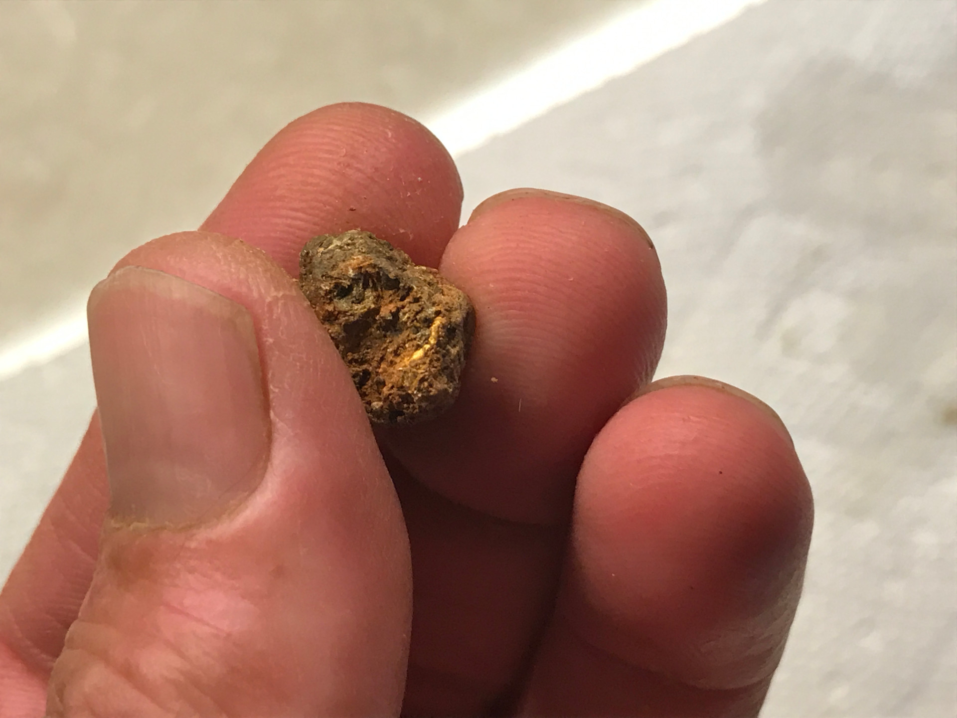
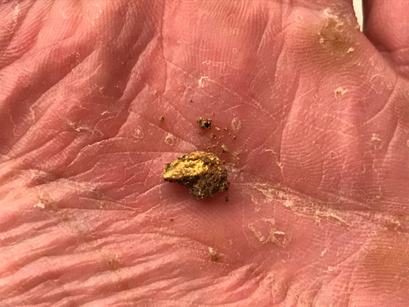
Hope you are all out digging on this holiday weekend!! Often times when detecting for gold nuggets in dry placer conditions I get clumps of clay or dirt containing gold. What sort of clumps or lumps does your pay layer produce? This lump came from a layer of decomposing bedrock hard pack layer above a stream bed high on a flat no longer part of the current creeks flow.

-
Greenland could be a hot spot for coal, copper, gold, rare-earth elements and zinc, according to the Geological Survey of Denmark and Greenland. https://www.cnn.com/2022/08/08/world/greenland-melting-mineral-mining-climate/index.html?utm_source=pocket-newtab Easier than mining an asteroid -- maybe good practice for that.... (Article from 8 Aug, so a week ago as I post. I don't think I'm duplicating a previous post/thread.)
-
My son asked me what book to get that explains the geology and geological indicators to find gold sources? So, I said that I would get some suggestions from the seasoned gold hunters on Detector Prospector, instead of searching the internet where you will find that one person states that his book is the best, ... and, etc., etc. (My experience is somewhat limited, far from pro.)
-
I don't know exactly where to put this so I'll start here. Maybe Clay has it on his links or someone else has posted it but it got me to some maps I would not have found. I still don't understand most of the nomenclature. https://ngmdb.usgs.gov/mapview/?center=-97,39.6&zoom=4 MapView Betaby the NGMDB MapView lets you explore some of our favorite geologic maps from the NGMDB (USGS/AASG).
- 1 reply
-
- 7
-

-

-
- advice and tips
- geology
- (and 1 more)
-
 I’m curious to how you all see the mineralization of the soils you detect compared to other locations. Our soil here in central Arizona seems to be fairly mineralized. But, we haven’t been detecting anywhere out of state to let us effectively compare. Here’s a USGS map showing relative iron concentration in US soils. There appears to be heavy iron concentrations in the Pacific Northwest. Does this reflect your experience on the ground? If so, has this affected what you choose to swing? If not, how do you think your soil compares to elsewhere? us iron concentrations.pdf
 -
Flooding like nobody has seen in over 100 years is taking place in some of the historic gold districts of Montana, Idaho and beyond. An impressive late season snow pack followed by warm temps and rain has the rivers and gully''s a boom'n. Material that hasn't moved in over a century is on its way. Time to get your detector, sluice box, highbanker, dredge suits, etc. ready. Could be once in a lifetime prospecting opportunity, still keeping in mind the property damage is extreme & tragic for many and our hearts go out to them.
-
-
I would say my panning skills have improved quite well over the past couple of months since I began “looking” and I no longer have to use my magnifier to check wether it’s gold in the pan or not. The burn I pan is quite peculiar,as in the deeper I dig the less gold I find.I might find a couple of small flakes only a foot deep,but then dig down another two and only find tiny specks. I got talking to a guy yesterday called Gary,who pans the same area and he says the same thing,and we both agreed it must be something to do with the clay layer and that we believe the gold isn’t sinking beyond this layer.I would say the clay layer is false bed rock.Gary mentioned that he found a 2.4g nugget sitting on the clay layer but that he didn’t find anything else around it. Gary is the first person I have spoken too while panning and although he has only been panning himself for 5yrs,it was good to know that I’m not the only one who has noticed the lack of deeper gold. The clay layer has a very smooth consistency and is grey in colour.Some areas of clay do hold gravel but in general if I mash a chunk up it turns to nothing but a cloud. There is also not much in the way of black sand in this little stream,mostly blonde sand.There are flecks of platinum,zinc,sulphur,copper and iron to be found in the pan and some lead here and there. There was a gold mine near the top of one of the feeder streams and I will be going for a venture to see if I can find it.


.thumb.JPG.b46839319dc8de4aefe1f42407094dbd.JPG)