
Search the Community
Showing results for tags 'geology'.
-
Here a video link to the richest pocket gold mine in the gold country if not the state. Take note of the depressions from the wooden cross ties of ore cart tracks. A lot of barren quartz broke a lot of want to be mine owners but when they mined into a crossing the gold was in sheets. The contact was along the north south trending limestone formation. Later the drifts were used for passage ways between the cathouses and underground speak easies. Back in the 1950’s one of the sons of the then mine owner ran an ore cart off the tracks into a support timber. He discovered enough high graded gold buried under the foot of the timber to buy himself a new pick up truck and then some. Years later I would have the privilege of remodeling one of the above ground madam’s room, which was connected to this mine, into a bank manager’s office. The original cathouse door with glass window advertising, which led many a miner, logger & cowboy in the wrong direction, is still around back. I still own stock in that bank. Enjoy, few are alive that have ever got view inside of this historic mine.
-
Nick Zentner, Geologist CWU discussion on the Liberty WA placer & hardrock gold deposits.
-
You have had a lot of success over the years. I imagine you have found some wonderfully large masses of gold. Think about each of those for a few moments, especially those in the lower 48. Does anything appear as a common feature of their locations? Surely not everything would fit the same mold, but was there anything present frequent enough to indicate one location might be a little bit more likely to yield big gold than another? Thanks
-
 The Mystery Formation of Extremely Rich Gold Veins Might Finally Be Solved MICHELLE STARR 24 MAY 2021 Gold, for all its wonderful uses, isn't hugely abundant in Earth's upper layers. For each ton of crust material, there's an estimated just 0.004 grams of the precious metal. Yet somehow, there are regions that contain "bonanza" abundances - hyper-enrichment, in the scientific parlance. How these gold veins form in time spans as short as days from hydrothermal systems that only contain trace amounts of the metal has been a geological mystery. It's one that now has an answer, from the most unlikely of clues: the separation and clumping of fat particles in soured milk. "Scientists have long known that gold deposits form when hot water flows through rocks, dissolving minute amounts of gold and concentrating it in cracks in the Earth's crust at levels invisible to the naked eye," geoscientists Anthony Williams-Jones and Duncan McLeish of McGill University in Canada stated in a Q&A. "In rare cases, the cracks are transformed into veins of solid gold centimetres thick. But how do fluids with such low concentrations of gold produce rare ultrahigh-grade gold deposits? Our findings solve the paradox of 'ultrahigh-grade' or 'bonanza' gold formation, which has frustrated scientists for over a century." Milk is an aqueous solution made up of several components, one of which is microscopic globules of fat. At the pH level of fresh milk - very close to neutral - these fat particles have a negative charge, which causes them to repel each other. The souring process involves bacteria in the milk converting lactose to lactic acid, lowering the pH level accordingly. This causes the surface charge on the fat particles to break down, and the fat particles separate from the milk serum and clump together with each other via coagulation, forming a sort-of gross decomposing milk fat jelly. Williams-Jones, McLeish and their colleagues found a similar process when using transmission electron microscopy to study gold deposits from the Brucejack Mine in British Columbia. This is one of the spots around the world where bonanza-grade mineralization can be found, up to 41,582 grams per ton. It's long been accepted that gold is transported by way of fluid through Earth's crust. However, in order to reach the abundances found in hyper-enrichment zones, previous studies suggested that the gold may have been dissolved in high concentrations in fluids containing chlorides or bisulfides, and transported and deposited that way. The other possibility is a colloidal solution, with solid nanoparticles of gold dispersed throughout hydrothermal and geothermal fluids. Since the gold nanoparticles hold a charge (like milk fat), they repel each other. When the charge breaks down, the gold particles clump together in a process similar to coagulation, known as flocculation. This has been indirectly demonstrated in the past; now, McLeish and colleagues have observed how it actually happens. "We produced the first evidence for gold colloid formation and flocculation in nature and the first images of small veins of gold colloid particles and their flocculated aggregates at the nano-scale," Williams-Jones and McLeish said. "These images document the process by which the cracks are filled with gold and, scaled up through the integration of millions of these small veins, reveal how bonanza veins are formed." For this process, the concentration of gold in the geothermal fluids only has to be a few parts per billion. It flocculates to form a jelly-like substance, which gets trapped in cracks in Earth's crust to form rich gold veins. This finding suggests that rich gold deposits may be more common than we thought, and may have occurred in several other contexts than previous estimates had allowed for. If other studies and further examination can back it up, the research could give us a new toolkit for understanding and locating gold deposits around the world. "We suspect that the colloidal processes that operated at Brucejack and other bonanza gold systems may also have operated to form more typical gold deposits. The challenge will be to find suitable material to test this hypothesis," Williams-Jones and McLeish said. "The next step will be to better understand the reasons why colloid formation and flocculation occurred on the scale observed and reconstruct the geological environment of these processes." The research has been published in PNAS.
 -
I'm interested in any information on how gold veins/ lode deposits become offset and how to attempt to predict the amount of offset. Anyone have information on this? Thanks, RiverRat
-
Interesting! Will be useful when we eventually have a colony there.
-
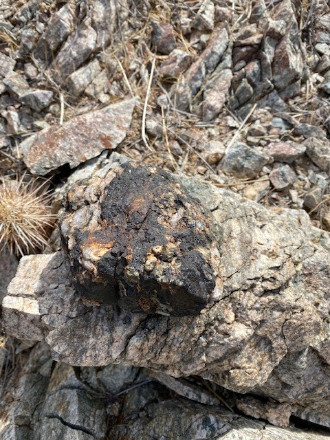
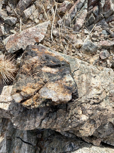
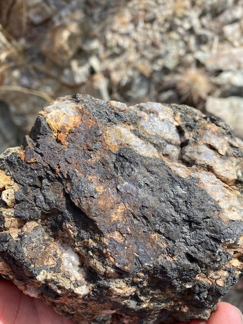
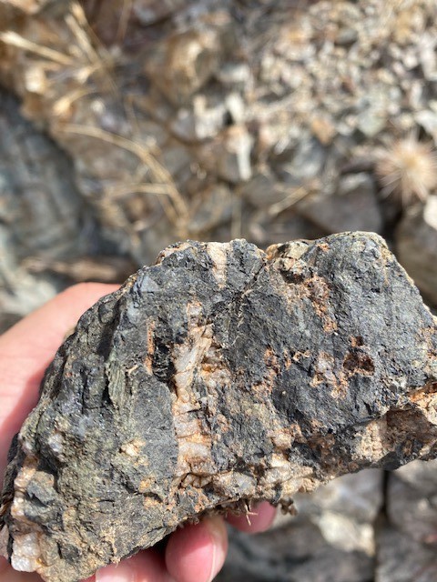
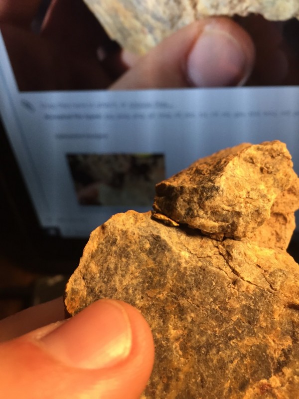
Hello, I was out this past weekend with my Gold Monster 1000. Here is a picture of a rock that I came across that had crystals and what I believe is black sand. I have come across black sand by it self and has done the same issue with my machine. Reading and sounding hot and then a blank sound as well. 1) I assume that you can find black sand like this still in a rock with Quartz. 2) Is is not true that usally when you find black sand you may end off finding gold as well because black sand and gold go together. here are four pictures of the rock. Allen
-
Stumbled onto this interesting article form another site...... Not sure where to post this but Steve can relocate it where he see's fit? https://www.westcoastplacer.com/paleochannel-hunting-guide/
-
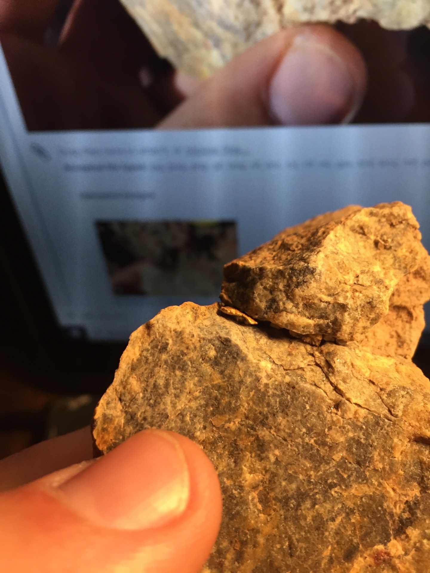
I nabbed a pretty neat find the other day and I think it was sunbaker... Is it only a sunbaker if you saw it before you disturbed it or is it still a sunbaker if the rock that it's lodged in tells a sunbaker tale? Every dirt dog can tell what half of a float rock was in the ground and what half was face up. This is a rock with a nugget lodged in it that tells one of those sunbaker tales. Is it a sunbaker? -OR- Was it a sunbaker? -...OR- Is it not a sunbaker? It's wedged in there really good! I haven't tried to yank it out because it's so unique as a sort of specimen of a bedrock nugget trap. I've picked at it and got no movement, plus it survived getting tossed around in my pack on my hike. An interesting find too! One of those days, patch hunting a new area (this new area hasn't met the three nugget threshold). All I had in my pocket was trash and my nug jug only held my test nugget. But lo, another signal! Few and far between, they are out here. Giving the spot a boot scrape moves my target. Probably surface trash, a bullet. Gotta know. These 4 rocks. These 3. These 2. That one... it's not a hot rock? Turned in hand to reveal a little smooshie stuck in a crack! WHOA!!! My strongest theory is that this "specimen" is a remnant of the bedrock that trapped some gold, all the bedrock having been eroded away. The gold since washed down the hillside and into the main drainage, perhaps all the way into the basin... But hopefully it has only travelled just past where I stopped detecting for the day and I get a whopper bonanza another day! 😂 Yeah right.
.thumb.png.a12c67866fc1390d05843ded0e014649.png)
-
This is an interesting little story about Mineral Park, Arizona. It tells about a geologist who was told to find ore or be fired. There is a bit of history about fine gold recovery also. https://kdminer.com/news/2021/feb/06/mohave-county-geology-concentrate/
-
 I only went real nugget hunting one time in Stanton,Arizona in march 2002 because the late Charlie Wilson of Wilson metal detectors took us as guests for a week.I was using a Minelab gold machine he lent me that ran at 3 different freq.You had to choose one.I really envy you guys that get to do this in your area.I loved doing it even though I found no gold since i was new at this type of hunting.The owner of the Johnson mine even gave us permission to hunt his land which I thank him for.I met Chris Gholson and his father and they were fantastic people.
 -
As a beginner, I am trying to understand the details of the concept of nugget patch size. As I understand the concepts, a nugget field is defined as a general area that may contain gold. And a nugget patch is a small area within a nugget field that actually contains a group of gold nuggets. From what I have read so far, some patch hunters define a patch as any location that produces two or more nuggets within a distance of a few tens of yards. Is this a reasonable definition of a patch? This then implies that there is much barren space between the patches. I have several questions specifically on nugget patch size: 1) what is the range of sizes of actual nugget patches; 2) does the size vary depending on location (valley/gulley/gulch vs. mountain or hill); 3) does the patch size vary depending on geography (desert vs. a temperate area such as Sierra Nevada or Cascades); 4) is there a patch size relation to the age of the geology, that is, older rocks generally have larger patches? Any help in learning what to expect in the field would be appreciated.
-
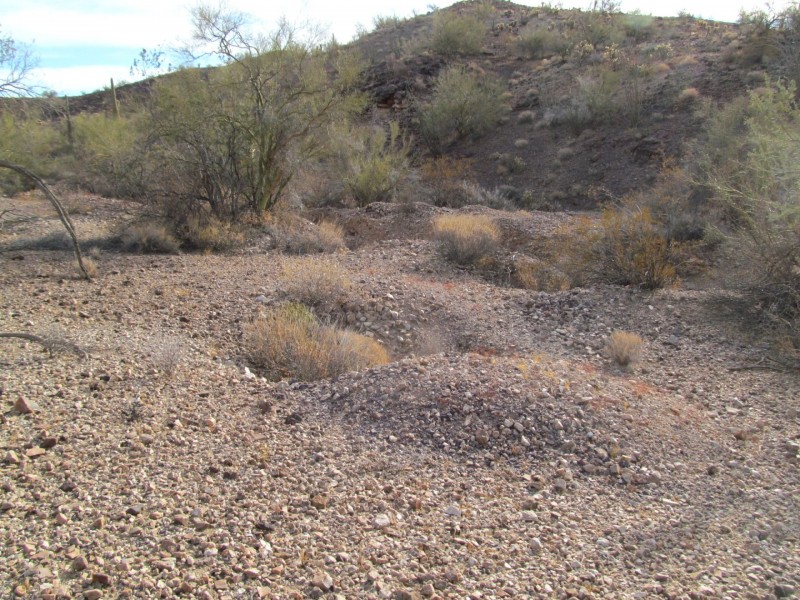
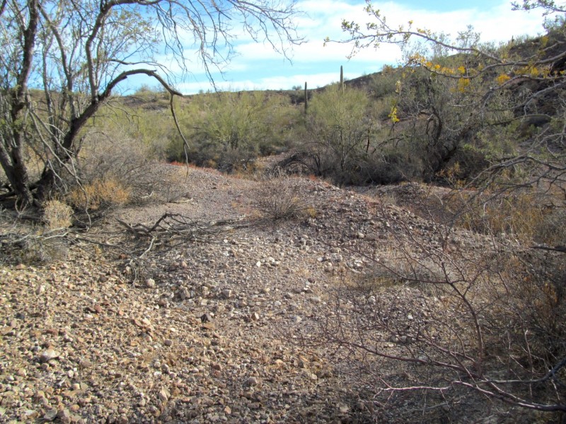
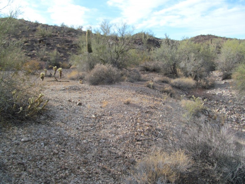
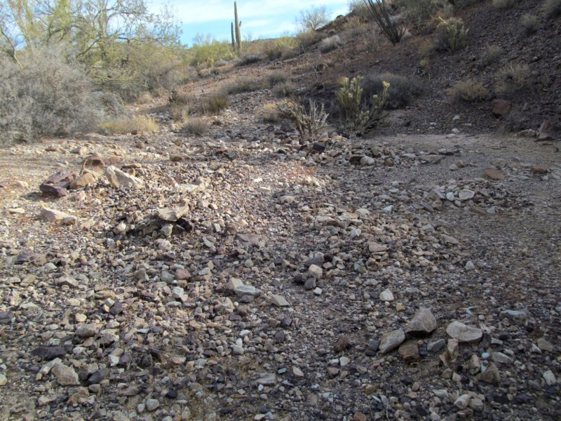
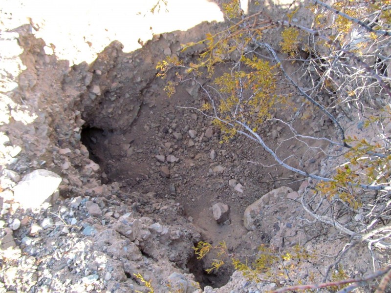
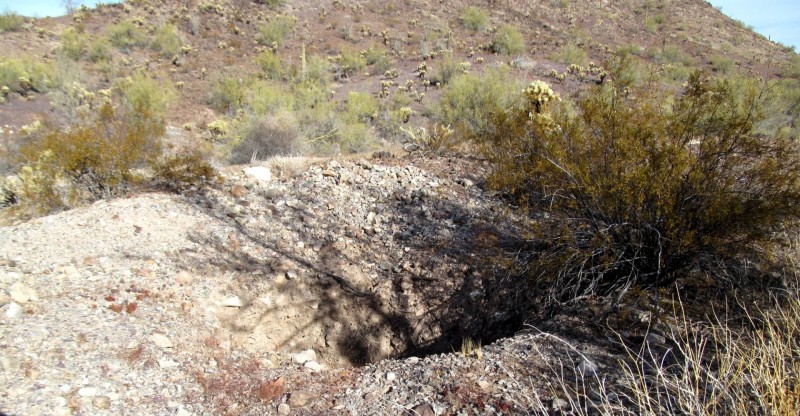
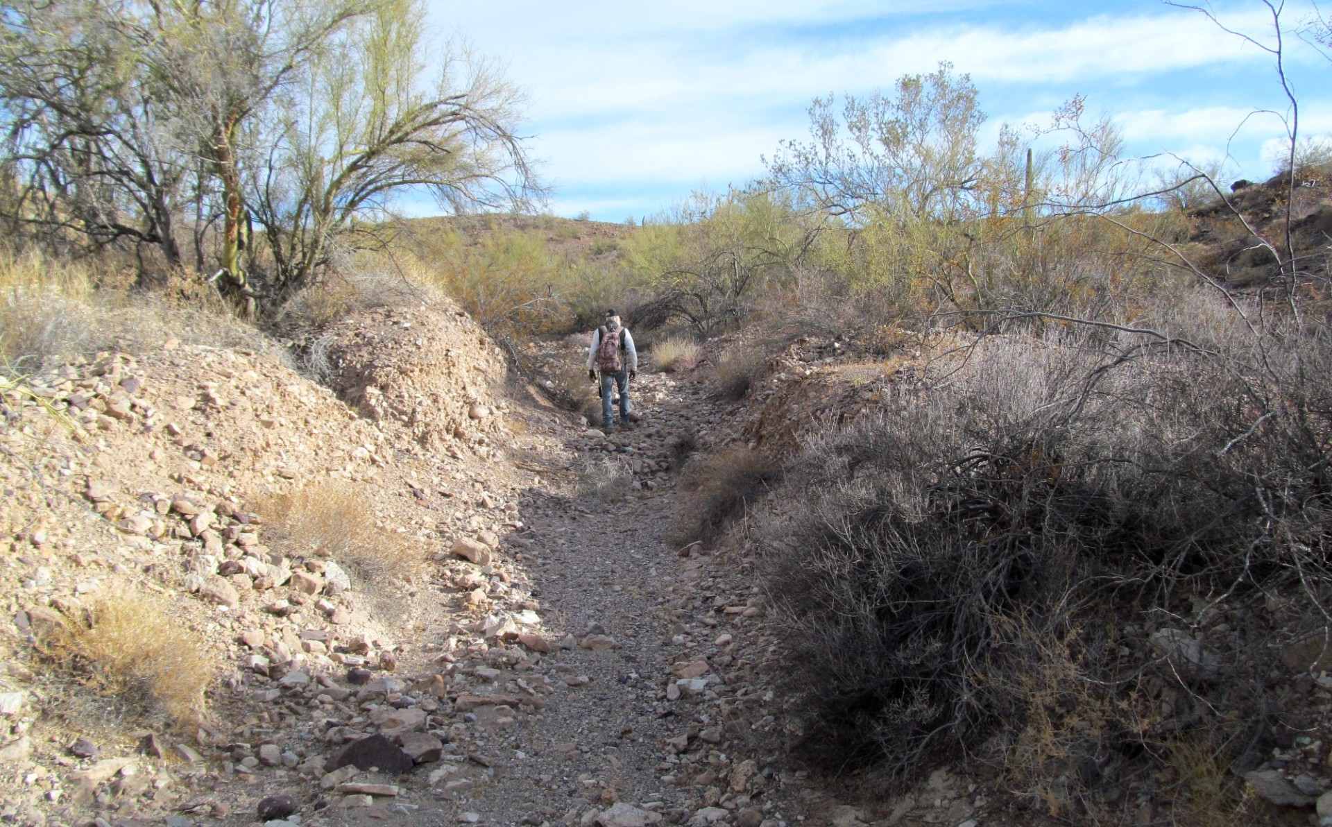
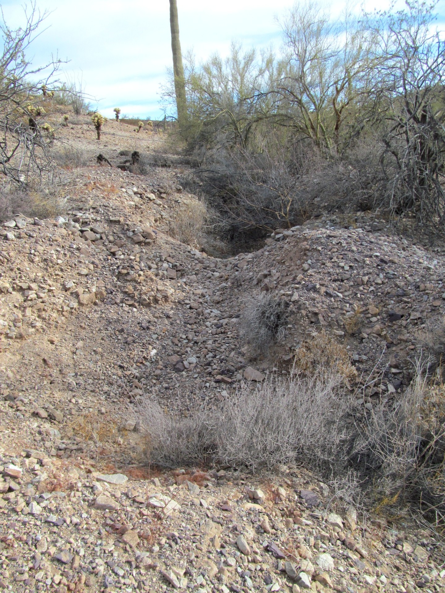
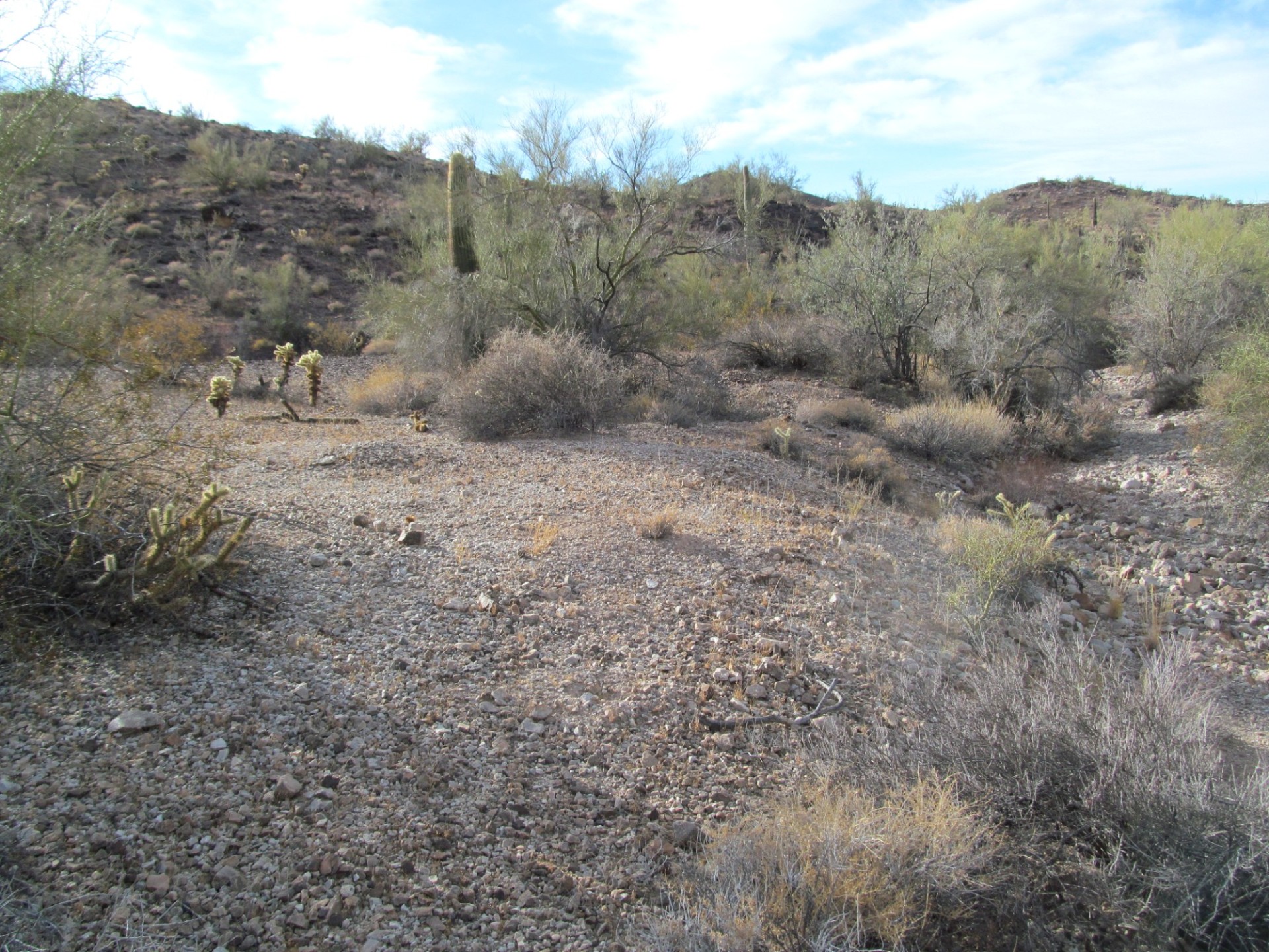
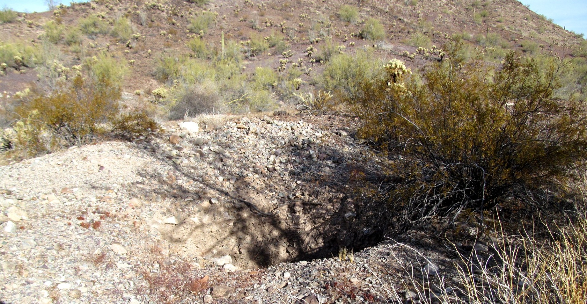
We took a day off from detecting and went out rockhounding for a day and came across these old workings , the old timers dug some deep cuts across the toes off some of the hills that ran down into the wash and found a couple small drift holes. the holes are about 10 foot deep with a couple small drift holes in each and the longest cut was around 50 to 60 yards long. there were dry washing holes that were just as deep and some were over 12 foot wide, some serious digging going on out there .


-
I was out at a creek in central Illinois where I had map dowsed for gold . We got a few specks of color but hours of hard work for not much yellow. Then I noticed blue clay lumps in the creek gravels , looked around for the source, and eyeballed the upstream creek bank wall. It was a VEIN of blue clay like 200 feet by 15 feet up the wall from the creek. I tried to pan some out after working it for 10 minutes in my gold pan. No Gold. Other spots in Indiana that have blue clay, it is loaded with gold, altho the gold rich blue clay is usually under creek gravels, not in a vertical wall. On Treasurenet, they say blue clay gummed up sluices in Nevada was it? Somebody had it assayed and found it was rich in silver which also gives it the bluish color supposedly? Should I go back to the spot and get some samples to send in for mineral assays? How much clay per sample, ounces, pounds? Where is a good assayer for not too much green? Thanks, -Tom V, now in central Indiana gold country and retired early...out of the rat race finally
-
Who do you know that has ever considered mining in Korea or a 'Korean Gold Rush' of a sort? The thought had never occurred to me until I read this brief article and then did a bit of research to find more links. I doubt there are any articles on nugget shooting in Korea. http://www.koreatimes.co.kr/www/opinion/2020/11/721_300053.html https://nanopdf.com/download/a-glimpse-of-life-at-the-gold-mines-royal-asiatic-society_pdf https://steemit.com/korea1960/@coped/gold-mining-in-south-korea-koryo-mines-part-1
-
 It was streaks of black sand on the beach. I hunted in the water with the Equinox 800 in Gold 1. I didn't dig any deep targets. The scoop would have black sand go across regular sand when I would shake the scoop. Everywhere I hunt is very mild. I don't know if this is affecting the depth here or not. My other beach waters would ground balance 0. This one was 14. The Gold Kruzer mineral was bouncing 2 - 3 bars. That's not to bad. I ran a super magnet thru the sand on the beach. Is this a lot of black sand on the magnet or not? I have seen sold black sand beaches in the upper peninsula of Michigan. They mine a lot iron in the UP.
-
I have been searching for a quartz reef for 3 years in this area and I found it. 1200mm wide ,and goes for 5 meters on top covered in moss,it's on a side of a ridge that was formed on a fault ,pushed up. the area is also covered in loose quartz rocks ,some the size of a football. white,yellow and rusty. I have been using a minelab 5000 in the area for a year. only found silver/lead nuggets and a hundred bullets .No gold. my experience with a detector and prospecting is a beginner. within a 6 kilometer radius of this spot are 5 gold mines ,2 working . old iron ore mine, old lead mine,and a old diamond mine. excited ,I run the detector over the reef and near area for 3 days and got no signals.Zero hits.not even a bullet. complete nothing. cheers Paul
.thumb.jpg.3d1d77e76d490803d6ec8e51cdaaaafe.jpg)
.thumb.jpg.83e2ca803c8fb2b0dd7567c07e342fa7.jpg)
-
hi guys and gals i have been interested in gold for years but so far no luck have read heaps of books ect dont need x marks the spot but some advice on how you guys have found your bits and bobs im hoping to retire next year and chase some gold up at talbot in victoria an old friend has just bought a home there thanking you all happy hunting
-
Most of us don't have a geology degree but it would probably help when we are out detecting and doing research. Geology has a language laced with time periods that I've never taken the time to learn so this is going to be a ramble. This is a chart which can help us to know history and geology and place the events which formed our detecting areas into the puzzle. We can then use plate tectonics to help us know how our region got to where it is today and understand the mountains and folds in the earth's crust. How do we tell the difference between geologic ages? http://www.stratigraphy.org/index.php/ics-chart-timescale One article I read said: On Earth, gold finally reached us some 200 million years after the formation of the planet when meteorites packed with gold and other metals bombarded its surface. During the formation of Earth, molten iron sank to its centre to make the core. This took with it the vast majority of the planet’s precious metals — such as gold and platinum. In fact, there are enough precious metals in the core to cover the entire surface of Earth with a four-metre thick layer. https://www.zmescience.com/science/how-gold-is-made-science-064654/ And then came the plates! Tectonic Plates’ Patterns Revealed https://www.livescience.com/38819-plate-tectonics-patterns.html Can someone that knows this stuff make it more simple? haha I mean where did the gold in Arizona, Nevada, California, Australia and New Zealand come from in a geological time frame (the beginning we know from the star or stars) and then the weathering has come into play. I guess every local Mining College has people working on that so that professional miners are more successful than the rest of us. Clay, are you reading this? The topic is too big so old timers learned from each other and passed along their knowledge of specific deposits and veins. The USGS and satellite imagery are probably now the tools in use and maybe we as detectorists could get a drone? Mitchel
-
 Worth the watch, good information for you Detector Prospectors! Lesson 1 - Where Does Gold Come From? Lesson 2 - How To Find Lode Gold Deposits
 -
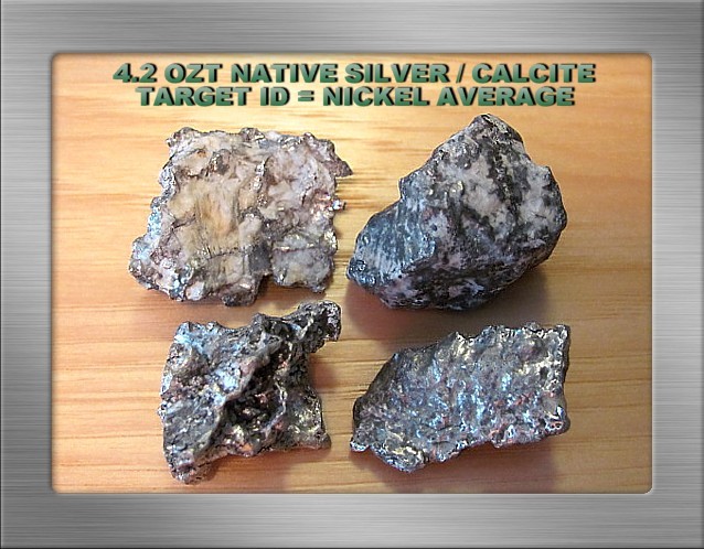
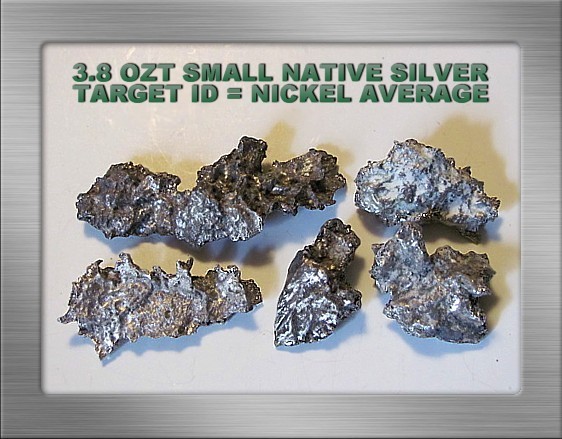
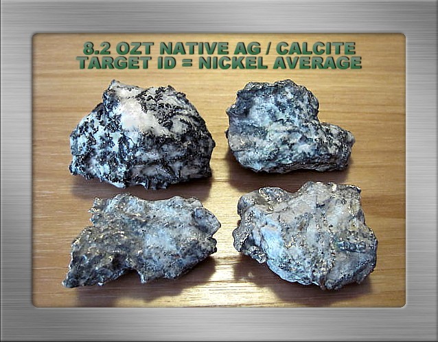
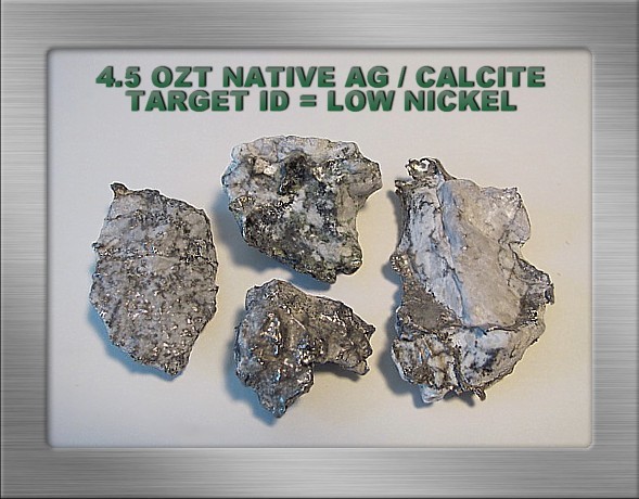
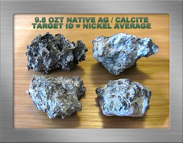
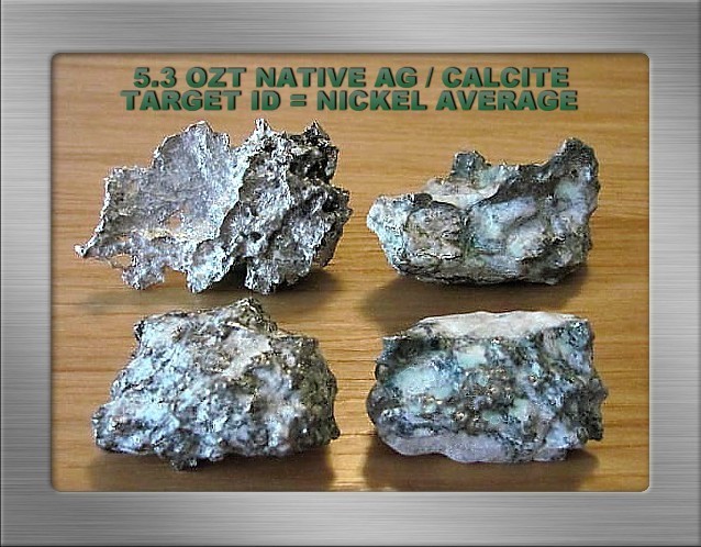
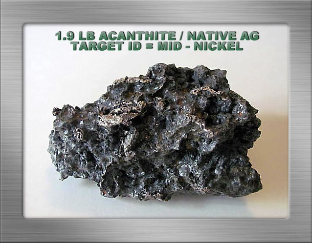
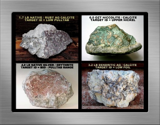
 Collecting Native Silver & Related Minerals in Northeastern Ontario’s Silverfields Introduction… I’ve been cleaning and photographing some small native silver specimens that were found with a metal detector during my last few rockhounding visits to the silverfields of northeastern Ontario. They are commonplace examples of small silver that hobbyists can anticipate recovering from the tailing disposal areas of abandoned minesites, ranging in size from one-half to several troy ounces. The information and silver photos presented below may interest newcomers to the fascinating hobby of rock, gem and mineral collecting, particularly for those who have reasonable access to collecting sites for native silver and associated minerals such as the example displayed below. It is comprised primarily of rich, dendritic acanthite with some minor inclusions of native silver visible on the surface. Searching for Small Silver… When selecting an appropriate prospecting-capable metal detector for this application, consider the field conditions where you will be operating it. A large portion of your time will involve searching abandoned minesite tailing disposal areas because these sites offer you the best opportunity to find native silver and related minerals. (a) At many sites ferromagnetic susceptible substrates can be characterized as ranging from light to moderate, and will have little effect on a VLF detector’s ability to function effectively. But some areas, for example diabase dominant substrates, exhibit more elevated magnetic susceptibilities that to some extent will reduce a VLF metal detector’s detection depth and sensitivity, target ID accuracy, and discrimination reliability. The effects of harsh ground mineralization can be somewhat mitigated by operating a VLF metal detector in a true motion all-metal mode to maximize detection depth and sensitivity to targets. A smaller / DD coil will reduce the ground mineral footprint scanned by the detector, permitting the use of higher gain / sensitivity levels than would otherwise be possible. Regardless of target ID or the absence of it, ensure that all weak signals are investigated until the source is identified. An obvious alternative strategy to improve detection depth is to use a suitable PI detector for searching more difficult ferromagnetic ground mineral areas. A more recent Minelab PI model will ensure the best possible detection depth over such ground. (b) Consider the most frequent size of the silver you can expect to find with a metal detector. The small silver depicted in the accompanying photos is representative, and as noted above, range from about one-half to several troy ounces. They are typically larger coin-size targets detectable to very good depths, but keep in mind when choosing a suitable prospecting-capable VLF detector that most small silver is low conductive, and on average is characterized by a nickel target ID. (c) In some areas conductive pyrrhotite hotrocks are a real nuisance to both VLF and to PI detectors. Abundant pyrrhotite can render specific sites unsuitable for metal detecting. Target ID ranges from iron to low foil, with most pyrrhotite signals eliminated by upper iron range discrimination. My PI units, the Garrett Infinium and White’s TDI Pro, both generate enticing low conductive signals to solidly structured pyrrhotite, and similar to small, low conductive native silver, pyrrhotite PI signals must be dug. (d) Mining country, and abandoned mining camps in particular, are littered with iron trash of all sizes and description. Small, low conductive iron signals can be eliminated with suitable VLF iron range discrimination, but most non-descript small iron produces low conductive signals from my PI units. Similar to pyrrhotite, our PI units cannot reliably distinguish low conductive silver from low conductive ferrous trash. All low conductive PI signals therefore must be dug, and to do so is prudent fieldcraft regardless which PI brand or model is utilized for this detector-prospecting application. Incidentally, the same observation largely applies to VLF target ID reliability over deeper, weak target signals in more difficult ferromagnetic substrate conditions. Such signals tend to produce questionable readouts that either frequent or reside within the iron target ID range. To have any confidence in VLF target ID, it is necessary to remove surface material from deeper target signals until a reasonably strong VLF detection signal can be obtained. If any doubt about target ID remains, dig it to be absolutely certain of its identity. By comparison to low conductive iron, big compact iron such as larger drill bits and milling balls, and sizeable elongated iron such as broken pipes and implements, rail spikes, and drill rods tend to VLF target ID in the non-ferrous range. My PI units produce high conductive signals to large compact iron. A similar response, usually a double low-high or single low-high-low signal, is produced as the coil is swept lengthwise on elongated iron, whereas low conductive signals are normally produced when the coil is swept across the length of such targets. With native silver’s variable conductive potential (variations in size, shape, purity, structure) quite capable of producing both high and low conductive PI signals, the foregoing explains why all PI signals should be identified. While a large portion of our fieldwork in the northeastern Ontario silverfields is more suitably addressed with VLF units, we frequently use a ground-balancing PI unit for general scanning over tough ferromagnetic substrates where ferrous trash levels are tolerable. In these conditions we employ larger coils to improve detection depth over what VLF units can achieve. Additionally, our PI units eliminate or reduce most non-conductive iron-mineralized hotrock signals in the area. Such signals can be a particular nuisance when searching diabase dominant substrates with a VLF unit. Our VLF preference is to use mid-operating frequency range detectors for this application. Mid-frequency units respond reasonably well to both high and low conductive silver, and to weaker signals produced by low conductive particulate and sponge silver. By comparison to high frequency units such as my Goldbug2 for example, they are less vulnerable to elevated ferromagnetic mineralizations, and see both higher conductive targets and larger targets at better depths. Incidentally, low operating frequency units work reasonably well, but are less sensitive to low conductives. We operate both the mid-frequency White’s MXT and Fisher F75 for motion all-metal mode close-up scanning involved with removing surface material from hillslopes, trenching, sinking testholes, and for detecting excessively trashy areas requiring a discrimination mode, but there are other perfectly acceptable detectors that will perform well at these tasks. Your detector choice ideally should feature a target ID in a threshold-based motion all-metal mode, a discrimination mode, include a manually adjustable full range ground balance, a “fastgrab” ground balance for convenience and to assist with target signal evaluation, and a selection of searchcoil types and sizes. Which type of metal detector is best suited for this application? We operate the PI and VLF units described above to deal with variable field conditions and objectives, but the VLFs do much of the fieldwork here. Newcomers should begin with a VLF unit that incorporates the features outlined above as a minimum. You may wish to supplement your stock coil with larger and smaller coils to increase your versatility in the field. Once you have gained some field experience with the conditions as described above, and generally have learned more about collecting silver minerals, you can make a more informed decision as to whether acquiring a suitable prospecting-capable PI unit is a viable choice to satisfy your objectives in the field. Where to Look for Silver & Other Minerals… As a general principle regardless of the type of minerals one seeks, successful collecting invariably depends on knowing where to look and a willingness to do serious pick and shovel work. Surprisingly detailed information about where to search for many minerals is readily available online to hobby newcomers, with many collecting sites readily accessible by personal vehicle. On occasion, more remote sites or identified prospects will typically require a short hike. For example, extensive information about abandoned gold and silver mines can be accessed online, and many current government publications are available to interested hobbyists. My personal favorites include a series entitled Rocks and Minerals for the Collector authored by Ann P. Sabrina, in association with the Geological Survey of Canada. These publications supply practical, useful information pertaining to abandoned minesites throughout Canada. They provide road guides to accessible collecting locations, a brief history of a site’s mining operations, normally include production numbers for more prominent minerals such as cobalt, lead, zinc, nickel, copper, silver and gold, and usually provide a comprehensive list of mineral occurrences for each site. For casual or recreational prospecting enthusiasts visiting this area with limited time to search for silver ores and nuggets, select abandoned sites that will more likely produce detectable native silver based on past production numbers. You can detect these sites with the certain knowledge that highgrade silver was inadvertently discarded to the tailing disposal and nearby areas, sometimes in considerable quantity. The probability of successfully recovering specimen grade silver is sharply improved compared to searching for outback silver float, obscure prospects, or low production sites. To improve the likelihood of finding silver, try to identify areas where valuable silver was handled and transported. For example, look for evidence of surface veins, shafts, and storage areas where silver was graded, moved, and sometimes inadvertently misplaced. There are many plainly visible field indications of former mine buildings, mill sites, ore transport routes and abandoned trails. While quantities of silver were frequently discarded to tailing disposal areas, keep in mind that some highgrade silver was unknowingly included with waste rock for road and other construction projects. Hobbyists have also detected large specimen grade silver that was occasionally lost to spills on steep embankments, washouts, or sharp bends along the transport routes of the time. Incidentally, we occasionally see examples of careless or halfhearted retrieval techniques when only a few more inches of digging in tough ground would have unearthed quality silver that produced unmistakably solid, tight non-ferrous target signals that could not be mistaken for iron trash. A general suggestion to newcomers is to be thorough in all aspects of your fieldwork, examine abandoned digsites, and dig all questionable target signals until the target is identified. Briefly About Acanthite… As a related but slight diversion from the topic of searching for small native silver, depicted below is a small but massively structured example of acanthite / native silver recovered from the Kerr Lake area of northeastern Ontario. While selecting some reasonably photogenic small silver examples, I decided to include it here because valuable acanthite https://www.minfind.com/minsearch-10.html recoveries are a rather infrequent occurrence in my personal experience and therefore welcome additions to my collection. After some 30+ prospecting seasons, I’ve never detected acanthite as a stand-alone mineral. My acanthite finds have always contained some detectable native silver. For those unfamiliar with this mineral, acanthite is a dark silver sulfide (Ag2S) approximately comprised of 87% silver and 13% sulfur. Smithsonian Rocks & Minerals describe it as the most important ore of silver. Much of the world’s current silver demand is satisfied as a by-product from the refining of argentiferous (silver-bearing) galena. Galena, a lead sulfide, generally contains some small (< 1%) amount of silver in the form of microscopic acanthite inclusions as an impurity. Acanthite is occasionally misidentified as argentite by hobbyists, but the correct mineral classification when referring to silver sulfide (Ag2S) at room temperatures is acanthite. Both these silver minerals possess the same chemistry but different crystalline structures. Argentite forms in the cubic (aka isometric) system at temperatures above 177 degrees Centigrade (temperature slightly varies according to reference source). Below that temperature acanthite is the stable form of silver sulfide, and crystallizes in the monoclinic system (Smithsonian Rocks & Minerals 2012 American Edition, Eyewitness Rocks & Minerals 1992 American Edition, Wikipedia). The transformation of argentite to acanthite at lower temperatures often distorts the crystals to unrecognizable shapes, but some retain an overall cubic crystalline shape. Such crystals are called pseudomorphs (false shapes) because they are actually acanthite crystals in the shape of argentite crystals. Acanthite crystals frequently group together to form attractive dendritic (branching) structures embedded in light-hued carbonate rocks that range from rather intricate to massive. In the field, try to be visually alert to darker (typically sooty-black) acanthite that may be exposed while digging targets, trenching, or by chance encounters with recently exposed material. For example, the local township occasionally removes tons of tailings for road and other construction projects, resulting in fresh new surfaces for hobbyists to explore. Prominent Minerals Associated with Native Silver… Native silver, acanthite, pyrargyrite and proustite ruby silvers, stephanite, and other collectable silver minerals primarily occur in carbonate veins in association with gangue minerals such as quartz, chlorite, fluorite, barite, albite, hematite, magnetite and many other minerals related to relatively shallow epithermal deposits. Attractively structured native silver embedded in light-hued carbonates, or for example in association with other silver minerals such as acanthite and proustite, is highly valued by the mineral collecting community. For newcomers incidentally, structure refers to how the silver is formed, examples include massive or nuggety formations, plate, disseminate or particulate, sponge, highly crystalline, and various dendritic or branching patterns as illustrated by the native silver example in the multi-photo below. The native silver in this area is intimately associated with major cobalt-nickel arsenide deposits that include notables or collectibles such as safflorite, cobaltite, nickeline, and skutterudite. A number of these ores, typically arsenides and sulfides, produce perfectly good signals from VLF metal detectors. Solidly structured nickeline (aka niccolite), a nickel arsenide, is a fine example that can generate strong signals from both VLF and PI metal detectors. Moreover, it is not unusual for rockhounders to find surface examples of nickeline with its copper-green surface oxidation annabergite, and cobaltite displaying its pink-to-more infrequent reddish surface oxidation erythrite as depicted below. A wide variety of additional minerals can be collected from the mine dumps. These include more localized occurrences, for example, allargentum (silver antimonide), titanite (wedge-shaped, vitreous calcium titanium silicate formerly called sphene), native bismuth, chrysotile serpentine (asbestos), rutile (titanium oxide) and breithauptite (nickel antimonide), to more commonplace minerals such as sphalerite, arsenopyrite, chalcopyrite, bornite, galena, marcasite, iron pyrite, and so forth. A Final Word… In closing we should point out to interested readers that there has been a resurgence in active exploration for both diamonds and cobaltite minerals in the northeastern Ontario silverfields. The existence of diamonds has been widely known for years, and historically there has been a strong industrial demand for cobaltite for hardening steels and other alloys, paint, ceramic, and glass pigmentation, and in other various chemical manufacturing processes. Apparently now there is increased interest in cobaltite for the manufacture of batteries. Industrial demand notwithstanding, for many years cobaltite has also attracted hobbyists interested in recovering valuable crystals. I hope that both experienced mineral collectors and hobby newcomers have enjoyed reading about native silver and a few of the more prominent associated minerals in this area. Thanks for spending some time here, good luck with your rock and mineral collecting adventures, perhaps one day it will be our good luck to meet you in the field. Jim Hemmingway, October, 2019
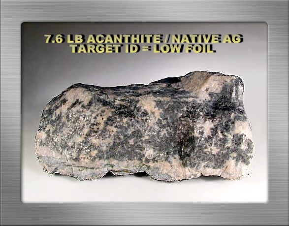
-
I was hiking in an area in central Indiana not really known for hotrocks. I went to check a creek island out for kicks and found out it is covered with rusty red rocks, and purple and pink rocks.The island is roughly 100 feet long and 20 feet wide and 4 feet high above the fast moving creek.It is jam packed with these rusty red rocks. Downstream is all a sheet of bedrock and small gravels and NONE of these rusty red rocks. I was told I could not pan, not so sure about detecting unless maybe my Falcon Gold Probe? How does one use this detector to check for ferrous and non- ferrous rocks exactly? I need to get some small gravels/dirt maybe and pan offsite. So, why is this island , or my so called Hot Rock island , like this? We usually only find red hematites and black sands and white gravels in Indiana creeks and not very many of them. But gold is usually found where the red stones are at and chunky black sands. -Tom V.
-
“Robert Louis Desmarais is the only inhabitant of a Californian ghost town, Cerro Gordo, where he has been searching for a lost vein of silver for 22 years. A 70-year-old former high school teacher, Desmarais used to visit the remote spot in the school holidays to search for ore. But he eventually moved there full-time, to live away from the crowds "up in the mountains, under the stars". Cerro Gordo (Fat Hill in Spanish) was once the most fruitful silver mine in California. "It helped to build Los Angeles," Desmarais says. Convinced there is plenty of silver left, he descends 800ft with a chisel and hammer to "crack rocks and see what's behind them".” More story and photos at https://www.bbc.com/news/stories-49084230
-
 I’m curious to how you all see the mineralization of the soils you detect compared to other locations. Our soil here in central Arizona seems to be fairly mineralized. But, we haven’t been detecting anywhere out of state to let us effectively compare. Here’s a USGS map showing relative iron concentration in US soils. There appears to be heavy iron concentrations in the Pacific Northwest. Does this reflect your experience on the ground? If so, has this affected what you choose to swing? If not, how do you think your soil compares to elsewhere? us iron concentrations.pdf


.thumb.jpg.008984156b596a0063f90b0d7fbc295b.jpg)
.png.8da0c4be428fd2d447b8268dff9af308.png)


.jpg.49f177afe23451727153f051843ec520.jpg)
.jpg.4abdb99d4f7a44a2f51181e9ff23fd73.jpg)
