Jump to content

Research Goes Beyond Google Earth.. Bulldog Diggings


Recommended Posts

Karelian back in 1979-8o there were no gold maps available in Victoria except those that you had to research your self in Melbourne (100 miles/160 Km away) and no Google Earth either we had to get Aerial Photos to see the area (to pick out the surface patches). GPS systems came available to the public about 1983/4  I got my first GPS in 1990 it was slow poor reception in the bush but they got better and about 2000 they got rid of the 100 yard degrading of the signal. By 2003 I had time to download every state of Aust. and was able to filter their records for historical Gold Mines. I kept these to myself till 2010 and made them available to members on a gold forum for free. Some opportunist copied them and tried to sell them $50 a state on other forums but other member directed them to my free post. I set the data up, so it could be used with google earth and most map programs and GPS. Using Google Earth you can get views like yours above of all Historical Gold Mines in each state that the Mine department made available.

If you are interest in these historical location try this link.

.....LINK.....

  • Like 1
Link to comment
Share on other sites


Great link, thanks. I'm doing more research because the area, among others; is of great interest. Lucky that there is such a wealth of information out there. Thanks.

Screenshot_2020-12-07 Victorian Heritage Database.png

  • Like 1
Link to comment
Share on other sites

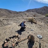
Just looking at the images of the ground, I'm thinking the White's GMX Sport would be ideal for running a coil over some of the cracks in the bedrock. If there are examples of conglomerate and quartz still embedded in bedrock then there could be a few small specs for me to find.  Yes I take images of rocks... All the best.

gravel cement.jpg

IMG_0073 (2).JPG

IMG_0092 (2).JPG

  • Like 2
Link to comment
Share on other sites

On 12/7/2020 at 6:14 PM, geof_junk said:

Karelian back in 1979-8o there were no gold maps available in Victoria except those that you had to research your self in Melbourne (100 miles/160 Km away) and no Google Earth either we had to get Aerial Photos to see the area (to pick out the surface patches). GPS systems came available to the public about 1983/4  I got my first GPS in 1990 it was slow poor reception in the bush but they got better and about 2000 they got rid of the 100 yard degrading of the signal. By 2003 I had time to download every state of Aust. and was able to filter their records for historical Gold Mines. I kept these to myself till 2010 and made them available to members on a gold forum for free. Some opportunist copied them and tried to sell them $50 a state on other forums but other member directed them to my free post. I set the data up, so it could be used with google earth and most map programs and GPS. Using Google Earth you can get views like yours above of all Historical Gold Mines in each state that the Mine department made available.

If you are interest in these historical location try this link.

.....LINK.....

I have had this for many many years,awesome collection of data,a job well done mate

  • Thanks 1
Link to comment
Share on other sites

Create an account or sign in to comment

You need to be a member in order to leave a comment

Create an account

Sign up for a new account in our community. It's easy!

Register a new account

Sign in

Already have an account? Sign in here.

Sign In Now
×
×
  • Create New...