Jump to content

Ambient Noise Temography.


Recommended Posts

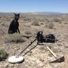
I’ve seen the more typical geosurveys used for mapping faults and exploration of oil and gas using thumper trucks or a dead weight along with a long string of geophones with them (vibration sensors strung along a long line across the ground to pick up the vibrations), but I was not aware of the more passive technique called Ambient Noise Temography (ANT) surveys. I just saw an ad here on DP about it from this company- it’s pretty interesting what they are doing and legit too- it’s not a gold spear or anything like that, but probably many times more expensive than those as well because it depends on you using several of these sensors.

ANT surveys use a grid of sensors that measure ambient Earth motions like local disturbances form humans like trains and trucks, and ocean waves hitting the coast many miles away to measure and map underground geological features they say over 2km deep.  It’s pretty cool technology that mining companies are using.

For a deeper review of it (skip the 1st minute):


  • Like 2
Link to comment
Share on other sites


Interesting. This is similar to the large scale conductive ore body detector I proposed a while back using existing ULF/ELF submarine and other ambient low frequency transmitter frequencies out there.

An idea I've had for over a decade and had every electronics/detector techie sort I've told this to tell me it was not possible. 😅

  • Like 1
  • Sad 1
Link to comment
Share on other sites

I'm curious how they can use random noise, at unkown distances, to determine anything. I can see how known power going into the ground, at a known point, being used however. I also see how measuring the ambient soil voltage could indicate a conductive ground anomaly.

Jim

Link to comment
Share on other sites

Multiple papers online regarding west coast major faults systems, found one paper with both vertical & horizontal cross sections. Appears a major array is in place over Nevada and the southeastern Sierra Walker Lane. The cross section imagines are color coded I assumed based on bedrock density. Some impressive depths. 

  • Like 2
Link to comment
Share on other sites

4 hours ago, Jim in Idaho said:

I'm curious how they can use random noise, at unkown distances, to determine anything. I can see how known power going into the ground, at a known point, being used however. I also see how measuring the ambient soil voltage could indicate a conductive ground anomaly.

Jim

Their system is scanning multiple frequencies, but not only that it’s also looking at patterns at each frequency, so I think it can identify individual types of vibrations by that and follow it as it traverses through the landscape. It’s using timing to determine how dense the material is that those pulses or vibrations are traveling through along the array. Anywhere the signal slows down would indicate a change in density of the ground at that point. They can determine depth by the distance between the sensors as well.  I think it’s pretty cool technology, and the resulting maps are interesting.

Of course it doesn’t replace groundwork, someone has to go out there and identify what the different density materials are and if they’re worth digging up.

  • Like 1
Link to comment
Share on other sites

6 hours ago, jasong said:

Interesting. This is similar to the large scale conductive ore body detector I proposed a while back using existing ULF/ELF submarine and other ambient low frequency transmitter frequencies out there.

An idea I've had for over a decade and had every electronics/detector techie sort I've told this to tell me it was not possible. 😅

Should’ve, would’ve, could’ve patented your idea!  Curious- have you delved into soil resistance mapping yet? It seems like a pretty cool technology as well.

Link to comment
Share on other sites

9 hours ago, GotAU? said:

Their system is scanning multiple frequencies, but not only that it’s also looking at patterns at each frequency, so I think it can identify individual types of vibrations by that and follow it as it traverses through the landscape. It’s using timing to determine how dense the material is that those pulses or vibrations are traveling through along the array. Anywhere the signal slows down would indicate a change in density of the ground at that point. They can determine depth by the distance between the sensors as well.  I think it’s pretty cool technology, and the resulting maps are interesting.

Of course it doesn’t replace groundwork, someone has to go out there and identify what the different density materials are and if they’re worth digging up.

I can see how that would work, assuming lots of sensors over a wide area. But seems to me it would lack  much resolution. It's interesting, but probably has a long way to go. Might be pretty good for really large deposits.

Jim

Link to comment
Share on other sites

These sorts of ideas are for large scale prospecting - ore body scale.

  • Like 1
Link to comment
Share on other sites

16 hours ago, Jim in Idaho said:

I'm curious how they can use random noise, at unkown distances, to determine anything. I can see how known power going into the ground, at a known point, being used however. I also see how measuring the ambient soil voltage could indicate a conductive ground anomaly.

Jim

If you measure the noise signals at a set reference point as a baseline then you do have a known reference frame. Then you measure how the signal changes at different points of interest around the baseline to see how the environment affects it. Wether you generate/transmit that signal or you use an existing ambient signal, it's still a usable signal. 

A similar concept already exists that can see through walls using ambient wifi RF.  

Similarly, you could use tectonic movements from half the planet away as stimuli for seismic refraction measurements (depth to bedrock measurements, formation layers, etc). Essentially taking the place of the stimulus from a thumper truck, dynamite, a sledgehammer, etc. Problem being these events are not happening constant enough to depend on alone or to be highly useful. Technically you'd just need to look at how the signal changes across many measurements/locations though to generate some useful information about underlying geology, I'm not sure a baseline would even be required to get useful data, as the reflection/refraction times themselves just need to be measured relative to the time of the initial impulse (thump) rather than magnitudes, but dunno. Not totally unlike the way GPS works, in a way, except listening for "echos" of reflectance/refraction relative to the time of arrival of the initial impulse.

Extrapolate from that and you could also use blasts from nearby quarries, or other ambient noise. Going further, you can move from the sonic spectrum into the EM noise spectrum, especially very low frequencies, and you can penetrate some distance into the ground and get info from those as well. These signals are more common. All of them combined I imagine is closer to whatever this company is measuring - to get a wider frequency range picture and to ensure there are at least some elements of some frequencies present wherever in the world they deploy. 

  • Like 1
Link to comment
Share on other sites

11 hours ago, GotAU? said:

Should’ve, would’ve, could’ve patented your idea!  Curious- have you delved into soil resistance mapping yet? It seems like a pretty cool technology as well.

Not me, but Jim has. 🙂

Separately, a company I sold a project to did some resistivity surveys with a professional contractor. That contractor ended up unfortunately lighting a part of the mountain face on fire in doing so a few years back! 

  • Haha 2
  • Oh my! 1
Link to comment
Share on other sites

Create an account or sign in to comment

You need to be a member in order to leave a comment

Create an account

Sign up for a new account in our community. It's easy!

Register a new account

Sign in

Already have an account? Sign in here.

Sign In Now
×
×
  • Create New...