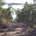
Steve Herschbach Posted December 10, 2015 Share Posted December 10, 2015 I wish they had been a bit more adventurous with distance from base camp with this but it gives at least an idea of the possibilities.... Link to comment Share on other sites More sharing options...
Mugsy Posted December 11, 2015 Share Posted December 11, 2015 I love the idea, been seriouly thinking about one myself. Anyone have any suggestions as which one to buy, there seems to be so many out there to choose from. Thanks Link to comment Share on other sites More sharing options...
Steve Herschbach Posted December 11, 2015 Author Share Posted December 11, 2015 Possible answer to your question Keith at http://www.detectorprospector.com/forum/topic/1164-drones/ Link to comment Share on other sites More sharing options...
indianbullet Posted December 11, 2015 Share Posted December 11, 2015 Pretty cool, I've had one on the wish list for some time. I read quite a few horror stories about folks buying a $1200 unit and having it get a mind of its own and disappear never to be seen again. I believe they have limits built into the gps systems to keep them in range and prevent that from happening now? Need to learn more about them for sure. Link to comment Share on other sites More sharing options...
Hard Prospector Posted December 11, 2015 Share Posted December 11, 2015 A buddy of mine was out detecting in a steep wash near Yuma last month when he noticed he was being followed by one of those things only 30 to 50 'from above and behind him. He pulled his Taurus Judge from its holster and took aim.......it hauled ass outta there never to be seen again Link to comment Share on other sites More sharing options...
tvanwho Posted December 11, 2015 Share Posted December 11, 2015 The under $200 ones I see only have a range of 150 feet which seems about useless to me? I'd want at least 500 feet range altho you would only see a speck in the distance and have no idea whether it is coming or going? I'd also want to be able to view the drones camera picture from the transmitter or large cell phone or tablet, vs an SD card after the fact. I like the idea of a pilots eye view while flying it plus a return home failsafe in case of loss of radio control. If you wanted to scope out a spot on private land, this might be the ticket, and no trespassing issues, unless it crashes on said property. Having one follow me up a desert wash would be pretty nerve rattling tho. Link to comment Share on other sites More sharing options...
Bada Bing Posted December 12, 2015 Share Posted December 12, 2015 I would like to hear from those using the stiching software to map an area. Any particular standout software? We are off the grid and have no internet access when out there so it would have to be a stand alone software. Any info appreciated Cheers BB Link to comment Share on other sites More sharing options...
jasong Posted December 12, 2015 Share Posted December 12, 2015 I used Agisoft Photoscan to stitch with, it's standalone, there might be better options now though. It worked better for me than Photoshop's stitcher which stumbled a lot in places like praries where there isn't much but gray ground and bushes and the photos look similar. It was a bit tough to learn though, in fact if I do another aerial survey I'd have to go back and read the tutorials myself again since its been a year or so. Also, if you use a GoPro or another camera with fisheye then you need to do a fisheye correction in Photoshop or similar before stitching if you want to geolocate the overlay and have it match up at all, or shoot in Narrow FOV which requires a lot more flight passes. The fisheye correction isn't perfect either and you generally lose your corners and parts of the edges due to distortion. Link to comment Share on other sites More sharing options...
evanpcrook Posted December 13, 2015 Share Posted December 13, 2015 Dji phantom 2 or 3 series I would recommended the 3 advanced ($900ish) with a android or apple phone/tablet you can easily set gps flights and it will takeoff and land itself. It also has the option of using mapping software that far surpasses google earth https://pix4d.com/mines-quarries/. You get around a 25 min flight time and in an open area around 1.2 miles of distance as the crow flies for live video. Though I flew one gps flight of over 4 miles in happy camp ca!! Link to comment Share on other sites More sharing options...
tvanwho Posted December 4, 2016 Share Posted December 4, 2016 American Made drone with gimbal mounted camera included ,25 minute flight time, GPS, Fly Home functions, controller shows you remaining battery life, and altitude,price is a measly $699 for the premium version with hard case to carry it in, 1.2 mile range, company located in Virginia,USA, their Customer Support is supposed to be top notch, Best Buy sells these drones but their price is 899 vs straight from the mfgr of 699 AND, the company has optional CRASH Damage insurance policies available Link to comment Share on other sites More sharing options...


Recommended Posts
Create an account or sign in to comment
You need to be a member in order to leave a comment
Create an account
Sign up for a new account in our community. It's easy!
Register a new accountSign in
Already have an account? Sign in here.
Sign In Now