Search the Community
Showing results for 'drone'.
-
Better fit it out with anti-drone tech. Paul, BB will have its image locked in his drones memory, once across the border...............
-
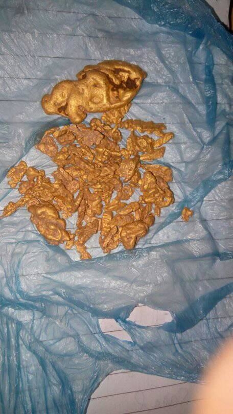
Hello everyone, I am new here to this forum. Recently my home town at my home country, prospectors started to discover Gold nuggets in large sizes at the surface without digging it, see the attached email The creek and valleys are so large that you can not cover by using a handheld detectors. I did some search and came across two other types. One is using a drone metal detector although the product is not out yet https://www.treasurehunter3d.com/dronerover and the other is long distance detectors upto 2km and 30 meters deep http://www.megalocators.com/en/ or http://www.imagelocators.com/index.php/component/virtuemart/long-range-locators/x-finder-gold-detector-long-range-locator-detail?Itemid=0 video is https://youtu.be/kv6EmzH34Ao I couldn't find review on the performance on the long range detectors, did any of you use it? or whether these are legit products that work? Thank you

-
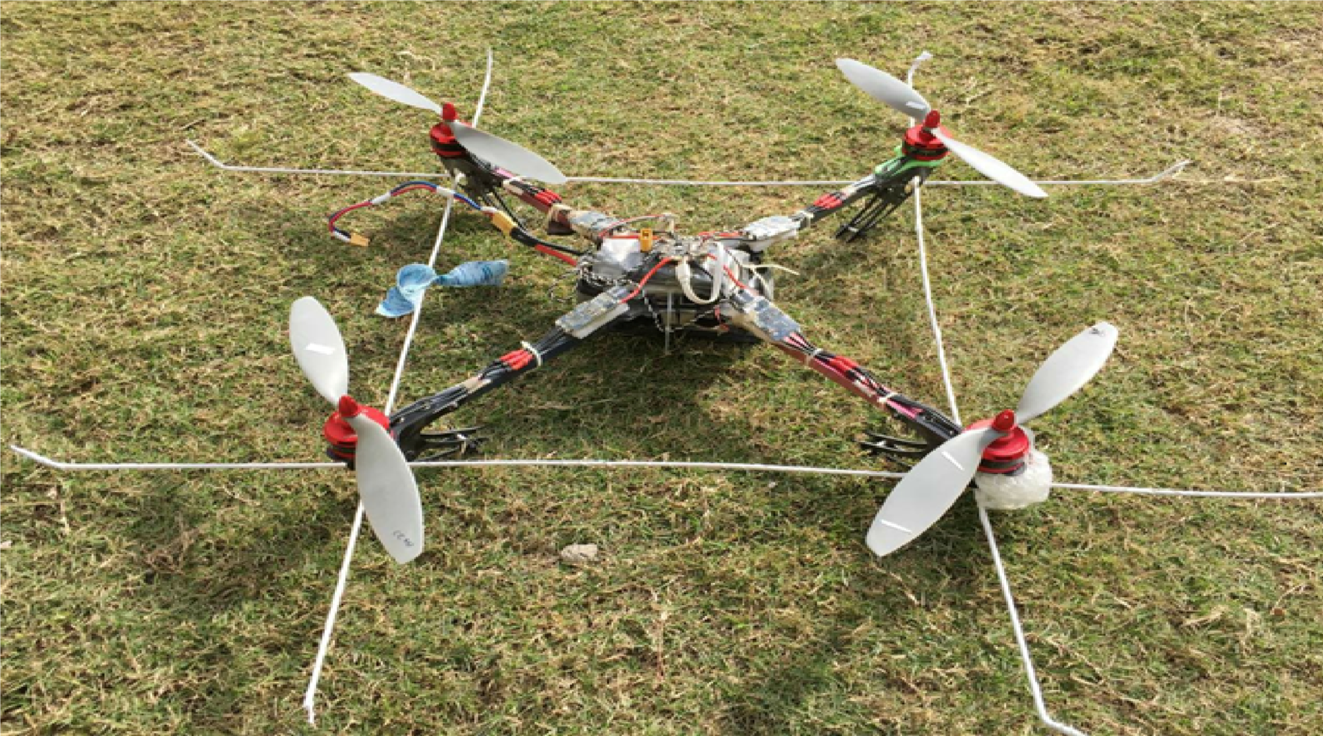
 HI everyone. i'm student of Electrical Engineering and in last year. Our group making final year project named as "Landmines detection using Drone". So far we have completed the Drone which have a payload of 1.5kg and a "Base Station" which will get the coordinates from Drone upon mine detection using its composite GPS module. Now we are stuck with Metal detector which will be less in weight and has more detection range. Please guide us which one will be suitable for us . Either from Pulse induction or EMI... If anyone has a design then please share with me. Thanks a lot..
-

Pulse Induction 0r Emi Metal Detector
RickUK replied to usama khurram's topic in Metal Detector Advice & Comparisons
In theory,this is a terrific project but has many many problems that you will come up against,weight issue is one of the biggest problems,also the depth capability of current detecting technology and that is the problem the depth,the way i am thinking you are looking to go with this project is fly a drone or what ever method you finally decide upon above a minefield and use the capabilities of the latest detecting technology. And that is the problem,even say Pulse of any other platform that is current available or in development 'wont' give you the depth that you are hankering after,as the depth is just not currently available,even if you look at say what is currently the deepest machine going and we think the GPX will fit the bill,then this is when the project falls apart again,as although the GPX or infact any other machine could be used,the capabilities of your drone just wont be able to not only lift it,but it would also hover nearly at ground level to get even a few inches depth.So hence this project would be dead in it current format. You can bet the big boys that have deep pockets in military defence and weaponry would be working on this type of project,but they have not only deep pocket possibly running into million rather than a project on say a $1000 budget but also develop the software needed even if its even feasible.Military Ariel drones that are used just for visual observations can of course be much smaller because of the advancement in camera size and hence this is why we see drones used for personal use as well as military exercises as well,the main draw back with your project is the weight and the depth of current detecting technology and that i feel just is not available at the moment,we have been stuck in a depth rut for years with hobby detecting. So although you have a stunning looking drone and some wonderful ideas on this project,i feel and excuse the pun i dont think this project will ever get 'off the ground',of course i hope i am wrong,but i try and look outside the box,possibly look at using the drone project for another military or peace time requirement or application......that i think could be the way forward with this project,even if the technology was available i doubt personally that anyone in there right mind would provide details free of charge anyway,as the possibility of a huge financial reward from these mine clearing devices could be skies the limit,but we are currently stuck with old technology of a human risking a life on clearing a mine field. Of course i wish you all the very best in the project,but its a very tough cookie to crack -
Pulse Induction 0r Emi Metal Detector
Mike Hillis replied to usama khurram's topic in Metal Detector Advice & Comparisons
Here is a link to a finished product of what you are attempting..... https://www.theverge.com/2016/7/19/12222104/landmine-detecting-drone-mine-kafon-drone I'd refer you to a google search of Land Mine detectors and mfg. See what the popular designs are. Then go to this group http://www.geotech1.com/forums/forum.php and see if anyone has the schematics available or something close that you can build to suit your vision. Best Regards, Mike -
Pulse Induction 0r Emi Metal Detector
Mike Hillis replied to usama khurram's topic in Metal Detector Advice & Comparisons
I see all kinds of issues with this but at the same time its a good project. I'd point you to look at real land mine detectors that exist today. Notice the loop size and how close they need to be swept over the ground. That fundamental will not change with your project. You will need to mount that loop on your drone and keep the search loop at that distance above the ground at all times. Second you will have to mount the search loop far enough away from your drone that the drone itself doesn't interfere with the electronic fields of the search loop. That in turn will affect your flying stability. Anyway....quite the project. Good luck. HH Mike -
Be aware if your out detecting and see one hovering over you. I was out with friends detecting and had a drone fly over and hover above us several weeks ago. The next weekend the exact spot had three people there detecting that hadn’t been there for months. Coincidence??
-

Pictures Of Battery Removed From Equinox
Chase Goldman replied to FlyFish's topic in Minelab Equinox Forum
I'll probably never have to worry about it because I'll have the drone-assisted Equinox 1800/personal assistant by the time the battery finally gives out. -

Can A Drone Be A Prospecting Tool?
SteelPhase replied to Reg Wilson's topic in Detector Prospector Forum
On the weekend I was in an area of pine plantations and detecting over where trees had been removed and the ground ripped by dozers. I flew the drone and could see colour changes of the soil (ironstone bands and old diggings that had been covered by pines). I then followed a gully which lead me to some diggings that I hadnt seen before and arent on maps. The drone is working out real well! On a side note, it was quite windy and I think if I had bought the Mavick instead of the Phantom 4, I would have struggled to fly it. -
Comparison Videos - This Versus That?
Mountain Mike replied to Steve Herschbach's topic in Minelab Equinox Forum
Maybe make some simple videos for the forum if you didn't want to do a full blown youtube. That way you can control the comments, usage, etc. Wouldn't have to be as finely edited either. OR you can get a couple gopros, drone, jeep, editing software, travel extensively, and a couple recurring characters and call yourself DR PROSPECTOR 24k -

Can A Drone Be A Prospecting Tool?
BeachHunter replied to Reg Wilson's topic in Detector Prospector Forum
I think it would be a great idea to use a Drone especially if you are going into wilderness areas, desert and other open areas. Or if you are going to be in an area for more than a few hours One thing Id sure wait until the price comes down. FAA rules say you cant fly them over 400 ft. In the USA.. -
Norvic, that Boeing drone would be sweet to mount a LIDAR under it, and build ultra detailed relief map of prospective ground. Google maps images of my area of interest just aren't good enough to identify paleo channels.
-
.thumb.jpg.77e4cb5bf39d44bdd2050d2edb7dfdb1.jpg)
Can A Drone Be A Prospecting Tool?
Norvic replied to Reg Wilson's topic in Detector Prospector Forum
That`s it BB, I`m mounting a culler on the drone............ But seriously you`ve nailed it just a matter of learning the ropes and giving it a go, I see Boeing has got in the act and have a payload drone. https://www.theverge.com/2018/1/10/16875382/boeing-drone-evtol-cav-500-pounds -

Can A Drone Be A Prospecting Tool?
Bada Bing replied to Reg Wilson's topic in Detector Prospector Forum
G'day Reg I have been flying the Mavic Pro for over a year. It is just an amazing piece of kit. Not only is it compact and I have it setup to deploy within a minute, its video and real-time footage are spectacular. I think I'm a bit more adventurous that the blokes above - I'll send mine 3 km's away with no VLS. We usually have someone on wedgie watch though, don't mess with the wedgies. What do we use it for? Well, all sorts of things. Finding our way into difficult spots, deploy the drone and find an old track. Up fence lines that look dodgy and overgrown to see if we can make it. We've found shafts and old dryblowings that you would have to stumble over to find. Followed a bloke who was trying to follow us (that was very funny stuff). Getting birds-eye-view of runs and dig-holes as well as documenting our pushes. I have some fantastic cinematic videos of the amazing areas we prospect - some are breathtaking. I would love to share these but the blokes I go out with would rather not. Is it expensive - yes. Hard to learn - not really but like anything it takes time and a bit of practice. My advice is of course not to get one for a few more years ......... Cheers BB -

Can A Drone Be A Prospecting Tool?
IDdesertman replied to Reg Wilson's topic in Detector Prospector Forum
Right now I don't see how they would be any more beneficial than Google Earth is. I can already get a good bird's eye view of an area using Earth sitting at home, and decide if its worth a closer look. If I'm out in the field I'd rather be detecting than messing around with a drone. Technology is always improving though. I could imagine a time when one could be used for more detailed analysis of geology, etc. Heck, maybe even hook one up directly to a detector and have it do the hunting for you! Seems far fetched, but we're about to have self-driving cars so I suppose anything is possible. -

Can A Drone Be A Prospecting Tool?
Steve Herschbach replied to Reg Wilson's topic in Detector Prospector Forum
I got a cheap drone last year to explore the concept. What I discovered is I want to go detecting more than I want to launch a drone. I managed to not use it even once. Kind of pathetic but it is the same success rate I have with thinking I am going to take videos while I am prospecting. It all seems like a dandy idea, but once I hit the ground I go into work mode and stuff like that seems a waste of time. Still, the drone I believe is a good idea for the right situation. -
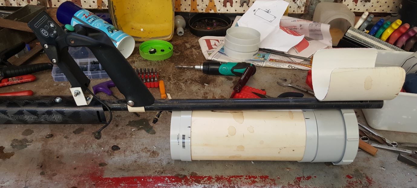
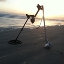
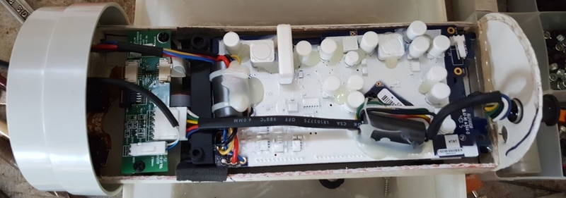
I got pretty excited about this so, yesterday I did this and I`ll let the photos tell the story. Bit agricultural but has it been to Jenny Craigs, the SDC box without the electronics weights 839 grams, the "Plumbers" SDC box with the electronics weights 662 grams. I have a couple of 2700Mah LiPo batteries for a Hubsan Drone in the mail should be here next week. I believe one of them will be enough and it weighs 116 grams and will slide in below the circuit board. Alternatively the 18650s in a 2 cell holder will also slide in below the CB but I feel the flat pack LiPos with their PCB will be the more permanent go so as once tested it can be sealed and batteries charged externally, Also in the screw on end cap there is room for the Pro Sonic Trani at present I have the speaker mounted in there with holes cut in the end cap but once finished suspect I`ll just mount the Pro-Sonic Trani and seal as that.

-

What's The Terrain Like At Lsd, Here's Your Answer
Swampstomper Al replied to a topic in Detector Prospector Forum
Some drone footage of the same general area: Swamp -

New To Nugget Detecting, Help With Choice?
SteveJJ replied to SteveJJ's topic in Metal Detector Advice & Comparisons
We have our differences but our interests bear us through. He's the one bringing me into the hobby, truth be told. Actually, I'm the one that brought a camp chair along to sit and watch him dig the deep holes for targets he found with his 4500. Part of my joy is just soaking in the natural beauty that surrounds the tailings piles. I brought a drone to video the landscape, as well as to scan the areas for signs of digging and pile movement, and 'hidden' piles off in the trees. While I've enjoyed going for copper and silver, I'd like to have potential ROI so have interest in gold and platinum. Why not get 100x more for your finds? Now that he's invested in his GPX4500, he's more attuned to the potential returns. It doesn't hurt that Gerry, who sold him his 4500, detects in Oregon and has talked it up with him. I'm up for the whole Rocky mountain range, and anticipate spending much of my retirement out there. Oh, and I did purchase a TDI SL and am closing on a Gold Bug 2 in a couple days! 4x4 and camper to pull behind it next year. Gonna get the goods while the paychecks are coming in so I can enjoy retirement in a couple years. -
What a concept. How big would a buried nugget have to be in order to be detected from 175 feet in the air? However much tongue in cheek my first question was, Wouldn't it be neat if you could significantly charge the ground in an area in such a way that surface/shallow metal resonated in some such a way as to be picked up by an overhead sensor? I mean, we're grinning and nodding and winking at the request but at some level you have to admit that you would think some such activity could be possible. Try this on for size. What if you used an infrared heat sensor/camera and looked at the heat residuals of surface objects at a particular time after sundown or ambient temperature? Gold would either cool more rapidly or more slowly as compared to the surrounding soil and rock. It might take a little time to build a background database to compare results to, but I would think that is something that is totally doable. Combine it with GPS, put it on a drone and fly the grid. Analyze, and recover. HH Mike
-
 The short answer is no, there is no such technology to directly detect gold from 30 meters and greater distance, and those who claim they can build a long range locator to do this are lying. That said, there are geophysical devices to detect soil conductivity and resistance, the magnetic characteristics of rock as well as other geologic characteristics that are used by geologists for exploration of mineral deposits on a large scale - many of these are done by flying over the deposit in an airplane, helicopter or by a drone. So if your goal is finding buried treasure or placer gold deposits, then no, LRLs dont work, if your goal is geophysical exploration for large mineral deposits, then some of this equipment to indirectly detect the characteristics of rocks does exist, but this is probably not a good place to get more detailed information on them.
 -
Good info Mitchel, thanks.... If you happen to talk to Dr Steve Chesley, could you ask him if he could calculate meteorite falls during dark flight? I will be in Salem Oregon during the eclipse, to get total eclipse, going to send the drone up, and get some shots from 400 feet up... Dave
-
Ha! The fly was my disguised drone! We got off with .0025 grms. Thanks for sharing!
-
Amyone on the Forums have any drone experience yet? just wondering.....This guy does. Enjoy! Cheers, ig
-
Uav-drones For Gold Prospecting
Steve Herschbach replied to idahogold's topic in Metal Detector Advice & Comparisons
Don't let this happen to your drone! This link has some amazing photos