Jump to content

West Aussie Gold Trip... Another Australian Gold Tourism Ad


Recommended Posts

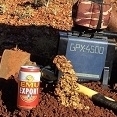
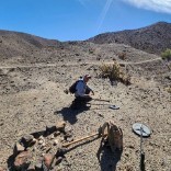
I did the annual 5 and a half day drive from east oz to the Pilbara area in western Australia for 8 weeks prospecting with a friend. Floods earlier in the year scoured the creeks out and that helped, but a lack of natural fires meant many places are covered in thick spinifex  giving you only about 10% of the ground to detect on.  We managed 23 ounces between us, which was not brilliant considering we know a fair few places from earlier trips. But the trip, scenery, camping and people we met made the annual trip something great and I can't wait for the dry winter WA prospecting season to start each year. Some of the gold...hundreds of nuggets were sub grammers, my best was a 76 gram flatty found at about 26 inches down with the 19 coil. My favourite piece is the squashed leaf gold nugget with little pyramidal gold crystals on its surface. cheers RDD

Ps. I hope to visit the US and take in the scenery/people......and detect a couple nuggets from some of your iconic goldfields one day.

IMG_0003.JPG

IMG_0005.JPG

IMG_0006.JPG

wa-2017 76gms (2).jpg

Link to comment
Share on other sites

  • The title was changed to West Aussie Gold Trip... Another Australian Gold Tourism Add

That is almost too good for me to imagine ... splitting 23 ounces and that being a tough trip!

Well done.

Thank you.

Mitchel

Link to comment
Share on other sites

Thanks Mitchel, it was arrogant of me to say 23 oz was not good. Its just that I go detecting there a lot and know many spots and do research and rely on my hobby gold income. I do aim for a big tally. Its gold fever I guess. But I am in a good place to detect, where big untouched patches still do exist. And I am sure there are some over there too. cheers RDD

Link to comment
Share on other sites

RDD, of interest perhaps, do you use moving map software such as Oziexplorer on a mobile device, with geological and topological maps, to assist getting to those researched locations? 

Link to comment
Share on other sites

4 hours ago, Norvic said:

RDD, of interest perhaps, do you use moving map software such as Oziexplorer on a mobile device, with geological and topological maps, to assist getting to those researched locations? 

Hi Norvic, my mate runs Oziexplorer with geology/tenement layers to get us to coordinates and keep us away from Mining leases and on legal/40e ground. Close up viewing of google earth and WA sat imagery and sat burnt area maps from the NOAA satellites are the biggest help. Using sat imagery to find and mark the route of very faint 4wd tracks that get you close to where you want to go is main game in research to get to areas to explore I have found. RDD

Link to comment
Share on other sites

Nice trip RedDirtDigger,  the flat one with the pyramids on it is my favorite. When you fellas go out on those long trips to hunt, what is the average amount of time ( hours ) spend detecting every day? I know many of us here in the States are in awe :ohmy:  when we see big gold and a lot of it from Aussie hunters, but I bet you're pounding the ground all day long. Hope your next trip brings even more...

Link to comment
Share on other sites

6 hours ago, RedDirtDigger said:

Hi Norvic, my mate runs Oziexplorer with geology/tenement layers to get us to coordinates and keep us away from Mining leases and on legal/40e ground. Close up viewing of google earth and WA sat imagery and sat burnt area maps from the NOAA satellites are the biggest help. Using sat imagery to find and mark the route of very faint 4wd tracks that get you close to where you want to go is main game in research to get to areas to explore I have found. RDD

RDD, Many thanks, myself I started many years back with Fugawi then switched to Oziexplorer once it became available. Powerful tools that help us, hopefully ML will expand on the GPS capabilities that is in cooperated in the Z and give us this mapping ability right there in front of us out in the field, until then I currently use a Ozi android app on a smartphone with GPS built in, with the PC at home running Ozi to "make" the maps. Our Government Mines depts. are making this easy now with their freely available Geo, Tenement etc customisable maps that can be downloaded and exported into Ozi.

A tit bit, the Fugawi name apparently originated from "Where the #$%^ are We"

Link to comment
Share on other sites

Create an account or sign in to comment

You need to be a member in order to leave a comment

Create an account

Sign up for a new account in our community. It's easy!

Register a new account

Sign in

Already have an account? Sign in here.

Sign In Now
×
×
  • Create New...